Mostly Mapping Map of the Day - April 28, 2015
- Subscribe to RSS Feed
- Mark as New
- Mark as Read
- Bookmark
- Subscribe
- Printer Friendly Page
- Report Inappropriate Content
Earlier this week an earthquake registering 7.8 on the Richter Scale devastated parts of Nepal, with the nation's capital of Kathmandu hardest hit. The quake struck before noon just 50 miles from the city in an area known to be among the most seismically hazardous in the world, according to the U.S. Geological Survey. According to CNN, as of today the death toll has passed 4,600 with at least double that number injured, and is expected to rise. Approximately 8 million people are affected across Nepal, an indication of the enormity and scale of the devastation.
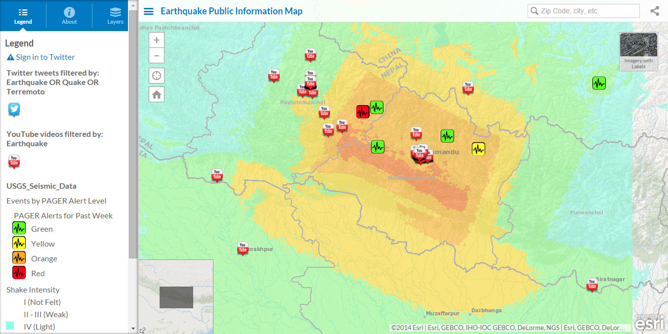
The map shown below is from the Esri Disaster Response organization portal. It's the Earthquake Public Information Map (or PIM) which uses the Public Information Map (PIM) template. The Earthquake PIM currently opens centered on Nepal. It includes social feeds as well as the USGS Seismic Data showing PAGER alerts and shake intensity.
Other resources are available for those interested in learning more and in assisting with the response effort. The Esri Disaster Response Program website serves as an umbrella site useful to bookmark for responding to any event. You will also find specific maps and information concerning the Nepal earthquake, including the following important resources:
- GIS Assistance
- Earthquake Public Information Map (PIM)
- Catalog of online Nepal earthquake maps
- Disaster response resources
Stay tuned to the Public Safety GeoNet place for additional resources and information concerning the Nepal earthquake response effort.
You must be a registered user to add a comment. If you've already registered, sign in. Otherwise, register and sign in.