Mostly Mapping Map(s) of the Day - August 25, 2017
- Subscribe to RSS Feed
- Mark as New
- Mark as Read
- Bookmark
- Subscribe
- Printer Friendly Page
- Report Inappropriate Content
Hurricane Harvey, currently a Category 2 storm, is predicted to gain strength and become a Category 3 storm sometime today, as it makes landfall in the vicinity of Corpus Christie, Texas. Landfall is currently expected late tonight, or early Saturday morning. So far seven Texas counties have ordered mandatory evacuations of many thousands of residents in low-lying areas. The last Category 3 storm to hit the U.S. was Hurricane Wilma in October, 2005, when it reached landfall in Florida.
Esri's Disaster Response portal provides live maps and feeds to complement your mapping, as well as assistance programs to help meet your needs.
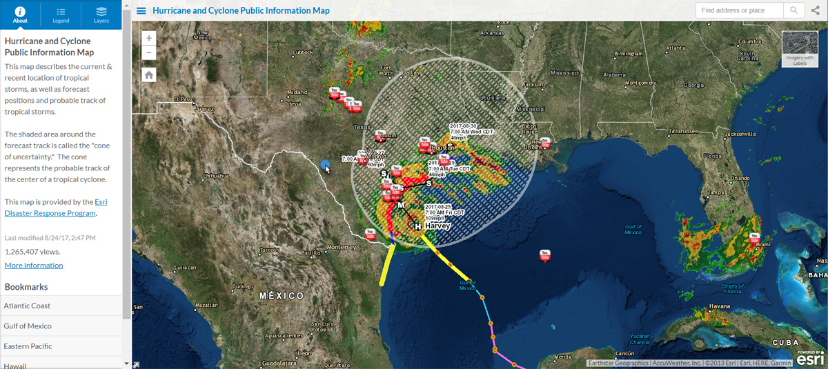
The Hurricane and Cyclone Public Information Map includes live feeds from the Living Atlas, along with the current and forecast hurricane position and strength.
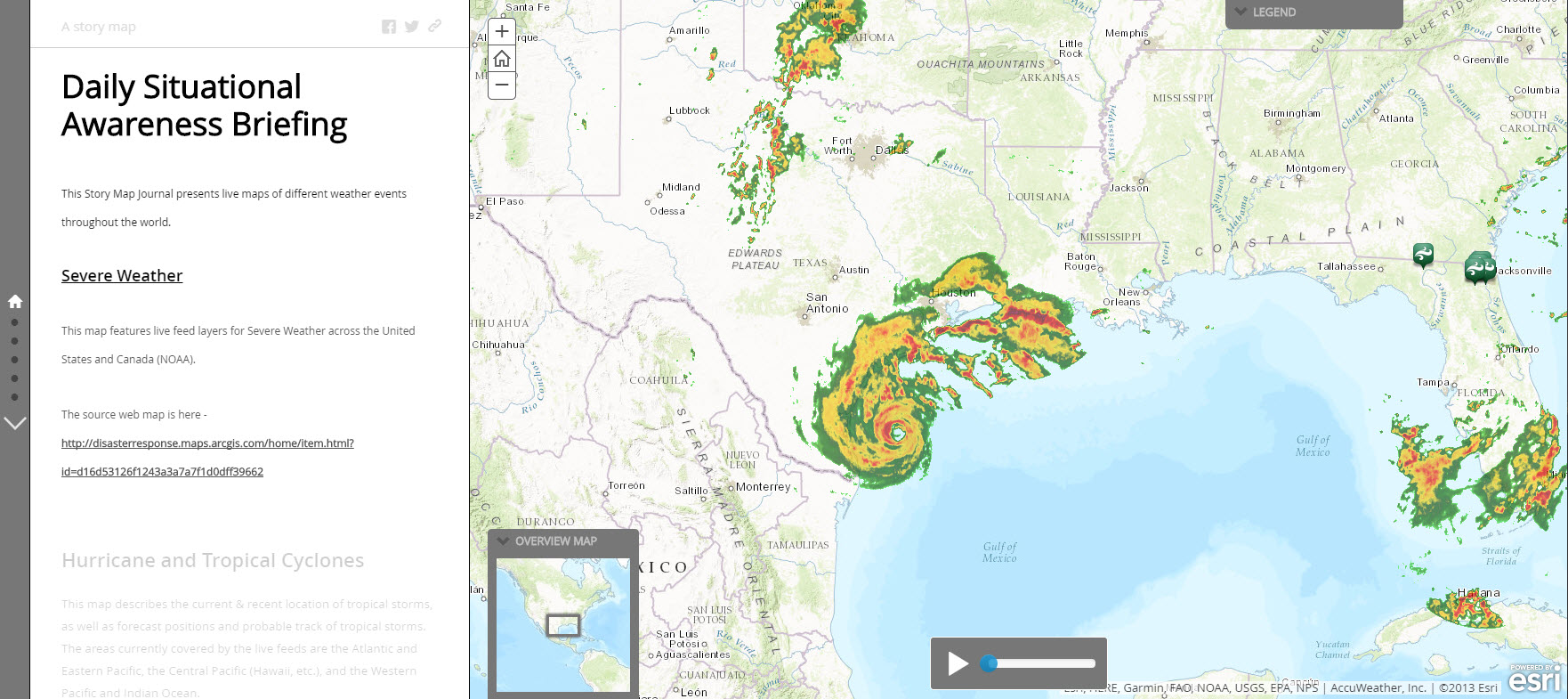
Daily Situational Awareness Briefing is a Story Map Journal that shows severe weather, hurricanes and cyclones, earthquakes, and more. The link will open the story map in autoplay mode, cycling through each of the journal sections.
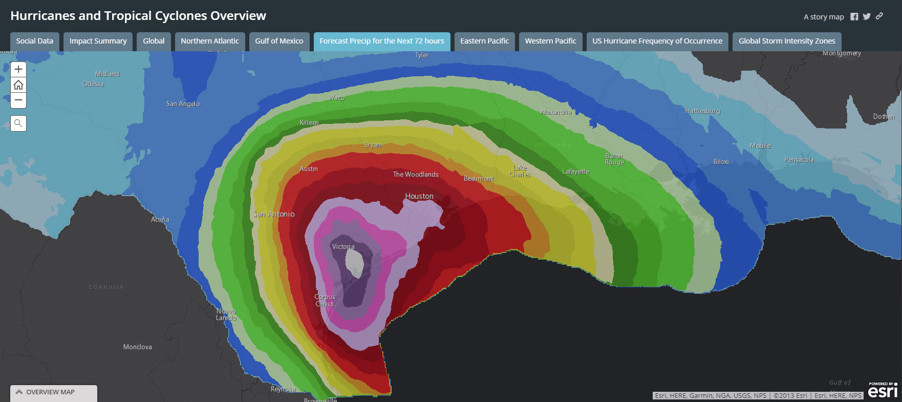
Hurricane and Tropical Cyclones Overview is a Story Map Series that "binds" together multiple apps about the storm. The series includes an Impact Summary of potential storm surge impacts and forecast precipitation over the next 72 hours.
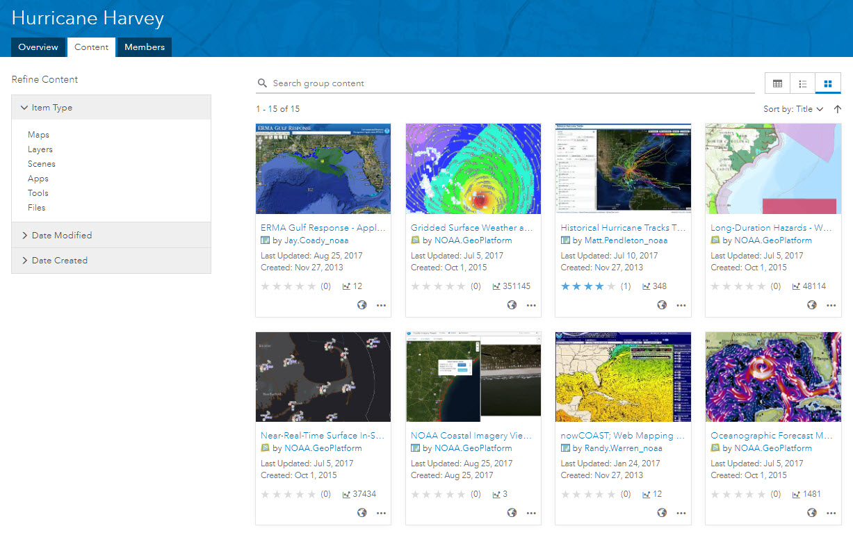
NOAA publishes a group of maps and layers about Hurricane Harvey.
Other apps and layers can be discovered by searching ArcGIS online.
Disaster Resilience Story Maps https://community.esri.com/community/public-safety?sr=search&searchId=2074f727-f7b8-4853-8060-ae2c5b...
You must be a registered user to add a comment. If you've already registered, sign in. Otherwise, register and sign in.