- Home
- :
- All Communities
- :
- Industries
- :
- Education
- :
- Education Blog
- :
- The Sounds of Planet Earth Story Map
The Sounds of Planet Earth Story Map
- Subscribe to RSS Feed
- Mark as New
- Mark as Read
- Bookmark
- Subscribe
- Printer Friendly Page
- Report Inappropriate Content
Planet Earth is a noisy place. Some sounds are made objects on, above, or below the natural landscape, and others by things that humans have constructed upon that landscape. Test your knowledge about those sounds by using my new "Sounds of Planet Earth" story map. This story map contains 100 sounds. After listening, take the quiz for each sound to test your answer on what each sound is. Some are easy, and some are intentionally very challenging!
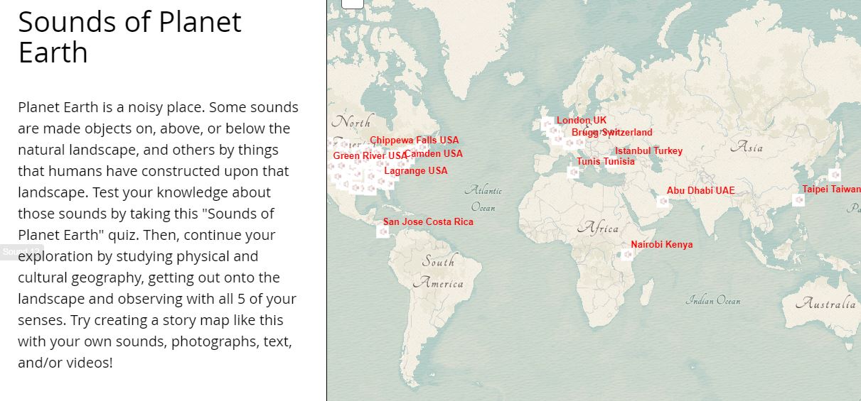
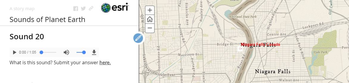
Each point on the map is associated with a sound. You can navigate to each sound through the map interface, or use the navigation bar on the left side of the map to move to each sound in numeric order, or feel free to skip to specific sounds. One you choose a sound, a player appears, allowing you to listen to it. A link appears below each sound for you to submit your guess as to what that sound is. The quiz is optional but is a fun way to engage with the content.
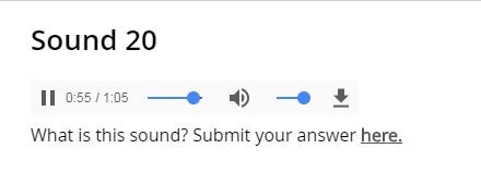
Each sound player shows the interactive web map next to it; for example, Sound #20. In this case, the map gives a mighty good clue, but in other places around the Earth, the map provides very little additional information!
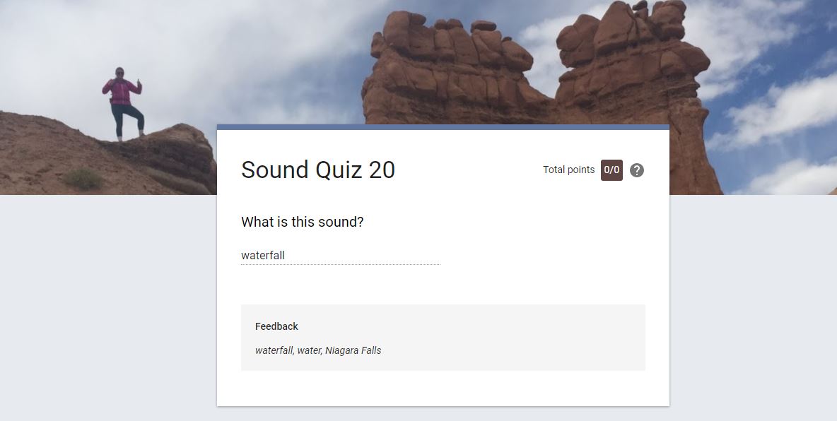
Here is the answer for Sound #20. In this case, I provide a few answers that would be acceptable, instead of just one answer. Oops, I just gave the answer for this sound away!
How did I create this story map? 1) I created a spreadsheet with city, state, country fields for each sound. My goals included wanting to have sounds of nature and sounds created by people, a diversity of different places around the world, to spark spatial thinking, and for them to be interesting. I used my own sounds because I own the content and did not need to seek permission to use them.
2) In ArcGIS Online, I added this spreadsheet and created a feature service and a map from it. In the map, I used a custom sound speaker graphic created by a wonderful artist that I know for the point symbol. Using the technique to access the new basemaps that I discussed here, I used the Modern Antique basemap for this story map for something fun and different. I used the new functionality with Arcade expressions to label my features. I shared the map with everyone.
3) I selected and downloaded 100 of my videos from my YouTube channel and used Camtasia from TechSmith to separate out the audio. Web utilities exist that allow you to download audio files from YouTube but beware--most of them contain nasty malware and worse. Camtasia works very well for this task, and is much safer; plus, you can trim your sound clips. Why did I download the videos in the first place? Well, I originally wanted to point directly to my YouTube audio from my story map but after several tries, I could not get this method to work. So, on to Plan B of downloading, stripping out the audio, and uploading, as I explain below.
4) I converted my 100 sound files from wav format from Camtasia to MP3 using Format Factory. I have used Format Factory for many years and it works well for conversion of audio and video files into different formats.
5) I uploaded the 100 mp3 sound files to a library on www.archive.org. Archive.org is the Internet Archive, a non-profit library of millions of free books, movies, software, music, websites, and more. For each file, I provided metadata and made them Creative Commons in licensing so that anyone can now use them. In a spreadsheet (separate from my spreadsheet that I used for my geocoding, above) I recorded the URL for each mp3 file so I could point to the sound file in my story map.
6) I created 100 quizzes and answer keys using Google Forms. I then viewed each quiz, recording the URL in my working spreadsheet.
7) I used the Map Journal story map app to build my sound story map, pointing to the map that I created in step 2. For each sound, I set the appropriate map scale and extent. For each sound, I edited the HTML, pointing to my sound file and to the quiz.
When done, I tested each sound to make sure it was working, and that the correct quiz and answer key was associated with each sound.
One of my blocks of code looks like this, below, with the first string representing the sound file and the second string representing the quiz, below. So, it shows that if you and your students can get comfortable with a little bit of coding, it can reap great rewards.
<p>
<audio controls=""><source src="https://archive.org/download/niagara_falls_201707/niagara_falls.mp3
" type="audio/mpeg" /> does not support?</audio>
</p>
<p>What is this sound? Submit your answer <a href="https://docs.google.com/forms/d/e/1FAIpQLSdBrJ1I6MF2CFu004hiPgcMGq8NPT3I4ZWln491YBNzcXeyoQ/viewform
" target="_blank">here.</a></p>
I hope the story map is useful and sparks ideas for what you could do with these tools. I encourage you to continue your exploration by studying physical and cultural geography, getting out onto the landscape, and observing with all 5 of your senses. Then, try creating a story map like the one I made with your own sounds, photographs, text, and/or videos! You can use my technique or try another method of creating a sound-based story map.
If this topic interests, you, a few of my other favorite sound story maps include Alan Lomax's documentation of the music of the South, a concert tour by the Grateful Dead, and that doesn't make you grate-ful, more Dead here from 1977, some of the traditional Christmas holiday music from around the world, the Sound of Music filming locations, and a map on the Lakota language that I created with James Rattling Leaf.
Thank you for reading about my Sounds of Planet Earth map: Hear the sounds, examine the map, test your knowledge, get out onto the landscape, observe with all of your senses, and make story maps of your OWN sounds!
You must be a registered user to add a comment. If you've already registered, sign in. Otherwise, register and sign in.
-
Administration
38 -
Announcements
44 -
Career & Tech Ed
1 -
Curriculum-Learning Resources
177 -
Education Facilities
24 -
Events
46 -
GeoInquiries
1 -
Higher Education
518 -
Informal Education
264 -
Licensing Best Practices
46 -
Pedagogy and Education Theory
187 -
Schools (K - 12)
282 -
Schools (K-12)
183 -
Spatial data
24 -
STEM
3 -
Students - Higher Education
231 -
Students - K-12 Schools
84 -
Success Stories
22 -
TeacherDesk
1 -
Tech Tips
83
- « Previous
- Next »