Turn on suggestions
Auto-suggest helps you quickly narrow down your search results by suggesting possible matches as you type.
Cancel
Go 3D
Subscribe
520
0
08-17-2017 09:18 AM
- Subscribe to RSS Feed
- Mark as New
- Mark as Read
- Bookmark
- Subscribe
- Printer Friendly Page
- Report Inappropriate Content
08-17-2017
09:18 AM
Try the resources below to see how using 3D in ArcGIS Online brings an extra dimension into your web GIS.
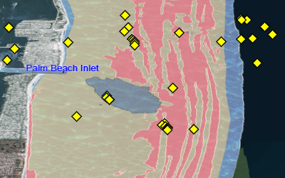
Explore Florida's beaches and inlets in 3D.
Watch what's possible with 3D in a browser.
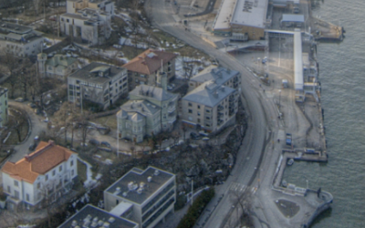
Understand the built environment with real-world 3D visualizations.
See Story Maps come to life with scenes.

Share your feature data as scene layers.

Develop 3D web apps with mesh data and smart mapping APIs.
You must be a registered user to add a comment. If you've already registered, sign in. Otherwise, register and sign in.
About the Author
Molly Zurn (she/her) leads Product Engineering writing at Esri. She helps ArcGIS users apply modern GIS best practices and approaches. Outside of work Molly loves to ski, run, and hang out with her family and dogs.