- Home
- :
- All Communities
- :
- Industries
- :
- Public Safety
- :
- Public Safety Blog
- :
- How Analyzing Location Can Support Opioid Abuse Re...
How Analyzing Location Can Support Opioid Abuse Reduction Strategies
- Subscribe to RSS Feed
- Mark as New
- Mark as Read
- Bookmark
- Subscribe
- Printer Friendly Page
- Report Inappropriate Content
By John Beck, Law Enforcement Industry Manager • Esri Public Safety Team
Drug overdose deaths in the United States continue to mount—having tripled since 1999. There were 33,091 opioid-related deaths in 2015; that's 90 Americans every day.1 The data shows that there are multiple causes for the statistics' jump. In 2012, medical care providers wrote 250 million opioid prescriptions, more than enough to give a bottle of pills to every American.2 Four out of five heroin addicts were introduced to opioids through prescription painkillers.3 Compounding the problem is the fact that today's street heroin is increasingly being cut with fentanyl, a powerful synthetic drug that is from 50 to 100 times more powerful than morphine.4

Those who have lost loved ones can post memories and a photo of friends or family members to this online interactive map and database.
This epidemic is showing no signs of slowing, and it is taking a terrible toll on American families. But beyond the personal toll, the burden this crisis is putting on our communities is immense. First responders and health care providers are overwhelmed. Federal, state, and local agencies are searching for ways to get ahead of the crisis, but it's a complicated problem. Having multiple stakeholders means that interagency cooperation is paramount to achieving meaningful results, and probably the single best path lies in data analysis and data sharing. By gaining an understanding of the data, local agencies can start to own the problem and take meaningful action to save lives and reduce the impact on our communities.
Just as our first responders and health care providers are on the front line of the epidemic, they may also be best positioned to drive change. Not only are they the first to assist at the scene of a possible overdose, they also encounter drug users in the community and at medical facilities on a daily basis. Police will have drug incident, crime, and arrest reports and data from field interviews. Police will also have firsthand knowledge about the locations of illegal drug markets and where associated crime is happening in the community. Health and human services will have valuable data that can help community stakeholders understand the problem. Key data can include information about the number of prescriptions; where they are written; and when, how many, and where overdoses occur.
Finally, it is important to know where appropriate community resources (treatment facilities, naloxone dispensaries, prescription drop-off locations, etc.) are located. The operative term in these datasets is where. Any analysis of opioid data is going to be made more effective by looking at location and the spatial relationships of the various datasets. For example, a spike in the number of overdoses might seem unrelated until the data is visualized spatially to reveal clusters of drug activity. Field collection of this type of data can even become an early warning system for a possible outbreak of overdoses (related to a bad batch of street heroin or the often deadly counterfeit-prescription pills containing fentanyl). In turn, developing field intelligence can drive decision-making and resource allocation (such as assigning extra personnel, boosting naloxone stores, and improving the distribution of other treatment services).
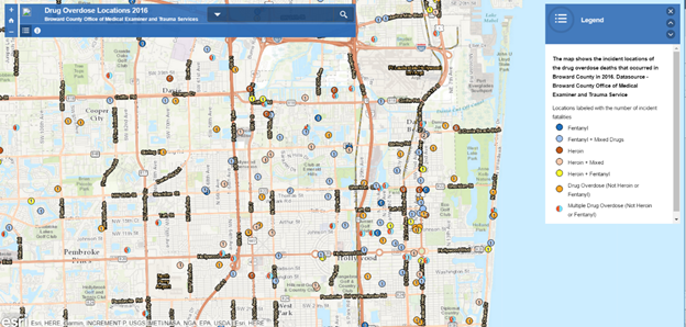
This map shows locations of drug overdose deaths in Broward County, Florida in 2016.
But once the data has been gathered and analyzed, what are the next steps? Change can't happen without the involvement of other community stakeholders, starting with elected officials and including local businesses, community activists, and organizations. Through community engagement, strategic opioid abuse prevention initiatives are obtainable. Esri has identified four key areas where a good location-based strategy can help stakeholders achieve results: improving education, providing access to treatment, ensuring effective response, and supporting successful prevention. Here's how to get started.
Education
Community awareness is the foundation of any opioid abuse prevention strategy. The first question might be, does your community even recognize that there is a problem? Improve awareness by sharing data about the problem, including overdose mortality data, local spatial and demographic trends, and reports on how your community compares to national trends. Give context to your data by sharing information via story maps that educate and inform the public. Finally, engage your citizens as strategic partners by promoting interactive online and mobile tip-reporting apps that encourage crowdsourced problem solving.
Treatment
Prompt care for overdose victims and access to treatment facilities can save lives. Collecting data about health care resources and combining it with a good analysis of overdose trends and locations can help communities prioritize and plan for new treatment facility locations. Use spatial analysis to determine where the greatest need is, which communities may be underserved, and where opioid problems are likely to occur in the future. Dig even deeper by doing a road network and treatment facility analysis and comparing these to hot spots of overdoses to gain a complete picture. Use dashboards to monitor overdose activity and hospital bed availability and manage treatment resources.

Centers for Medicare & Medicaid Services provides tools for mapping opioid prescribing rates.
Response
Good data analysis can lead to improved response from police and other first responders by helping them prioritize where to conduct law enforcement activities. Data analysis can also be used to generate crucial intelligence surrounding hot spots of overdoses and other types of drug activity. By looking at historic and current data spatially, predictions can be made about when and where the next breakout may occur. Data and analysis can be pushed out to mobile apps that will show personnel what activity is occurring nearby and enable them to collect field data that can then be shared with the operations center in real time. By adding proximity information about resources and the closest treatment facilities, workers will have better access to the tools they need to do their jobs.

This Operation Medicine Cabinet map helps share information about prescription drug drop-off locations in Oakland County, Michigan.
Prevention
The final piece of any successful opioid abuse prevention strategy is the reduction of opiate availability in the community. Again, this starts by generating awareness in the community and among stakeholders as to the dangers of prescription painkillers and targeting illegal drug markets that are trafficking in opioids and heroin. A good start is to get unused pain medications out of medicine cabinets and safely disposed of. Prescription drop-off programs can help, but they need to be easy to use and readily available. Maps and analysis can help provide optimal locations for prescription drop boxes. Overprescribed opioids and long-term use for chronic pain management can lead to abuse and addiction. Raising providers' awareness about their role in reducing overdose-related deaths is also important. Providing data and analysis about the issue in the community can help health professionals better understand the enormity of the problem. Finally, this data can help disrupt illegal drug markets by providing law enforcement with key locational intelligence before the drugs hit the streets. Spatial analysis can also be a valuable tool to help police understand criminal networks and the relationship between drugs and crime. Real-time predictive analytics and field mobility apps can help officers plan, coordinate, and respond quickly to developing intelligence about illegal activity.
Getting Started
Incorporating spatial analysis into your overall opioid abuse prevention strategy begins with the data. Collecting and integrating data from multiple stakeholders will take some cooperation. The need for good partnerships and information-sharing practices becomes even greater when trying to extract crucial opioid-related information from many disparate systems. When done right, the resultant data and analysis can reap immediate benefits. But agencies also need to be aware of the privacy implications of sharing opioid data. The Federal Bureau of Investigation (FBI) Criminal Justice Information Services (CJIS) protects personal information and biometric and property data. The Health Insurance Portability and Accountability Act of 1996 (HIPAA) protects all personal and health-related information about patients. Privacy protection standards need to be accounted for and met when sharing any opioid-related data.
Once all the related data has been gathered and correlated, the analysis can begin, and you probably already have the geographic information system (GIS) technology you need to get started. The ArcGIS platform is essential to supporting your opioid reduction strategy. Key stakeholders are already using ArcGIS to store, manage, location enable, and analyze their data, but ArcGIS also provides contextual tools for sharing and exploring data as well as engaging community partners. Spatial analysis provides the foundation for informed decision-making and can help clarify the problem, providing information including the spatial distribution of overdoses, the relationship between opiates and crime, predicted hot spots of activity, and the best locations and routes for resources. Esri's tools go beyond mapping and visualization with real-time capabilities that accelerate response, dashboards that improve operational awareness, mobile apps that allow you easily share and collect data from the field, and engagement apps that help you educate and inform the community. Learn more about how Esri supports the war to end addiction at go.esri.com/strategy.
Notes
- Division of Unintentional Injury Prevention, National Center for Injury Prevention and Control, Centers for Disease Control and Prevention. Available at https://www.cdc.gov/drugoverdose/index.html
- Centers for Disease Control and Prevention (2014). "Opioid Painkiller Prescribing—Where You Live Makes a Difference." Atlanta, Georgia: Centers for Disease Control and Prevention. Available at http://www.cdc.gov/vitalsigns/opioid-prescribing/.
- Jones, C. M. "Heroin Use and Heroin Use Risk Behaviors among Nonmedical Users of Prescription Opioid Pain Relievers—United States, 2002–2004 and 2008–2010." Drug and Alcohol Dependence. 2013 September 1; 132(1-2):95-100. DOI: 10.1016/j.drugalcdep.2013.01.007. E-publication date 2013 February 12.
- National Institute on Drug Abuse (2016). "Fentanyl." Retrieved March 20, 2017, from https://www.drugabuse.gov/publications/drugfacts/fentanyl.
You must be a registered user to add a comment. If you've already registered, sign in. Otherwise, register and sign in.