- Home
- :
- All Communities
- :
- Events
- :
- User Conference
- :
- User Conference Blog
- :
- UC Updates Day 4: GeoNet Meet-up Recap, Regression...
UC Updates Day 4: GeoNet Meet-up Recap, Regression Analysis and Nicholas Cage, UC Party
- Subscribe to RSS Feed
- Mark as New
- Mark as Read
- Bookmark
- Subscribe
- Printer Friendly Page
- Report Inappropriate Content
Grabbing some gifts at the Esri store

I started Day 4 with a need for some UC swag and I wanted to pick up some gifts the family back home so I explored the Esri store and grabbed a few of the slick "The Amazing Map Man," and The Flash-inspired "Powered by Esri" t-shirts. It was an added bonus to meet and quickly chat with Esri UC student assistant Jessica Leonard who helped to ring up my items as she shared her love for maps and walked me through her impressive UC button collection. Big thanks to all the Esri store staff and student assistants for helping out at UC this year. We appreciate your hard work and support!
What swag, books and other UC gear did you pick up in the store? What were some of your favorite store items this year?
GeoNet Thursday Meet-up: Inspired and building towards the future

The final day of the GeoNet UC meet-ups were all about making new relationships, storytelling and meaningful real-time collaboration. The exploratory Esri rebranding feedback sessions with Christina Sullivan were insightful as community members shared their thoughts with Christina on what they thought of the branding statements. I was excited to watch these discussions unfold because the is exactly the type of collaboration and co-creation we're aiming to have in the community in the future.
We were honored to have Joseph Kersti share his success stories from the Education team. "The GeoNet Community provides not only technical assistance, but gives them confidence in their ability to teach effectively with GIS," Joseph said. "It also gives them encouragement to go farther with GIS instruction to foster critical thinking and spatial thinking skills."
I walked away from the meet-up feeling, yet again, inspired from what I heard and excited about the opportunity we have to build on the GeoNet Community experience. Did you attend the meet-ups? What did you think? How would you like to see us evolve meet-ups in the future?
To see the other stories and stats from the meet-up, you can download a copy of our meet-up presentation deck here.
Asking important questions through Regression Analysis
I learned a lot during the latest Ten Questions for Esri video, so one of my highlights of the afternoon sessions was building on my understanding of spatial analysis and going deeper into exploring regression analysis via Lauren Bennett. She set the stage explaining what regression analysis is, it's approach and key characteristics:
- It's a method and model to help us examine and explore spatial relationships
- It helps us better understand factors behind observed spatial patterns
- It helps us predict outcomes based on understanding
She further explained that, "You should use regression analysis in your work because you can explore correlations, predict unknown values and understand key factors to the data you're collecting and mapping."
To make the point of truly understanding your data and making sure that your data is meaningful, useful, accurate and actionable, Bennet used humor to prove her point and shared a couple entertaining slides highlighting data about the misdirected correlation between "Number of people who drowned by Falling into a Swimming Pool vs Number of Nicholas Cage films."

Bennet walked us through the equation and variables that support regression analysis. Deep stuff, for sure. And I didn't "get" all of it completely. But I did walk away with a deeper appreciation for the complexity that goes into creating a map that will not only lay out data but will help a customer, audience or organization make a critical decision.

Here are my big takeaways:
- Before you sit down to gather and then map your data you should make sure to ask the right questions and have a good understanding of context.
- Be open to exploration. What you think you are going to find out and what you discover along the way might be very different. So use analysis to check in and see if you're on track.
- Have a solid framework or idea of the story you want to tell before you tell it.
- Always be thinking about the context of your data and what it means in the broader story you're aiming to tell.
- Big decisions require big thought. Critical decisions require critical thought.
Esri UC Party Time
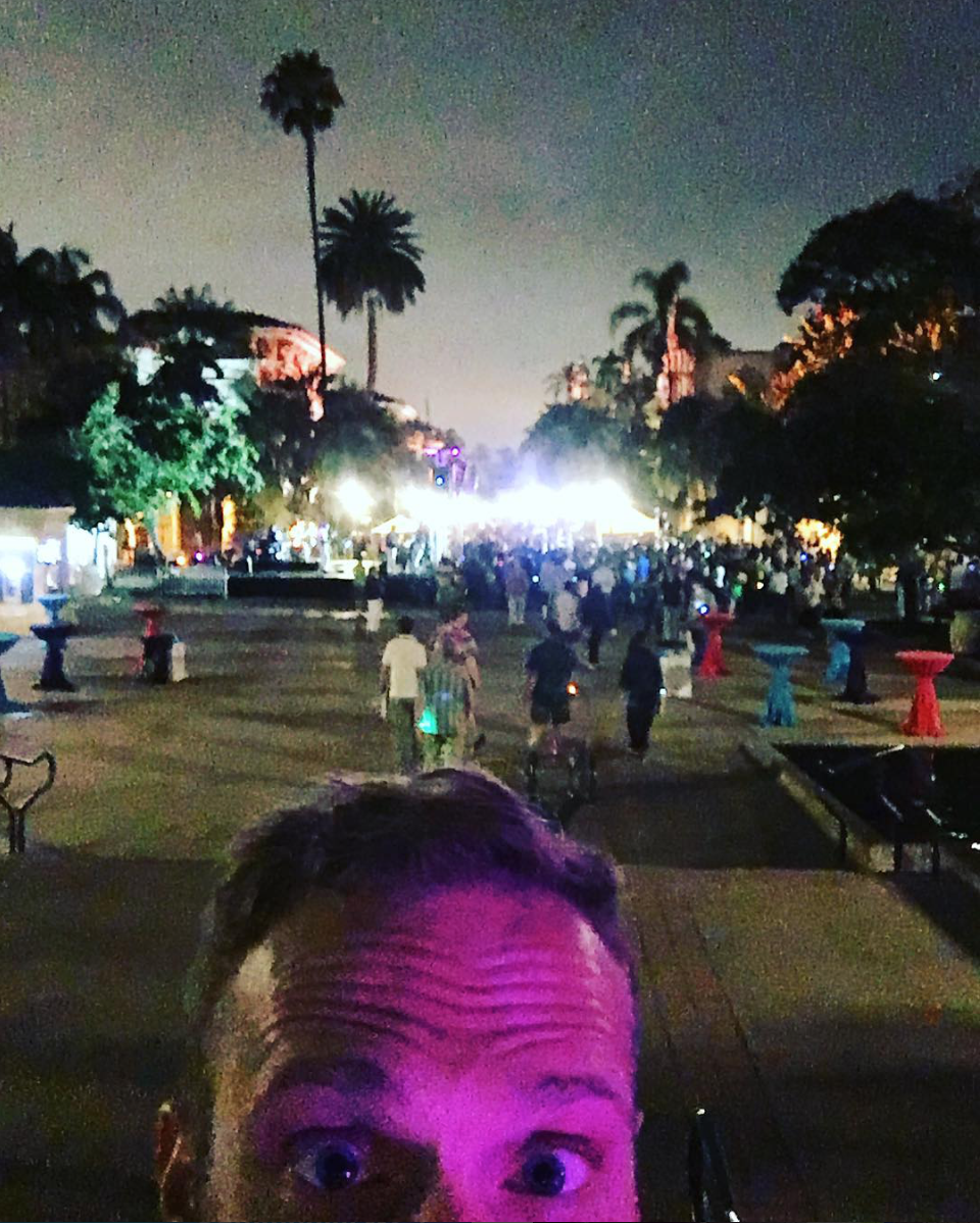
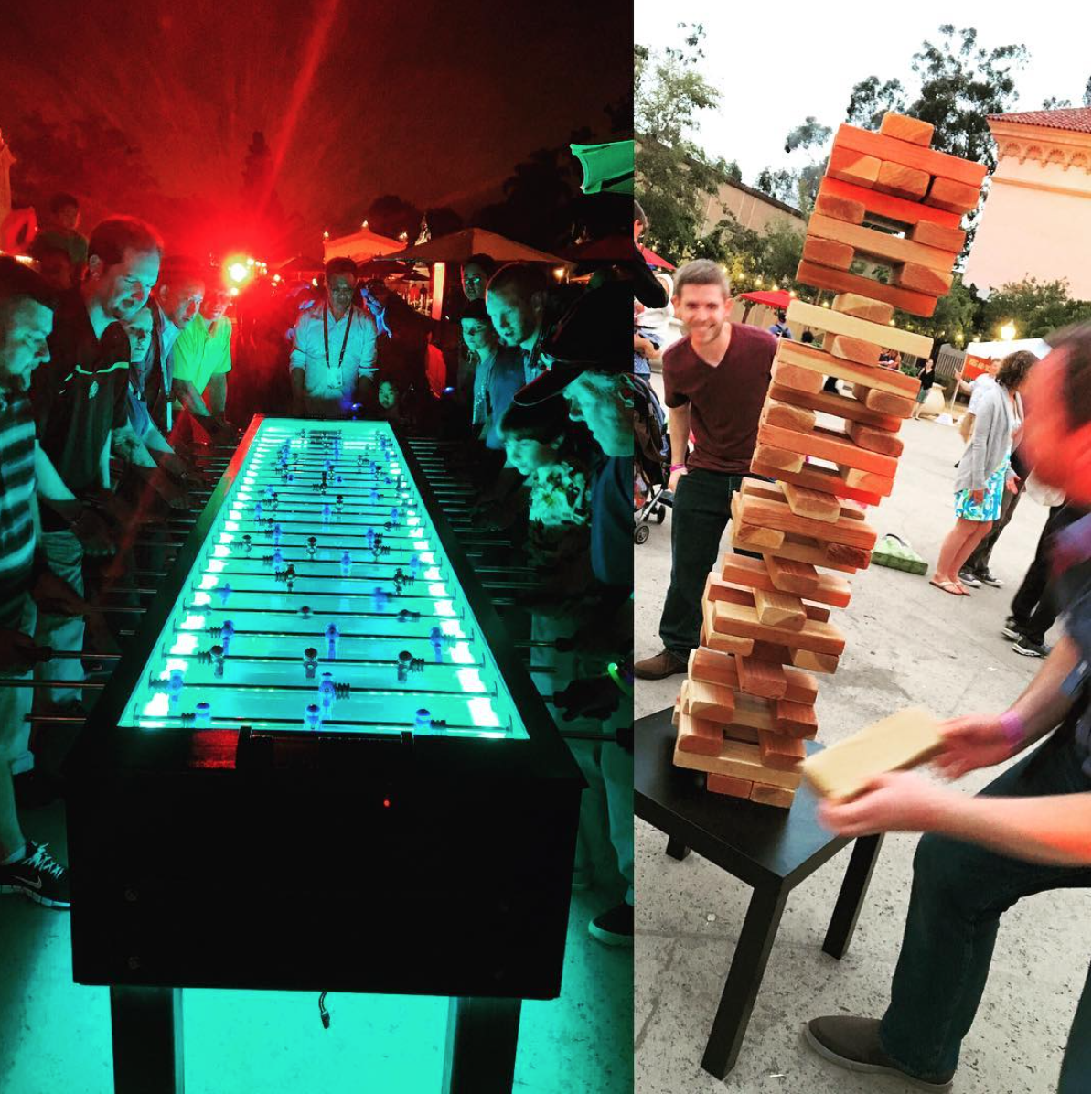
After a busy day of drinking from the glorious and beautiful firehose of GIS and doing lots of big thinking, a big celebration sounded like a perfect end to the day. I jumped on the bus and headed to Balboa park and embarked on my first UC Party. It was a remarkable experience, to say the least, so I grabbed a few pics as the festivities unfolded around me. I cruised the park and museum grounds munching on tasty treats and taking in live music, opera singers, dazzling aerialists, life-sized Jenga games, art galleries, illuminate foosball matches, and munching on tasty treats.
How was your UC Party? Share your experience in the comments below.

You must be a registered user to add a comment. If you've already registered, sign in. Otherwise, register and sign in.