- Home
- :
- All Communities
- :
- Products
- :
- ArcGIS Earth
- :
- ArcGIS Earth Blog
- :
- ArcGIS Earth Automation API is Here
ArcGIS Earth Automation API is Here
- Subscribe to RSS Feed
- Mark as New
- Mark as Read
- Bookmark
- Subscribe
- Printer Friendly Page
- Report Inappropriate Content
With the release of ArcGIS Earth 1.6, we are happy to announce that ArcGIS Earth Automation API is now available. See more from ArcGIS for Developers or the ArcGIS Earth homepage.
We heard many voices of support for an ArcGIS Earth API after the first release of ArcGIS Earth less than 2 years ago. Many of you wanted the ability to control and interact with ArcGIS Earth, including 2D and 3D contents on the globe. So, we designed the ArcGIS Earth Automation API to enable a seamless app-to-app communication experience.
What is the ArcGIS Earth Automation API?
The ArcGIS Earth Automation API provides a standard interface for third-party applications that support .NET. It is based on NetNamedPipeBinding Class (System.ServiceModel) and provides fast, reliable on-machine communications.
What can you do with it?
With the ArcGIS Earth Automation API, developers can now build .NET extensions on top of applications. For example, you can extend your application to access resources from ArcGIS Earth, and automate or script ArcGIS Earth behaviors for 3D navigation and visualization.
Specifically, ArcGIS Earth Automation API allows you to:
- Get and set camera positions.
- Control fly navigations of the camera.
- Add layers to ArcGIS Earth from online or local folders.
- Manage your ArcGIS Earth workspace (add or delete layers).
- Take a snapshot of the current view.
ArcGIS Earth Automation API provides a focused experience. It gives you control over the scene and workspace of ArcGIS Earth. Esri will continue to add new, empowering features for a wider range of usage.
Try it now!
See what’s possible with the ArcGIS Earth Automation API. This sample demonstrates how to create an add-in for ArcGIS Pro 2.0 to synchronize the 3D scene views between ArcGIS Pro and ArcGIS Earth. As you can see below, by switching between preset bookmarks in ArcGIS Pro, we get a simultaneous view on the same SLPK data from both ArcGIS Earth and ArcGIS Pro.
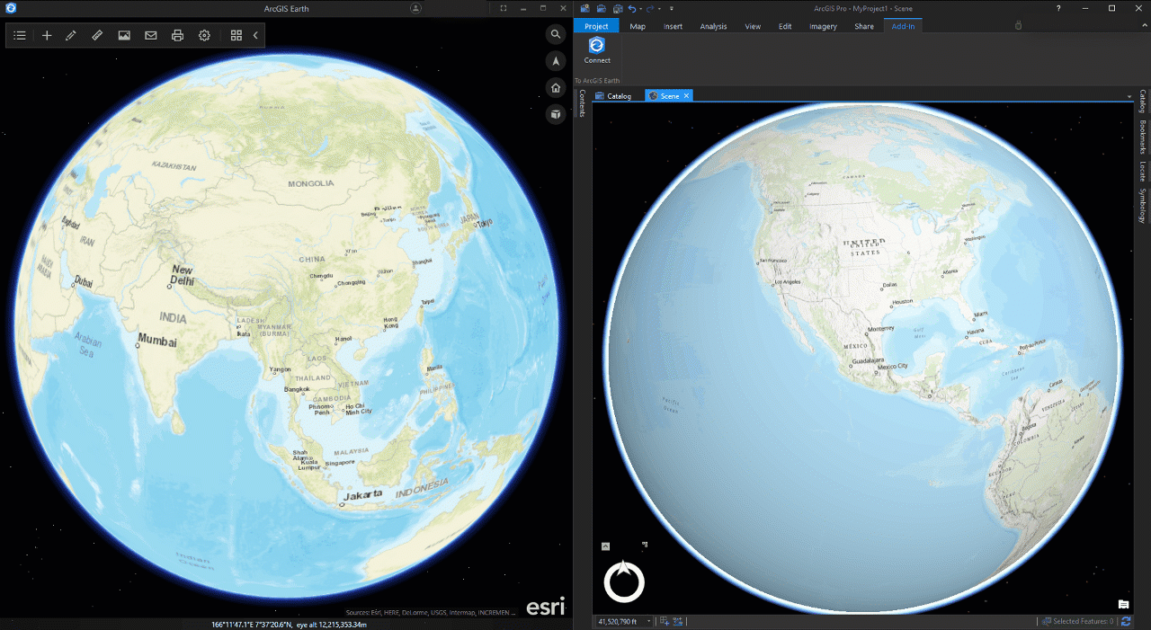 |
To try this add-in, go to View Synchronization Sample and download the example codes to your local machine. Note that you need to build the add-in within your local development environment, and also modify the codes where necessary. For example, you can add callback more messages for duplex communications.
Want to know more?
Get more details from the ArcGIS Earth product homepage, post your questions and share your ideas with us on GeoNet.
A special thanks to Yongwei Kang and Mandi Li for providing content to this blog.
You must be a registered user to add a comment. If you've already registered, sign in. Otherwise, register and sign in.