- Home
- :
- All Communities
- :
- Products
- :
- ArcGIS Maritime
- :
- ArcGIS Maritime Blog
- :
- The Science of Where: are your S-58 errors
The Science of Where: are your S-58 errors
- Subscribe to RSS Feed
- Mark as New
- Mark as Read
- Bookmark
- Subscribe
- Printer Friendly Page
- Report Inappropriate Content
At 10.5.1, ArcGIS for Maritime: Charting will support S-58, the validation standard for S-57 data published by the IHO (International Hydrographic Organization).
Validate S-57 File is a new tool in our Validation toolset that integrates seamlessly with your production workflow. In ArcMap, the validation results are written to a Data Reviewer workspace where they can be reviewed and fixed.
In addition to writing the results within Data Reviewer, the tool outputs a shapefile, which can be loaded, visualized, and easily understood in any application that can read shapefiles.
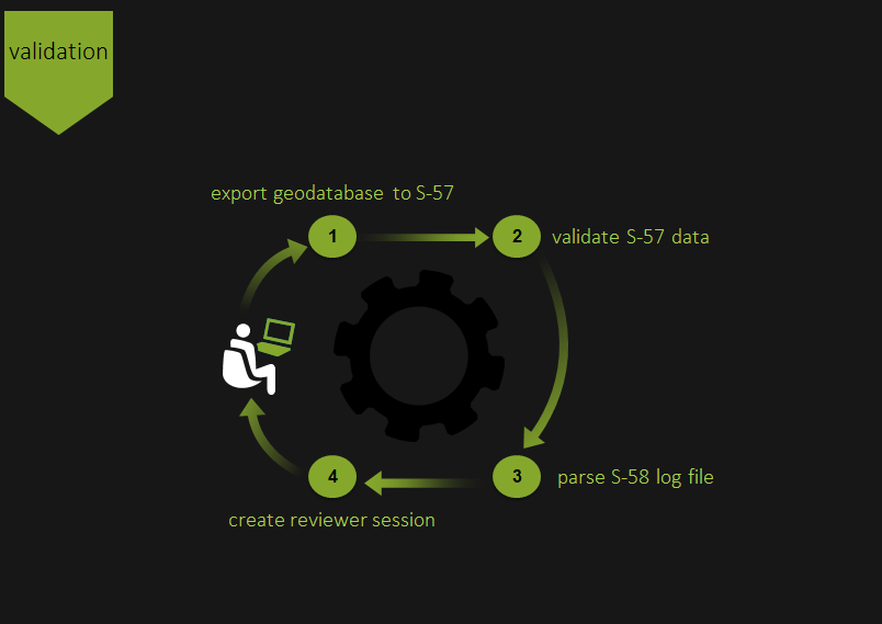
As a geoprocessing tool, Validate S-57 File can be accessed through the ArcMap interface or can be automated to run outside of ArcMap. This eliminates the need to learn a new production system, while still giving access to a geospatially-enabled analysis of errors in an S-57 file.
For Questions and Feedback please contact us at maritime@esri.com
You must be a registered user to add a comment. If you've already registered, sign in. Otherwise, register and sign in.