- Home
- :
- All Communities
- :
- Products
- :
- ArcGIS Online
- :
- ArcGIS Online Ideas
- :
- Legend properties in ArcGIS Online
- Subscribe to RSS Feed
- Mark as New
- Mark as Read
- Bookmark
- Follow this Idea
- Printer Friendly Page
- Report Inappropriate Content
- Mark as New
- Bookmark
- Subscribe
- Mute
- Subscribe to RSS Feed
- Permalink
- Report Inappropriate Content
We could surely benefit from the incorporation of legend property options in the online ArcGIS. I asked if it was possible to configure the visible features (example: limit the number of map notes being shown) in a question post, and got this reply. Would be great to be able to limit the symbols, etc that are shown to ones that are used in the current map extent. That'd really clean up presentations that students make, and simplify the look of a map or presentation.
- Mark as Read
- Mark as New
- Bookmark
- Permalink
- Report Inappropriate Content
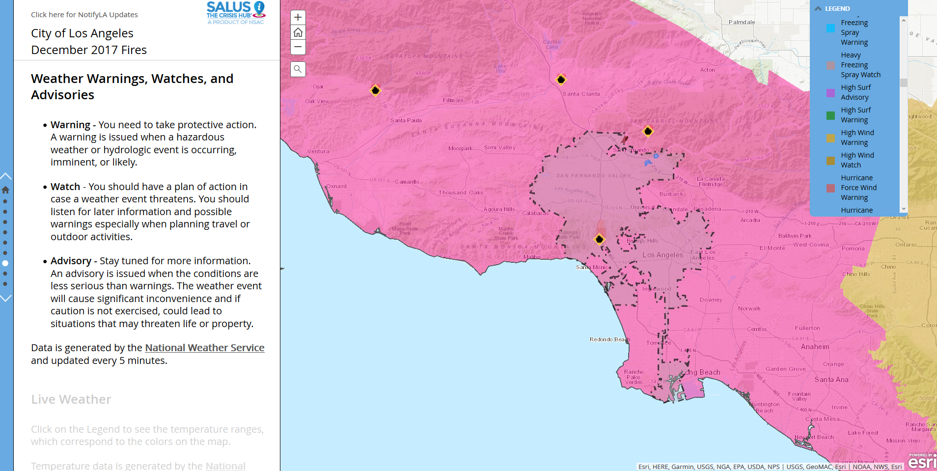
Not to discount the importance of student and other presentations that Andrew mentioned above but in an emergency situation, a clear understanding can save lives. The attached image is from the Los Angeles fire story map. I've found with the National Weather Service watch and warning feed that the legend displays all possible watch and warning categories. The area shown is either a Red Flag Warning, Hurricane Watch, Typhoon Warning, Tsunami Watch, or Winter Storm Warning. I am a GIS practitioner and am fairly sensitive to color but I can't tell any of the above apart, especially when transparencies are applied. A dynamic legend in a web map is long past due. For reference, the story map is located here and the tab discussed is 8th.
You must be a registered user to add a comment. If you've already registered, sign in. Otherwise, register and sign in.