Turn on suggestions
Auto-suggest helps you quickly narrow down your search results by suggesting possible matches as you type.
Cancel
- Home
- :
- All Communities
- :
- Products
- :
- Mapping
- :
- Mapping Questions
- :
- Re: Beta 10: Multiple Pages in a Layout
Options
- Subscribe to RSS Feed
- Mark Topic as New
- Mark Topic as Read
- Float this Topic for Current User
- Bookmark
- Subscribe
- Mute
- Printer Friendly Page
Multiple Pages in a Layout
Subscribe
10236
15
10-28-2009 07:06 AM
10-28-2009
07:06 AM
- Mark as New
- Bookmark
- Subscribe
- Mute
- Subscribe to RSS Feed
- Permalink
- Report Inappropriate Content
Hi,
I am interested in the Multiple Pages in a Layout functionality.
I have only dipped my toe in this area so have a basic question regarding how it is put together.
It would seem that the creation of multiple pages in a layout is only accessible through the Data Driven Pages Wizard?
I would have thought that the functionality would be...
User is in layout. User right-clicks chooses New... Page... User sets up page bla bla bla.
Then the purpose of the automation would be to power this functionality to simply make it easier IF the user wanted to base it on a feature class / areas etc
Can anyone clarify what the functionality is?
Cheers,
Adam
15 Replies
01-13-2011
10:31 AM
- Mark as New
- Bookmark
- Subscribe
- Mute
- Subscribe to RSS Feed
- Permalink
- Report Inappropriate Content
I also got the impression at the What's new in 10 event hosted by ESRI that you could group multiple figures into one file. In my group we use ArcMap to make all of our figures for groundwater modeling reports. When we are done we can have 35 .mxd files in our project folder. After one of my coworkers mentioned it at a meeting yesterday (works in a different group) I decided to check it out. I was very disappointed to learn that this multiple feature created a grid of the map area and created maps for each section of the grid. We have no use for that at all.
Also at the Whats new in 10 event the ESRI people said they watched users to come up with this new version. You really need to watch members of my unit because a lot of the changes we have found so far either don't help us or make things harder. We don't digitize streets and roads and sewer lines. We don't care about topology. We use ArcMap for data analysis and figure making.
Also at the Whats new in 10 event the ESRI people said they watched users to come up with this new version. You really need to watch members of my unit because a lot of the changes we have found so far either don't help us or make things harder. We don't digitize streets and roads and sewer lines. We don't care about topology. We use ArcMap for data analysis and figure making.
02-11-2011
10:06 AM
- Mark as New
- Bookmark
- Subscribe
- Mute
- Subscribe to RSS Feed
- Permalink
- Report Inappropriate Content
I also got the impression at the What's new in 10 event hosted by ESRI that you could group multiple figures into one file. In my group we use ArcMap to make all of our figures for groundwater modeling reports. When we are done we can have 35 .mxd files in our project folder. After one of my coworkers mentioned it at a meeting yesterday (works in a different group) I decided to check it out. I was very disappointed to learn that this multiple feature created a grid of the map area and created maps for each section of the grid. We have no use for that at all.
Also at the Whats new in 10 event the ESRI people said they watched users to come up with this new version. You really need to watch members of my unit because a lot of the changes we have found so far either don't help us or make things harder. We don't digitize streets and roads and sewer lines. We don't care about topology. We use ArcMap for data analysis and figure making.
I agree 100% I would really like to be able to have one document and be able to set up layouts in multiple sizes for reports to construction plans. I have not spent much time with python but does anyone know if you can accomplish this with that program.
02-12-2011
01:30 AM
- Mark as New
- Bookmark
- Subscribe
- Mute
- Subscribe to RSS Feed
- Permalink
- Report Inappropriate Content
How many different layouts do you need for one report?
I can think of two. Portrait and landscape.
I know everyone expects to have multiple layouts like ArcView 3, but there are equivalents.
You can export pages into one print document at the end.
Most of the variations can be handled with dynamic text element in an index map without programming and you can export all the pages into a single PDF document.
If you want more variations than the basic dynamic pages you can program the layout.
Within a layout you can adjust all the major elements, change text and move spare elements stored off the page on to the visible printable area with a bit of python. You can have multiple data frames in one layout.
I can't see any issues with your workflow, but it is a bit sketchy. I suggest that you may need to just rebuild it and automate some parts a bit better and you surely would be able to avoid 35 MXDs. I have never had more that two. Maybe post a thumbnail of an example map/diagram?
09-22-2011
09:09 AM
- Mark as New
- Bookmark
- Subscribe
- Mute
- Subscribe to RSS Feed
- Permalink
- Report Inappropriate Content
Our goal in 9.4 was two-fold:
[INDENT]1) deliver a set of tools for building complete map books
2) provide an automated way to update layouts, data frames, and map documents[/INDENT]
Many people express a need for mulitple layouts because they want to achieve one of those two things. There are also other reasons people want multiple layouts. The 9.4 beta period will be very important for us, as we need to understand which problems 9.4 has actually solved, and which workflows still need solutions.
I think our future plans regarding multiple layouts will should be made with unfulfilled user requirements in mind. For now, our solution is what you see in 9.4, focused on satisifying the above two requirements. In the future, we can consider full multiple layouts but should do so with a set real world goals. It would be great for us if you could provide additional details about multiple layout workflows. I think that some needs could be covered with the new 9.4 python scripting experience. Other requirements should go on ESRI's list for a future release.
Thanks,
Michael
I'm really disparate that ArcGIS is not effectively responding to the very basic needs of the users!
The ArcGIS users need to install so many other tools (such as: XTools Pro 7.0 En, ETGeoWizards, ETGeoTools, MapLogic Layout Manager, etc.) to do some very BASIC issues
I'm wondering why the developers at ESRI don't take these very BASIC needs into consideration!!!!
As for the multiple layouts, i got MapLogic Layout Manager but still couldn't print multiple layouts at a time!
How can ArcGIS stop this tragedy?
Thank you,
regards,
Jamal
----------------------------------------
Jamal Numan
Geomolg Geoportal for Spatial Information
Ramallah, West Bank, Palestine
Jamal Numan
Geomolg Geoportal for Spatial Information
Ramallah, West Bank, Palestine
09-26-2011
06:26 AM
- Mark as New
- Bookmark
- Subscribe
- Mute
- Subscribe to RSS Feed
- Permalink
- Report Inappropriate Content
The arcpy.mapping script environment can accomplish many of these tasks.
Take some time to review the help and Resource Center. Here is a good starting point:
http://help.arcgis.com/en/arcgisdesktop/10.0/help/index.html#/Introduction_to_arcpy_mapping/00s30000...
Jeff
Take some time to review the help and Resource Center. Here is a good starting point:
http://help.arcgis.com/en/arcgisdesktop/10.0/help/index.html#/Introduction_to_arcpy_mapping/00s30000...
Jeff
09-26-2011
09:06 AM
- Mark as New
- Bookmark
- Subscribe
- Mute
- Subscribe to RSS Feed
- Permalink
- Report Inappropriate Content
The arcpy.mapping script environment can accomplish many of these tasks.
Take some time to review the help and Resource Center. Here is a good starting point:
http://help.arcgis.com/en/arcgisdesktop/10.0/help/index.html#/Introduction_to_arcpy_mapping/00s30000...
Jeff
Thank you Jeffrey for the answer.
Unfortunately, there is no any integrated example in the help that shows input and the result. No screen shots that show what we have and where we are going...!
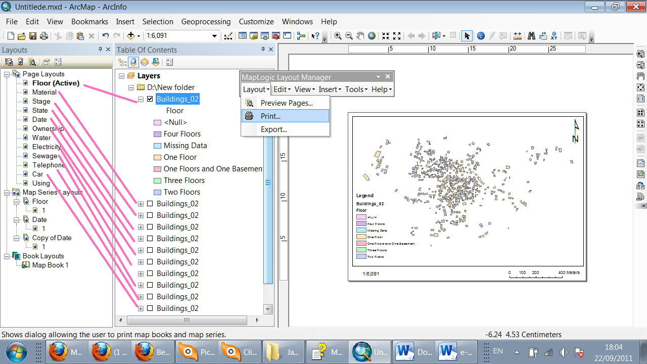
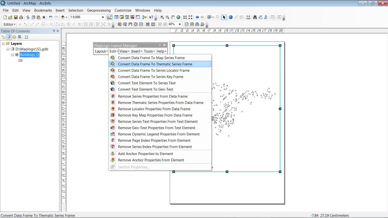
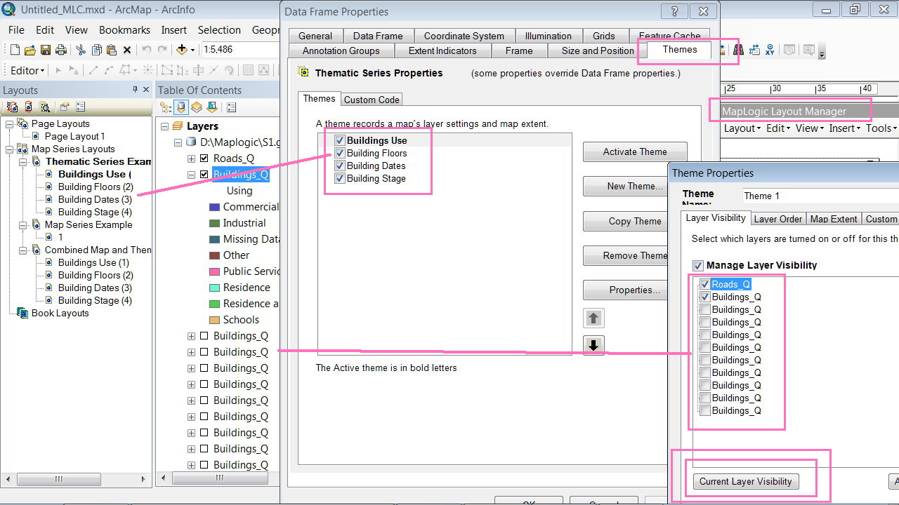
I'm not sure if there is some ready code that make it a bit easier to print multiple layouts...! do i need to be expert to do this very simple basic issue? and how come it is available for the end user by MapLogic (attached)?
How can i obtain an integrated code that has the features of MapLogic?
regards
Jamal
----------------------------------------
Jamal Numan
Geomolg Geoportal for Spatial Information
Ramallah, West Bank, Palestine
Jamal Numan
Geomolg Geoportal for Spatial Information
Ramallah, West Bank, Palestine
- « Previous
-
- 1
- 2
- Next »
- « Previous
-
- 1
- 2
- Next »