- Home
- :
- All Communities
- :
- Industries
- :
- Conservation
- :
- Conservation Questions
- :
- Re: Converting UK LCM2007 land cover data to polyg...
- Subscribe to RSS Feed
- Mark Topic as New
- Mark Topic as Read
- Float this Topic for Current User
- Bookmark
- Subscribe
- Mute
- Printer Friendly Page
Converting UK LCM2007 land cover data to polygons - please help
- Mark as New
- Bookmark
- Subscribe
- Mute
- Subscribe to RSS Feed
- Permalink
- Report Inappropriate Content
Hello everyone,
Firstly please apologize if this all sounds rather amateurish, I am completely new to ArcGIS and am currently losing my sanity over a university assignment. I have downloaded the LCM2007 land cover data for the whole of the UK from Edina Digimap. It consists of a raster and a vector file, both of which contain 24 classes of land cover (see picture).
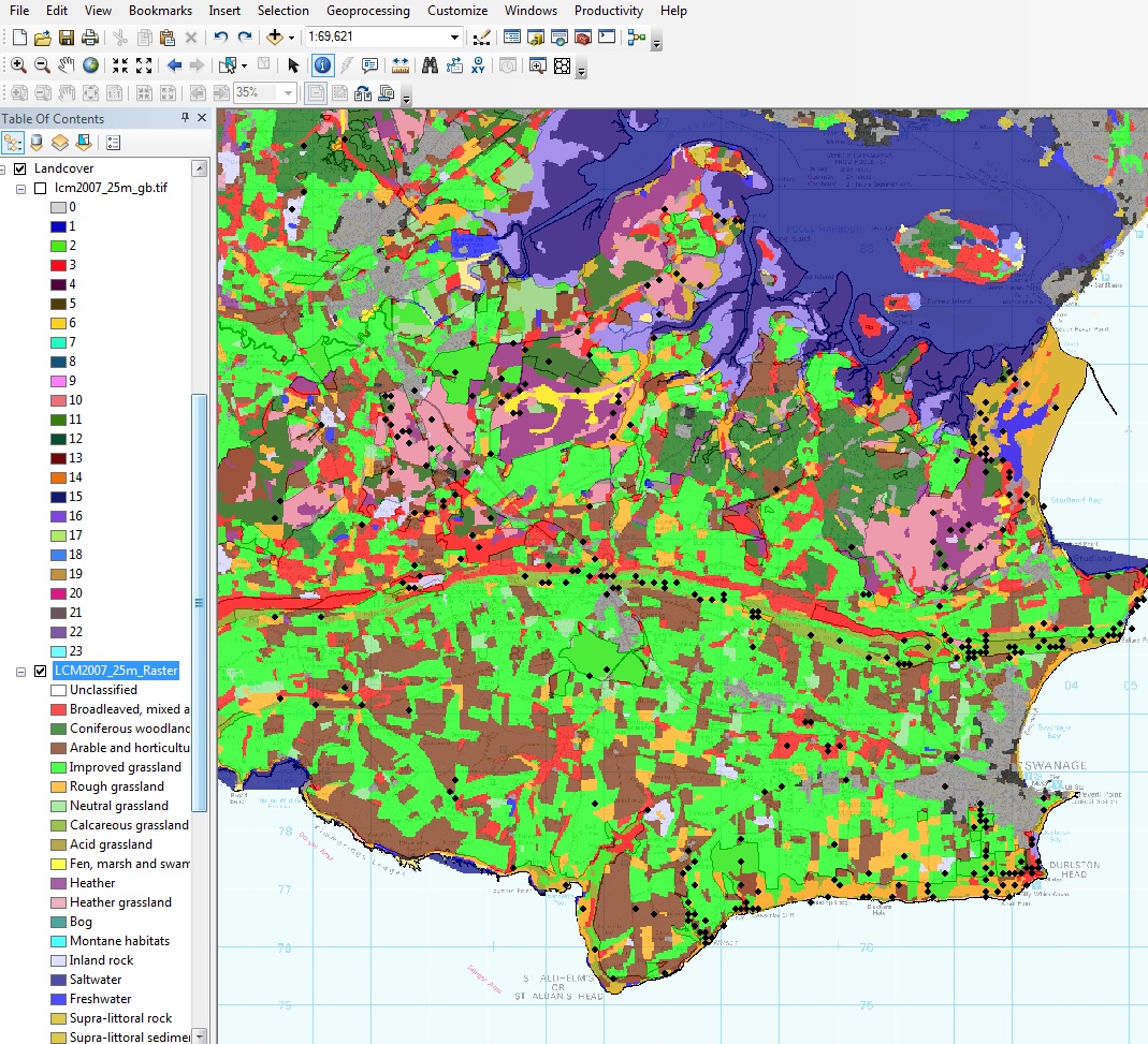
For my analysis, I need to work out which land cover type is preferred by butterflies in the area (black dots are butterfly sightings), so I need this land cover data as 24 individual polygons to calculate intersect etc. (unless there is a magical way for ArcMap to tell me which land cover type contains the most butterfly sightings without doing an individual intersect for each type)? In any way, I am currently stuck, as the Raster to Polygon conversion did not retain the different land cover types, but just gave me one single category, which makes it a bit useless.
Any suggestions at all?
- Mark as New
- Bookmark
- Subscribe
- Mute
- Subscribe to RSS Feed
- Permalink
- Report Inappropriate Content
I'm a bit confused. Don't you already have the land cover as vector date (polygons)? Anyway, if so, you can just use the Spatial Join tool to join the land cover data to your points, and then run Summary Statistics, and use the land cover types field as your statistics field to get a frequency of the different land cover types for your butterfly sighting points.
If you do in fact need to convert your raster to polygons first, you just need to make sure your are assigning the value field when you use the tool. It should have a different polygon for each land cover type, and then you can follow the above process.