- Home
- :
- All Communities
- :
- Industries
- :
- Natural Resources
- :
- Forestry
- :
- Forestry Questions
- :
- Re: Rock formations
- Subscribe to RSS Feed
- Mark Topic as New
- Mark Topic as Read
- Float this Topic for Current User
- Bookmark
- Subscribe
- Mute
- Printer Friendly Page
Rock formations
- Mark as New
- Bookmark
- Subscribe
- Mute
- Subscribe to RSS Feed
- Permalink
- Report Inappropriate Content
Hello, my name is Nik. I am a current student working on a Natural Resource project on finding suitability of habitats to find snakes. I am currently searching for a shapefile of a open rock formations in Pennsylvania. I am wondering if there is a current dataset that has listed any rock formations above ground or how I would be able to find quickly rock formations by using aerial imagery?
- Mark as New
- Bookmark
- Subscribe
- Mute
- Subscribe to RSS Feed
- Permalink
- Report Inappropriate Content
That is unfortunate. Maybe this type of data does not exist at the state-wide level? There may be bits and pieces of it scattered around. Have you tried asking the folks who gave you a shapefile about a potential outcrop dataset?
This may be a little far-fetched but have you tried contacting people in the Penn State Geology department? There may be someone there who could point you in the write direction (since the State does not seem to have this resource):
- Mark as New
- Bookmark
- Subscribe
- Mute
- Subscribe to RSS Feed
- Permalink
- Report Inappropriate Content
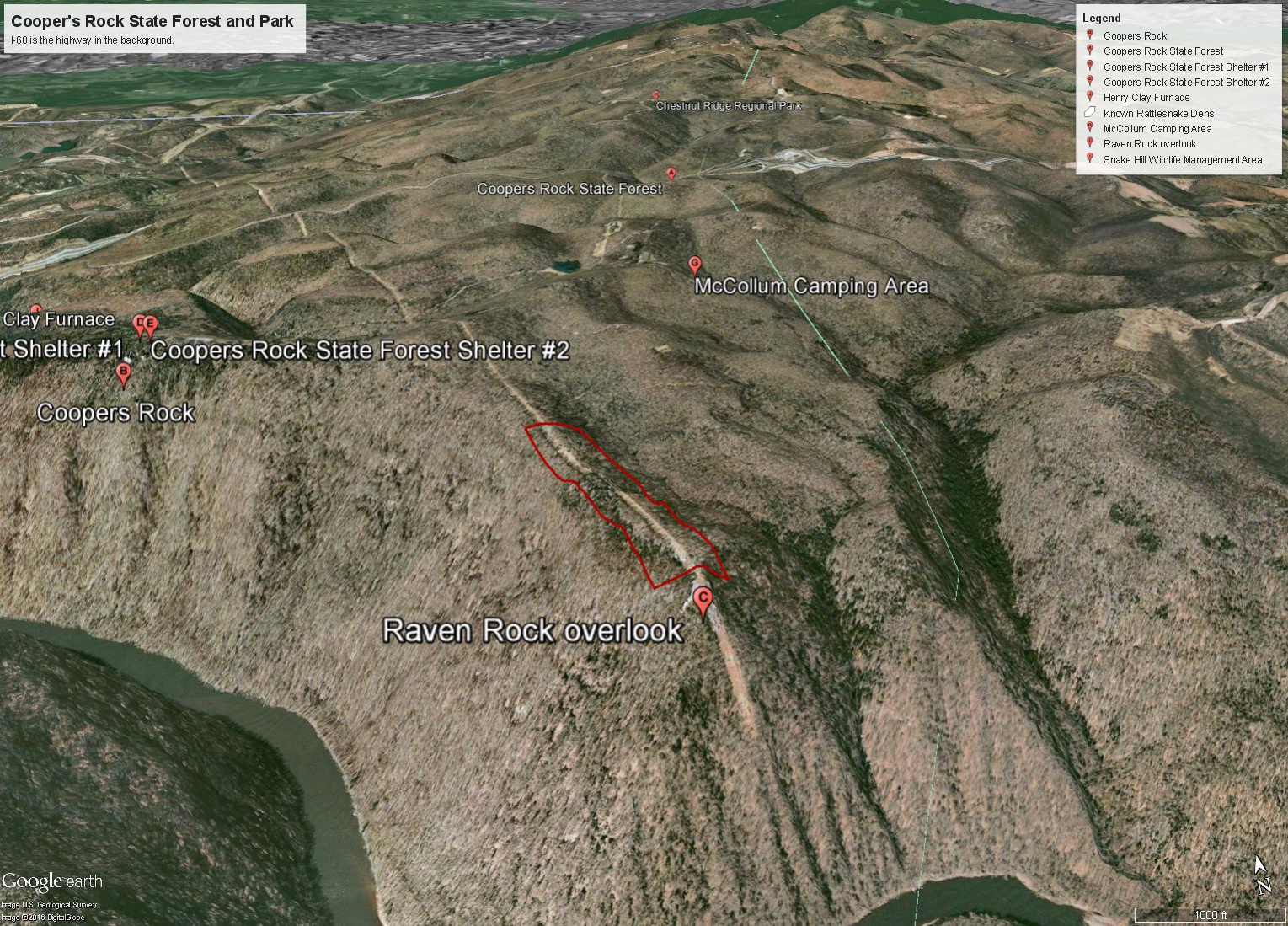
Unfortunately both PA and WV (where I live) are heavily forested so finding actual outcrops requires many hours in the field. I know that Cooper's rock state park in WV has both outcrops and large boulders strung out along the ridges and this makes some great snake habitat. There is a trail to Raven Rock ( an outcrop along the ridge ) and the utility company cut back all the trees along some high voltage lines. The rattle snakes love this part of the trail!
Also I would recommend looking for "leaf off" imagery and then starting with that at a similar scale to the attached image. Some state geologists in PA may have personal layers about outcrops...or at least a good personal knowledge of where they are...but in this region of the country I don't think outcrop polygons have been drawn!
- « Previous
-
- 1
- 2
- Next »
- « Previous
-
- 1
- 2
- Next »