- Home
- :
- All Communities
- :
- Products
- :
- Data Management
- :
- Data Management Questions
- :
- Re: How to create spatial index for Aerial Photos
- Subscribe to RSS Feed
- Mark Topic as New
- Mark Topic as Read
- Float this Topic for Current User
- Bookmark
- Subscribe
- Mute
- Printer Friendly Page
How to create spatial index for Aerial Photos
- Mark as New
- Bookmark
- Subscribe
- Mute
- Subscribe to RSS Feed
- Permalink
- Report Inappropriate Content
Hi Guys, I need help in building a spatial index of Aerial photos and have the Image Service project on the fly. Appreciate any ideas or inputs from anyone who has knowledge about this.
Thanks in advance.
- Jessiecar
- Mark as New
- Bookmark
- Subscribe
- Mute
- Subscribe to RSS Feed
- Permalink
- Report Inappropriate Content
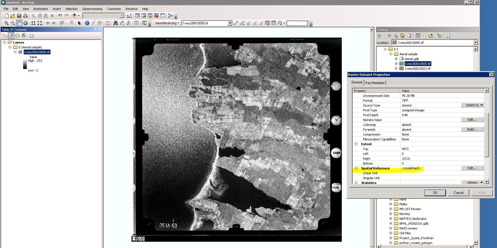
The georeference information is available as the metadata for all Aerial photos I have - both georeferenced & non-georeferenced images.
Here's a sample screenshot of an Aerial Photo that is not georeferenced.
Will try to use Phyton code in georeferencing by batch.
Thank you Xander.
- Mark as New
- Bookmark
- Subscribe
- Mute
- Subscribe to RSS Feed
- Permalink
- Report Inappropriate Content
Another problem I have here, as you can see on the sample image, the GCPs is not the current extent of the Aerial Photo. It require cropping before I can proceed in georeferencing by batch using Python code.
Any other inputs related to this, I would appreciate.
Thanks everyone!
- Mark as New
- Bookmark
- Subscribe
- Mute
- Subscribe to RSS Feed
- Permalink
- Report Inappropriate Content
Hate to tell you, but you are looking at a lot of manual labor...
- Mark as New
- Bookmark
- Subscribe
- Mute
- Subscribe to RSS Feed
- Permalink
- Report Inappropriate Content
That's a really old style aerial photo. Don't see many of them around these days. Xander is absolutely correct, there is no one click solution to get these geo-referenced easily.
But have you considered using more modern sources of aerial imagery. Or do these photos have some sort of historical interest?
- Mark as New
- Bookmark
- Subscribe
- Mute
- Subscribe to RSS Feed
- Permalink
- Report Inappropriate Content
You are right Neil, I need historical Aerial photos along with the recent ones. And I don't have problems with recent coz all of those are georeferenced.
That's what I'm trying to resolve Xander, finding a possible solution to not do a lot of manual work.
- Mark as New
- Bookmark
- Subscribe
- Mute
- Subscribe to RSS Feed
- Permalink
- Report Inappropriate Content
Good news. Me and my team were able to find other resources like gdal & metalab to do cropping of aerial to have the GCPs as the extent of each Aerial photo.
From there, once the Aerial photos are cropped, we can georeferenced these images by batch using Python or other script.
Thanks everyone for all the inputs.
- Mark as New
- Bookmark
- Subscribe
- Mute
- Subscribe to RSS Feed
- Permalink
- Report Inappropriate Content
Hi Jessiecar Esguerra , I don't want to ruin your day, but I don't think that it will be possible. Cropping the images in batch is no problem. What really is the hardest job is to find the control points and align the raster with these control points. See Fundamentals of georeferencing a raster dataset—Help | ArcGIS for Desktop
How are you planning to use a python script to do that part of the job?
- Mark as New
- Bookmark
- Subscribe
- Mute
- Subscribe to RSS Feed
- Permalink
- Report Inappropriate Content
HI Xander, I have the metadata for all my Aerial Photos which contains all the control points. I can use the image filename to link with the metadata and then assign those control points programmatically.
- Mark as New
- Bookmark
- Subscribe
- Mute
- Subscribe to RSS Feed
- Permalink
- Report Inappropriate Content
That is good to know! In what format are the control points stored? And how are they defined (rows, cols and related coordinates)?
- Mark as New
- Bookmark
- Subscribe
- Mute
- Subscribe to RSS Feed
- Permalink
- Report Inappropriate Content
For the control points I have two formats available in the metadata, the DMS & Decimal Degrees.