- Home
- :
- All Communities
- :
- User Groups
- :
- Coordinate Reference Systems
- :
- Questions
- :
- Re: Aligning Geotiff file with map
- Subscribe to RSS Feed
- Mark Topic as New
- Mark Topic as Read
- Float this Topic for Current User
- Bookmark
- Subscribe
- Mute
- Printer Friendly Page
Aligning Geotiff file with map
- Mark as New
- Bookmark
- Subscribe
- Mute
- Subscribe to RSS Feed
- Permalink
- Report Inappropriate Content
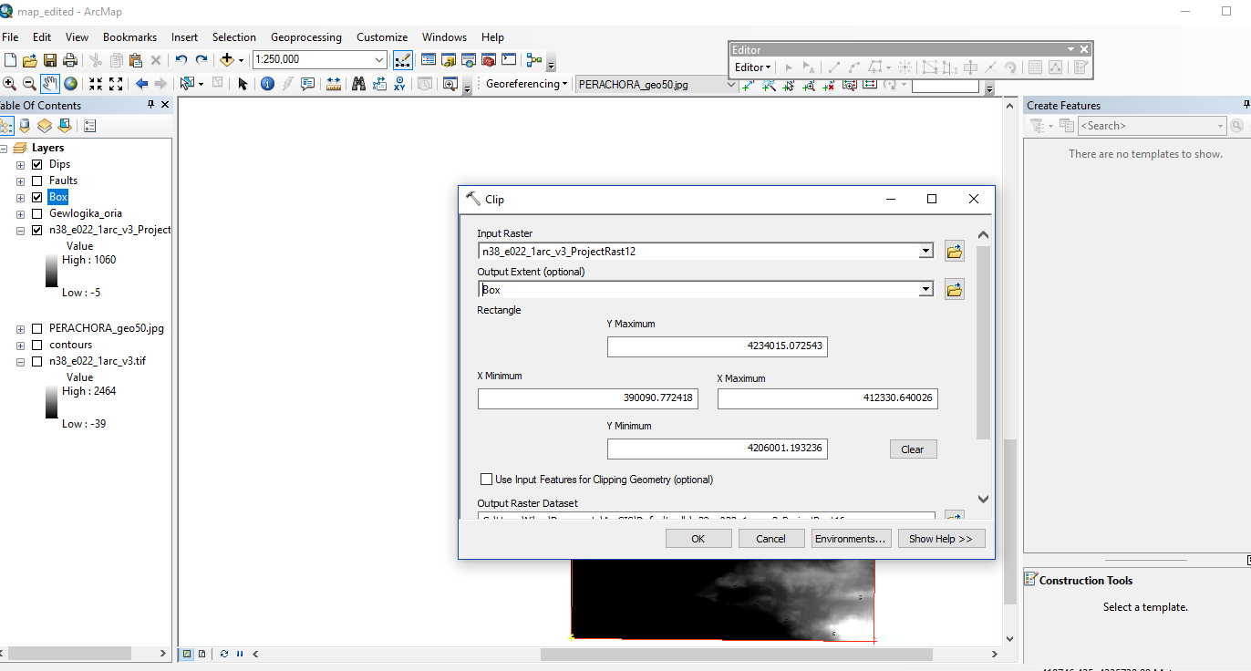
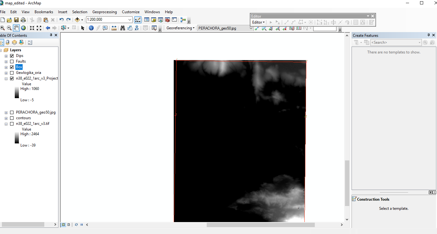
Hello everybody. I am having some trouble on something i work for and i would like some help. I downloaded a Geotiff file for the area that i am working for and i would like to clip it so it fits the outline of my map. My map is on GreekGrid and so i set the geotiff file on GreekGrid from ArcCatalog. Next i used the Project tool from arc toolbox (Projections and Transformations-Raster) and i create a new shapefile with GreekGrid as spacial reference. Then i cliped my file with Management Tools -> Raster -> Raster Processing -> clip. This is the result i am getting. The redbox is the outline of my map and it doesnt align with my file. Am i doing something wrong?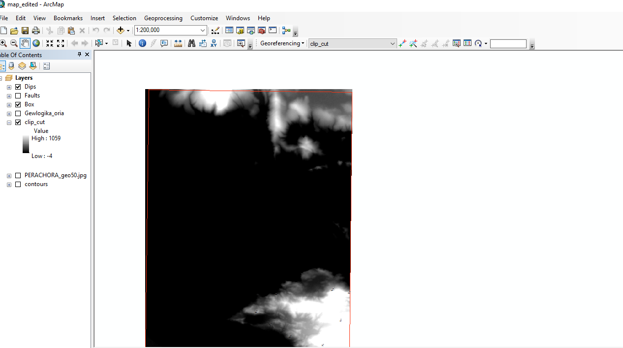
- Mark as New
- Bookmark
- Subscribe
- Mute
- Subscribe to RSS Feed
- Permalink
- Report Inappropriate Content
There are several things that could be causing this.
Some things to check:
- Check to see if the original Geotiff you downloaded already has a coordinate system assigned to it. If it does not, you want to use the Define Projection Tool. If it does and it is in a different coordinate system than you want, use the Project Tool. I usually find that GeoTIffs come with a coordinate system already assigned, so my initial guess is that you want to use the Project Tool. When to use the Define Projection tool and the Project tool? | Support Services Blog
- When running the Clip, check the Environments settings on the tool (click on Environments button and then expand the many topics). It may be that it is defaulting to a different setting(s) than desired. Setting geoprocessing environments—Help | ArcGIS for Desktop
- Also, it may be beneficial to use a Snap Raster. This is set while in the Environments settings.
How the Snap Raster environment setting works—Help | ArcGIS for Desktop
If none of these work, report back on what you found out. while the above are the more common issues, there are also several other things that could of gone awry. For example, Tiffs often come with a header line in the raster itself that acts as a world file, so even though a separate world file (.tfw) is not visible, it still using the "built-in" one. But that is less common.
Chris Donohue, GISP
- Mark as New
- Bookmark
- Subscribe
- Mute
- Subscribe to RSS Feed
- Permalink
- Report Inappropriate Content
It is a coordinate systems problem.
First, What is the coordinate system for your raster before you transform it? (Could you print screen the spatial reference in source tab of layer properties?)
Next i used the Project tool from arc toolbox (Projections and Transformations-Raster) and i create a new shapefile with GreekGrid as spacial reference.
Why did you use Project tool to transform the raster, instead of creating a new shape file with same coordinate of raster? (then transform the result after finishing clip process)
Finally, What is the coordinate system for data frame within all this process?
- Mark as New
- Bookmark
- Subscribe
- Mute
- Subscribe to RSS Feed
- Permalink
- Report Inappropriate Content
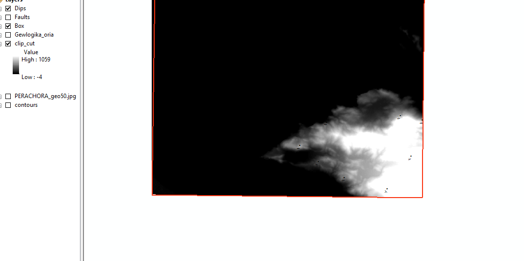
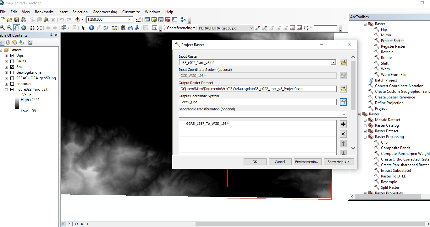
Alright this is what i am getting after i reproject my file.

Everything seems to be going well so far. I used the project tool since my geotiff was already on WGS84.
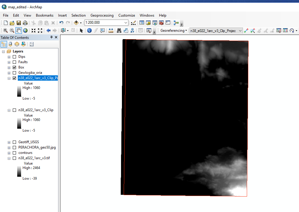
After the cliping process i get the result i posted on my initial post.
Below i upload some sceenshots showing the spacial reference of my files.Everything is set to GreekGrid .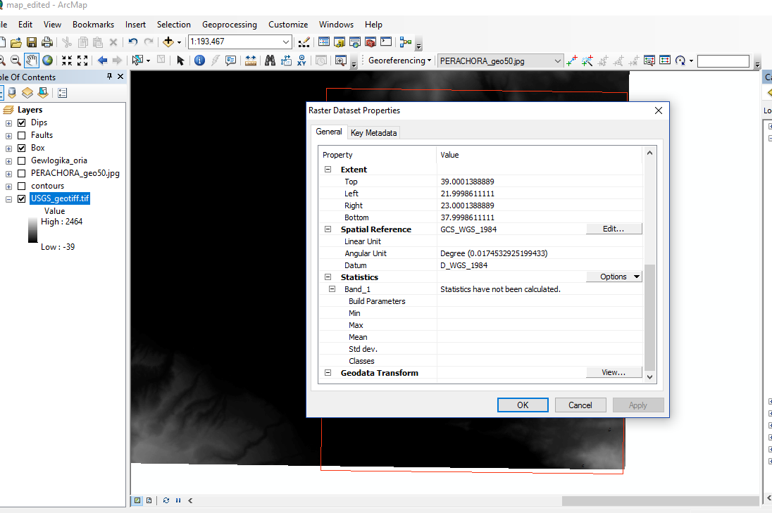 This is before using project tool on my geotiff file.
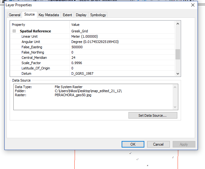 This is what everything else is set too.
So something is not set properly on the cliping process?
- Mark as New
- Bookmark
- Subscribe
- Mute
- Subscribe to RSS Feed
- Permalink
- Report Inappropriate Content
Now, Create a new shape file (polygon) in Greek_Grid .Then draw the extend . and be sure it well align with the raster before clip the raster.
- Mark as New
- Bookmark
- Subscribe
- Mute
- Subscribe to RSS Feed
- Permalink
- Report Inappropriate Content
I am not sure what you mean. Are you suggesting that i should create new
polygon after i clip my file? And if so what for? Thanks for your answer
and Happy Christmas.
- Mark as New
- Bookmark
- Subscribe
- Mute
- Subscribe to RSS Feed
- Permalink
- Report Inappropriate Content
Did you use the transformation method "GGRS_1987_To_WGS_1984" during reprojection of the Raster dataset?
Think Location
- Mark as New
- Bookmark
- Subscribe
- Mute
- Subscribe to RSS Feed
- Permalink
- Report Inappropriate Content
- Mark as New
- Bookmark
- Subscribe
- Mute
- Subscribe to RSS Feed
- Permalink
- Report Inappropriate Content
what I mean Is, let all layers (raster and polygon feature) in WGS 84. then do Clip. Is it align or not ?
if it is align , run Project tool for layers . OK
- Mark as New
- Bookmark
- Subscribe
- Mute
- Subscribe to RSS Feed
- Permalink
- Report Inappropriate Content