- Home
- :
- All Communities
- :
- Industries
- :
- State & Local Government
- :
- State & Local Government Questions
- :
- Re: Construct from parent - Incorrect breakline me...
- Subscribe to RSS Feed
- Mark Topic as New
- Mark Topic as Read
- Float this Topic for Current User
- Bookmark
- Subscribe
- Mute
- Printer Friendly Page
Construct from parent - Incorrect breakline measurements
- Mark as New
- Bookmark
- Subscribe
- Mute
- Subscribe to RSS Feed
- Permalink
- Report Inappropriate Content
Here's a video showing my issue. I've tried it on a different PC and did not get different results. Note the use of the parcel measurement button.
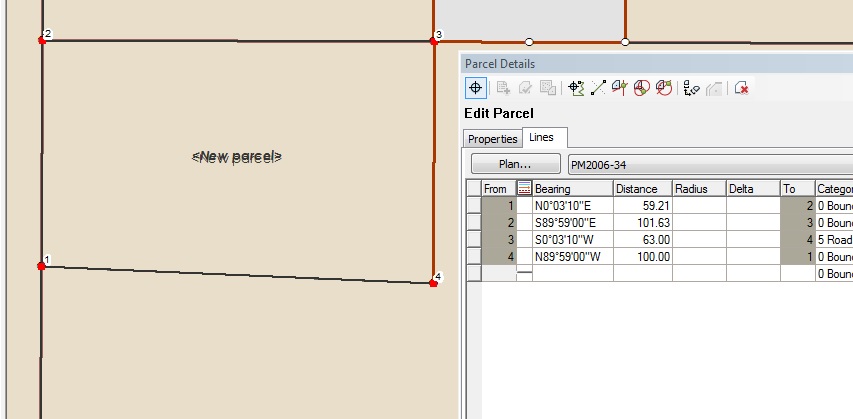
I've been heavily involved in migrating our parcels to the parcel fabric. In effort to teach myself to construct the fabric from scratch, I've been following the workflow for adding a new subdivision. I'm able to input the subdivision boundary without any issues. My problems come when it's time to construct from parent and use breaklines to add parcel corners. It seems that the breaklines do not land where they need to be, resulting in incorrect linework when constructed. I assume you must construct your line with the parcel measurement view button selected, meaning the parcel is in its original state prior to being joined. Is this correct?
In the image below, the north boundary is broken were required and the west boundary is broken at 63 feet. Upon the traverse of the road frontage, I head south 63 feet from point 8 to 12 and then head west 100 feet to point 9 from 12. As you can see, there is a major issue with alignment at point 9. When I measure the distance between points 4 and 9, I get about 59 feet, which is wrong, even though I typed in the correct breakline measurement
Any input as to why this is happening would be greatly appreciated. I've been struggling for days trying to figure out why this is happening. To temporarily fix my problem, I've been drawing the maps as a separate feature and then using the subdivision from CAD workflow to get my lines into fabric.
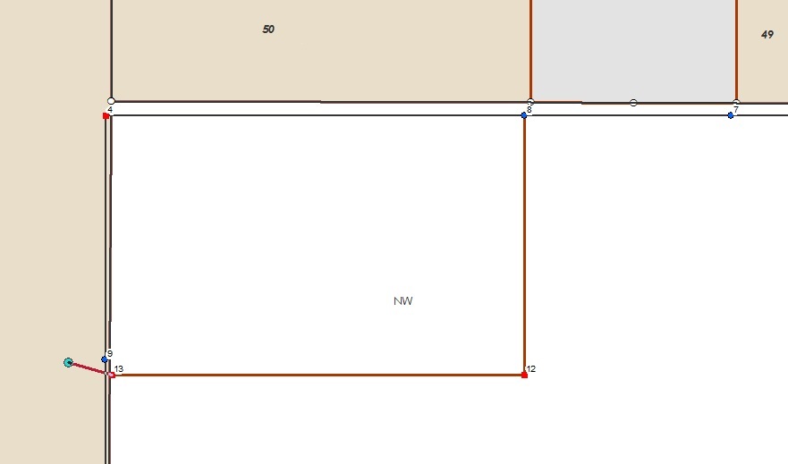
Here's the end result, note the incorrect measure 59.xx which was broken at 63.
- Mark as New
- Bookmark
- Subscribe
- Mute
- Subscribe to RSS Feed
- Permalink
- Report Inappropriate Content
I solved my problem, but in the most unlikely of ways.
No matter what, trying to construct the lots from the subdivision boundary always produced errors in the breakline dimensioning. I'm drawing this particular fabric from scratch, so I know that the fabric not the issue. I've tried this process using different maps, all did not work out right. Using the workflow also did not fix this issue.
I'm able to join the subdivision boundary to fabric without an issue, the issue comes when trying to build my road frontages/lots. After I built this latest subdivision, I did a construct from parent of the subdivision and created a lot - essentially, a copy of the subdivision boundary. Once the lot was created, I did a second construct from parent and started building my road frontages/lots. All of the sudden, I'm not getting breakline issues, or road frontages that will not close from one boundary line to another. Everything fit.
Has anyone had issues trying to construct lots from subdivision boundaries? I'm sure that this has to be a bug with the system.
The fabric is definitely proving to be a valuable tool the more I learn about it. But, I do feel like I'm spending days trying to figure out a lot of things because the documentation does not accurately depict real world situations. Creating a fabric from scratch is easy, even migrating existing linework isn't too difficult, but adding content to the fabric accurately has been a lot of trial and error.
- Mark as New
- Bookmark
- Subscribe
- Mute
- Subscribe to RSS Feed
- Permalink
- Report Inappropriate Content
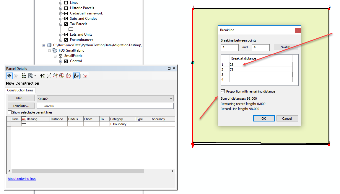
A way to maintain the measured unit for the breakline is to check the box "Proportion with remaining distance". The standard breakline will take a measured distance along the line which, based on spatial reference, misclose on parcel, might not measure exactly to 25ft if you draw a line. If you check that box and enter in the length of all the line segments you should be able to maintain the proper measurements:

- Mark as New
- Bookmark
- Subscribe
- Mute
- Subscribe to RSS Feed
- Permalink
- Report Inappropriate Content
Jason, thank you for the reply. Using the method of checking the "proportion with remaining distance" appeared to work where I needed to break my lines. It is a difficult for me to understand why that works. As I understand, proportion with remaining distance is used when the length of an existing line may change due to newer maps coming in having different measured lengths. Proportion adds new lines and flags the old line as unbuildable. In my case, I'm simply trying to follow the new subdivision workflow. Break the subdivision boundary to construct road frontage lines.
I don't seem to understand why using the breakline function while the map is positioned using the COGO dimensions (clicking parcel measurement view button) breaks the line incorrectly. Regardless of whether the button is selected or deselected, shouldn't the line break where it's needed since it's calculating the value based on the record dimension of the line?
Also, I have noticed that when doing a breakline, a line may become highlighted with a purple boundary (such as the west line in your second parcel photo). Is there a link to documentation describing what that means?
Thank you for your help!
Walid