- Home
- :
- All Communities
- :
- Products
- :
- ArcGIS GeoStatistical Analyst
- :
- ArcGIS GeoStatistical Analyst Questions
- :
- Re: Help with Spatial Join errors
- Subscribe to RSS Feed
- Mark Topic as New
- Mark Topic as Read
- Float this Topic for Current User
- Bookmark
- Subscribe
- Mute
- Printer Friendly Page
- Mark as New
- Bookmark
- Subscribe
- Mute
- Subscribe to RSS Feed
- Permalink
- Report Inappropriate Content
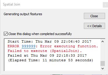
I am trying to join my data points to the map base shapefile through a spatial join. It is a very large amount of data and all appears to be going fine until the very end when it is creating the new output file. It just gives me the every generic error. Any suggestions as to what may be the problem and how to resolve? The peach line should look like the purple map. Thanks!
Solved! Go to Solution.
Accepted Solutions
- Mark as New
- Bookmark
- Subscribe
- Mute
- Subscribe to RSS Feed
- Permalink
- Report Inappropriate Content

Create a new file Geodatabase or save the feature class inside an existing File Geodatabase.
Make sure the data path is valid (No Space or special character should be present in the pathname).
Also I won't recommend saving the feature class in Default.gdb since it is stored in temp. folder.
Create a new File GDB in a short and valid pathname and save the feature class (e.g. D:\GISProject\MyDatabase.gdb)
Think Location
- Mark as New
- Bookmark
- Subscribe
- Mute
- Subscribe to RSS Feed
- Permalink
- Report Inappropriate Content
If it is a large amount of data, there is a chance that after spatial join, the data size is exceeding the 2 GB size limit of shapefile.
Try saving the output as a File Geodatabase Feature Class.
Let me know if the issue persists.
Think Location
- Mark as New
- Bookmark
- Subscribe
- Mute
- Subscribe to RSS Feed
- Permalink
- Report Inappropriate Content
jayanta.poddar I will definitely give this a try and get back to you on the result. Thanks!
- Mark as New
- Bookmark
- Subscribe
- Mute
- Subscribe to RSS Feed
- Permalink
- Report Inappropriate Content
jayanta.poddar the only option when filling out the output feature class is a .shp or how would I change that?
- Mark as New
- Bookmark
- Subscribe
- Mute
- Subscribe to RSS Feed
- Permalink
- Report Inappropriate Content
Create a new file Geodatabase or save the feature class inside an existing File Geodatabase.
Make sure the data path is valid (No Space or special character should be present in the pathname).
Also I won't recommend saving the feature class in Default.gdb since it is stored in temp. folder.
Create a new File GDB in a short and valid pathname and save the feature class (e.g. D:\GISProject\MyDatabase.gdb)
Think Location
- Mark as New
- Bookmark
- Subscribe
- Mute
- Subscribe to RSS Feed
- Permalink
- Report Inappropriate Content
This worked! Thank you!
- Mark as New
- Bookmark
- Subscribe
- Mute
- Subscribe to RSS Feed
- Permalink
- Report Inappropriate Content
I tried saving it to the default geodatabase area and it would not even start the spatial join. It was an immediate error.
- Mark as New
- Bookmark
- Subscribe
- Mute
- Subscribe to RSS Feed
- Permalink
- Report Inappropriate Content
Maybe this error is relate to spatial reference not same for layers or you are in start edit session.
- Mark as New
- Bookmark
- Subscribe
- Mute
- Subscribe to RSS Feed
- Permalink
- Report Inappropriate Content
All the layers spatial references are the same. Thank you for the suggestion though! Sometimes it is the small things lol.