- Home
- :
- All Communities
- :
- Products
- :
- Mapping and Charting Solutions
- :
- Mapping and Charting Questions
- :
- Re: Buffer with Land Avoidance
- Subscribe to RSS Feed
- Mark Topic as New
- Mark Topic as Read
- Float this Topic for Current User
- Bookmark
- Subscribe
- Mute
- Printer Friendly Page
Buffer with Land Avoidance
- Mark as New
- Bookmark
- Subscribe
- Mute
- Subscribe to RSS Feed
- Permalink
- Report Inappropriate Content
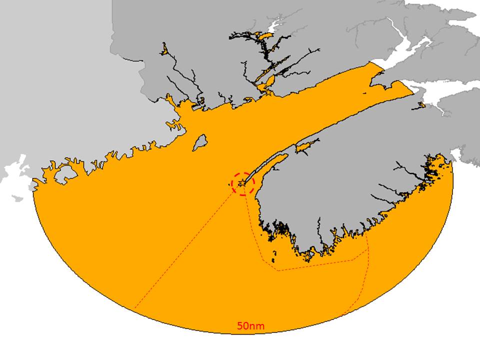
I have a problem with buffering and impact that land masses can have on distance.
We have SAR stations with vessels that have a 50nm action range to them. Now, Yes, we can draw a 50nm buffer around but we also wish for GIS to take into account (just like a vessel, in contrast to an airplane) that the 50nm range must go around land masses.
What ArcGIS tool could I use to fulfill this request?
I attached an image of my question.
- Mark as New
- Bookmark
- Subscribe
- Mute
- Subscribe to RSS Feed
- Permalink
- Report Inappropriate Content
From your screen shot it looks like the Buffer tool was used first with 50nm.
Then the erase tool was used to remove the land/shore boundary from the resulting buffer.
- Mark as New
- Bookmark
- Subscribe
- Mute
- Subscribe to RSS Feed
- Permalink
- Report Inappropriate Content
Good afternoon,
Yes, Created a 50nm buffer around one of our SAR Stations. But then used the simpler ‘Clip’ to remove the buffer over the land mass.
What my question is that, as a vessel needs to divert around land mass, obviously, the range of 50nm for the buffer gets shorter. I want to know if ArcGIS has a way of doing that for you.
Right now, I take 10-15 paths with the ‘measurement tool’ and them simply remove the vertexes that fall outside of that range. A very time consuming task… as I have over 200 stations and ranges (with also intersect with each other) to do.
Thank you.