3D Risk Modeling Tools
- Subscribe to RSS Feed
- Mark as New
- Mark as Read
- Bookmark
- Subscribe
- Printer Friendly Page
- Report Inappropriate Content
With the emergence of more severe climate events, 3d Resilience solutions are of highest importance.
A recent study undertaken by researchers from Princeton and Rutgers universities, found that along all of the U.S. coastline, the average risk of a 100-year flood will increase 40-fold by 2050.
The following tools and solutions can be leveraged by any government agency to model 3D flood exposure.
The tools require FEMA flood data following the May, 2014 FEMA Guidance for Flood Risk Analysis and Mapping | Flood Depth and Analysis Grids Standards to Generate a 3D Flood Grid and attribute Polygon and 3D models with Risk attributes.
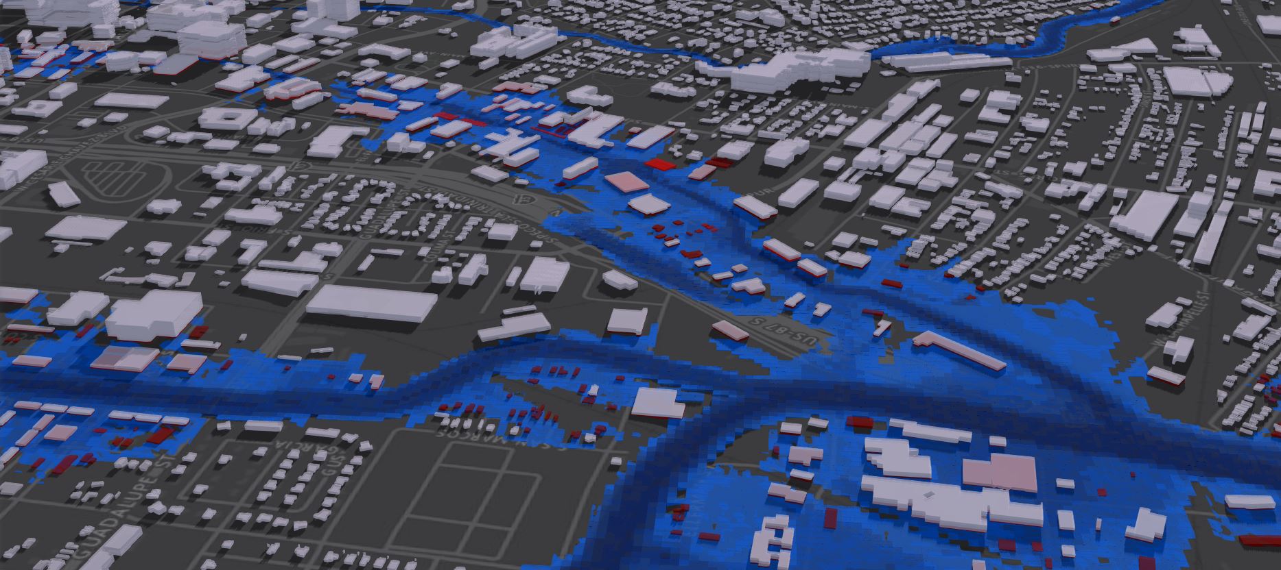
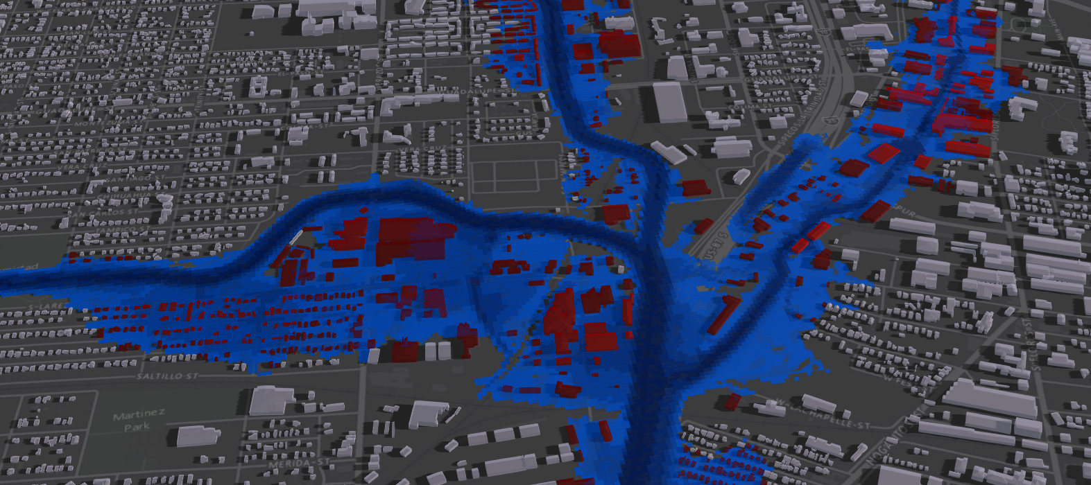
San Antonio, Texas 3D Flood Model generated with Esri 3D Risk Modeling Tools.
The 3D risk Tools require access to Water Surface Elevation Level (WSEL) Grids and Depth Grids.


Image Source: FEMA
Depth Grids must exist for levels 02%, 1% 2% 4%, 10% annual chance flood events
Download the 3D Risk Tools here: Risk_Tools_3D.zip - Box
- Extract the toolbox and map to the toolbox in ArcGIS Pro.
- More information on how-to map to toolboxes
Generating the 3D flood Grid
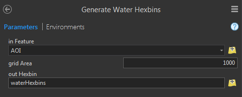
1.) Run the Generate Water Hexbins GeoProcessing tool.
- Input a Polygon covering the area you want to generate a grid for
- The default Units of the input polygon specify the units of the grid area Size.
- Grid Area is in units square ex: 1000 sq feet shown below
2.) Run the Flood Grid Attributor GeoProcessing tool.
- Input the waterHexbins Grid generated in the previous tool
- Input the % Water Surface Elevation and Depth Rasters

3.) Run the Flood Grid 2 AGOL/Portal GeoProcessing tool
- Input the Attributed Hexbin Grid from the previous process
- Set the Scratch folder for outputting files to
- Determine whether or not you want:
- Only Multipatches to be generated "retain 3D Grids"
- Only if interested in viewing in ArcGIS Pro
- Scene Layer Package
- 3D Format for sharing models on ArcGIS Online or Portal
- Share Package
- If you wish to Upload the Scene Layer Package to ArcGIS Online

- Publish the Layers on ArcGIS Online
- Add the Layers to a 3D WebScene
- Set Opacity to Layer
- Set Color to Blue
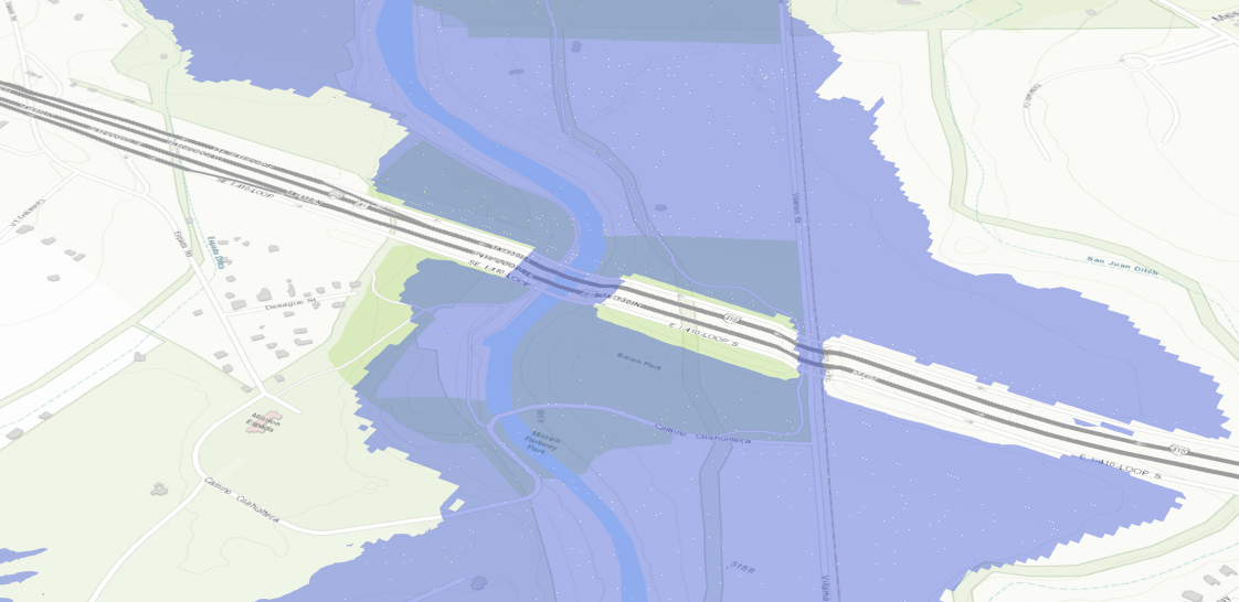
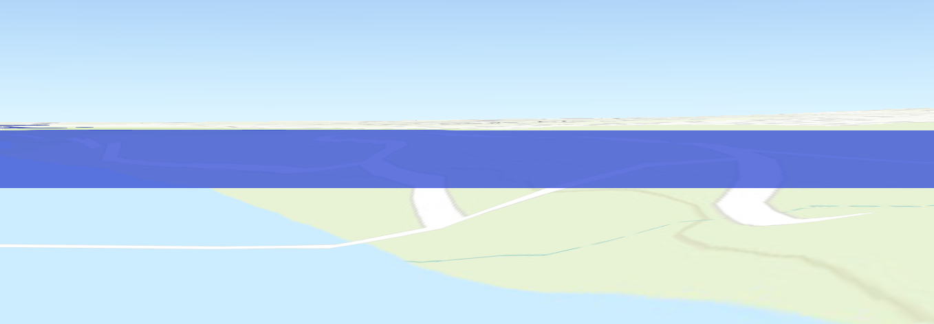
Result = 3D Gridded Plane denoting Water Surface Elevation attributed with Depth and other values.
** Note you can also manually manipulate the Grid after step 2 above instead using Appearance and Symbology in ArcGIS Pro**

Attributing Multipatch Features and Polygon Data with Flood Level attributes:
**Note: If you do not have 3D models use the Esri Local Gov 3D Basemaps Solution to Generate 3D Building from LiDAR.
** Esri can also accurately model your city in 3D from available LiDAR. Contact me: gtaylor@esri.com for more info...
1.) Run the Water Surface Elevation Attributor GeoProcessing tool.
- input Multipatch Building or Polygon Feature
ex: 3D Building, Building Footprint, Parcel, Block Group etc...
- Select the FeatureID.
- FeatureID cannot be a String (Text) based value.
- Input the % Water Surface Elevation and Depth Rasters
- Input the Digital Elevation Model (DEM) Raster
2.) Use Join or Relate Operations to Join the Table to the Footprints by FeatureID
3.) Use Symbology to color the 3D Building models by Attribute
Slicing Building Floors and Attributing floors with Flood data
Requirement: 3D Building models in Multipatch format.
1.) Download the FacilityTools located here: https://community.esri.com/people/GTaylor-esristaff/blog/2016/01/13/create-floors-from-3d-building-m...
2.) In the Facility Tools Toolbox run the Split Floors GP tool on the 3D Multipatch Buildings

3.) In the 3D Risk Tools toolbox Run the Water Surface Elevation Attributor (Building Floors) GP tool
- Input Building Footprints
- Select floorID
- Select buildingID
- Input the Building Flood Table generated in Step one of this process
- Select the buildingID

4.) Use Join or Relate Operations to Join the Table to the Footprints by FeatureID
5.) Use Symbology to color the 3D Building models by Attribute
Results = 3D Buildings with floors attributed with flood data

I will be updating this post with more in-depth instructions as time permits.
Best to get the tools out early to help Cities worldwide model Risk in 3D to further enable discussion leading to Resilient solutions.
If you have any questions regarding the tools please leave a comment below and I will respond as soon as possible.
Hope you find these tools helpful!
You must be a registered user to add a comment. If you've already registered, sign in. Otherwise, register and sign in.