- Home
- :
- All Communities
- :
- User Groups
- :
- 911 GIS
- :
- Questions
- :
- Homogenisation
- Subscribe to RSS Feed
- Mark Topic as New
- Mark Topic as Read
- Float this Topic for Current User
- Bookmark
- Subscribe
- Mute
- Printer Friendly Page
- Mark as New
- Bookmark
- Subscribe
- Mute
- Subscribe to RSS Feed
- Permalink
- Report Inappropriate Content
Hi,
I am new to ArcGIS. I am a bit stuck. I am adding a 2 layers in ArcMap :
ArcGIS coordinate system
* Type Geographic
* Geographic coordinate reference GCS_WGS_1984
and
* Type Projected
* Geographic coordinate reference GCS_MGI
* Projection MGI_Austria_GK_M31
I cannot see the projected layer - when I Define Projection as MGI, they are both there, but very FAR apart. Is it the Datum that is incorrect? How can I correct this?
Thanks in advance
Terri
Solved! Go to Solution.
Accepted Solutions
- Mark as New
- Bookmark
- Subscribe
- Mute
- Subscribe to RSS Feed
- Permalink
- Report Inappropriate Content
Thank you for the mail. The correct projected Coordinate system for LULC_NAWI is WGS_1984_UTM_Zone_33N.
Go to the Shapefile Properties from ArcCatalog > XY Coordinate System Tab. And define WGS_1984_UTM_Zone_33N as the coordinate system.
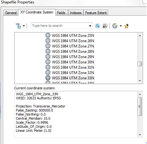
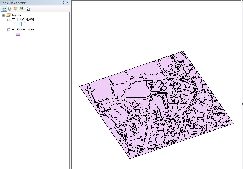
The Project_area and LULC_NAWI will then exactly overlay on each other.
Think Location
- Mark as New
- Bookmark
- Subscribe
- Mute
- Subscribe to RSS Feed
- Permalink
- Report Inappropriate Content
You don't define a projection unless the file is actually in that coordinate system, so check the each layers property to see if it is 'undefined'. If undefined, then define it. If the files have a defined coordinate system, but they are far apart, then they have been defined wrong.
If you want two files with a defined coordinate system to be in the same coordinate system, then you use the Project tool, not the Define Projection tool
- Mark as New
- Bookmark
- Subscribe
- Mute
- Subscribe to RSS Feed
- Permalink
- Report Inappropriate Content
Many thanks, firstly. They are far apart, so shall try and investigate in ArcCatalog to see which one has been defined wrong 
I look forward to reading your blog too, since I am now totally confused!
Terri
- Mark as New
- Bookmark
- Subscribe
- Mute
- Subscribe to RSS Feed
- Permalink
- Report Inappropriate Content
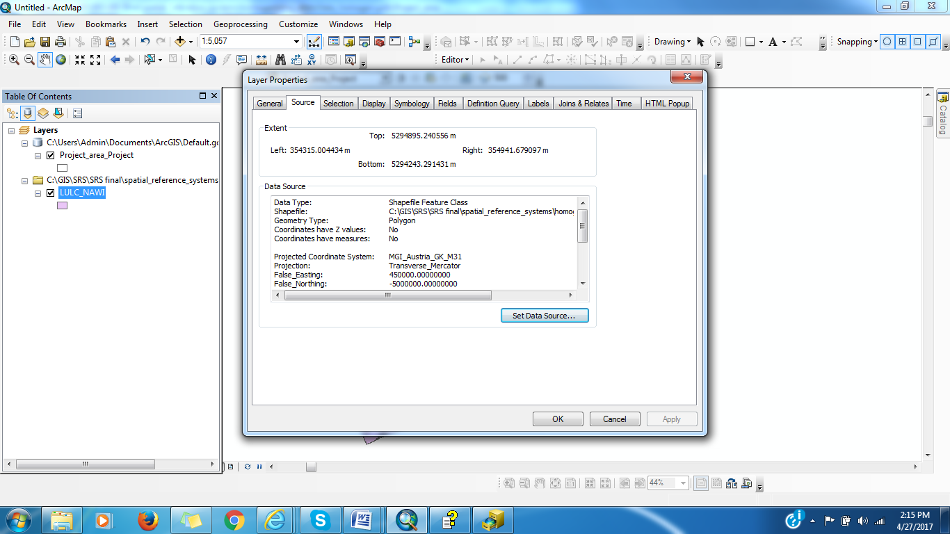
Could you attach the screenshot showing the spatial extent of the projected layer (Layer Properties > Source tab)?
Think Location
- Mark as New
- Bookmark
- Subscribe
- Mute
- Subscribe to RSS Feed
- Permalink
- Report Inappropriate Content
- Mark as New
- Bookmark
- Subscribe
- Mute
- Subscribe to RSS Feed
- Permalink
- Report Inappropriate Content
- Mark as New
- Bookmark
- Subscribe
- Mute
- Subscribe to RSS Feed
- Permalink
- Report Inappropriate Content
Is the data from Austria region? If you could attach a sample data from the projected data, I could have a look at it.
Think Location
- Mark as New
- Bookmark
- Subscribe
- Mute
- Subscribe to RSS Feed
- Permalink
- Report Inappropriate Content
Have emailed it to you.
Thanks
Terri
- Mark as New
- Bookmark
- Subscribe
- Mute
- Subscribe to RSS Feed
- Permalink
- Report Inappropriate Content
The first image is definitely in decimal degrees given its extent and its defined projection.
The second image is a strange one, given the extent values for the easting and the northing and the fact that the false northing is an extremely large negative number. Was that one defined as such already? or did you define it? since the northing values don't jive and given the latitude, I would expect something like a UTM since the northing is about 1/2 way to the N pole
- Mark as New
- Bookmark
- Subscribe
- Mute
- Subscribe to RSS Feed
- Permalink
- Report Inappropriate Content
I am a student of GIS - this was part of an assignment - the data was given incomlete like this to 'make us correct it' - but try as I may, I cannot work out that coordinate system either
Thanks anyway
Terri