- Home
- :
- All Communities
- :
- ArcGIS Topics
- :
- Applications Prototype Lab
- :
- Applications Prototype Lab Blog
- :
- Building Interaction Sample
Building Interaction Sample
- Subscribe to RSS Feed
- Mark as New
- Mark as Read
- Bookmark
- Subscribe
- Printer Friendly Page
- Report Inappropriate Content
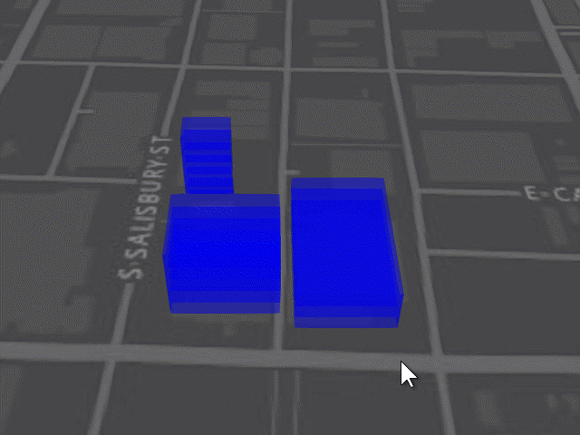
This developer sample demonstrates how to interact with a multi-level building in three dimensions using Esri's ArcGIS API for JavaScript version 4.3. With a simple click/tap and drag operation a building can be intuitively and smoothly repositioned on the Earth's surface. Note that each floor is a separate graphic but are treated as a single entity when manipulated.
Click here for the live application.
Click here for the source code.
It is important to note that the sample uses a few undocumented API calls to achieve this behavior. As such we caution against using these calls in a production environment as they are unsupported and will very likely change in the near future.
The code may seem overly or unnecessarily complicated, below is a summary of what the code does:
- Building Construction
For portability reasons, building floors are constructed from a set of hardcoded values. It is important to note that each floor is an individual graphic attributed with a building identifier. This identifier is used to group all adjacent floors for highlighting and spatial translation. - Dragging
The code is using the SceneView's drag event to respond to the three phases of a pointer's drag operation, namely start, update and end. During the "start" phase, a hittest is performed to identify the building floor (if any) under the pointer. If a floor is found, adjacent floors are identified and highlighted. In the "update" phase, two undocumented methods SceneView._stage.pick and SceneView._computeMapPointFromIntersectionResult are used to tracking pointer displacement in real world coordinates. These methods return the map location directly beneath the pointer, ignoring features and graphics. - Disabling/Enabling Pointer Interaction
When a building is dragged to a new location, it is necessary to disable map interaction so that map does not pan. To achieve this we used another undocumented method, SceneView.inputManager, to add and then restore handlers. - Moving
At present, it is not possible to update the geometry of an existing graphic. In order to show a graphic moving it must be deleted and then re-added. This may seem somewhat cumbersome but the performance hit is negligible. - Throttling
It is likely that the rate of the drag event is fired will exceed the display frame rate. If the display is performing at 60 frames per second (or better) then excessive drag events are ignored.
Once again I would like to stress that this is a developer sample specifically for version 4.3 of the Esri JavaScript API. It is very likely that some of the code used is this application will be either obsolete or redundant (or both) in future releases.
Special thanks to Johannes Schmid for his technical expertise!
You must be a registered user to add a comment. If you've already registered, sign in. Otherwise, register and sign in.