- Home
- :
- All Communities
- :
- User Groups
- :
- ArcGIS Desktop Installation Support
- :
- Questions
- :
- Re: ArcMap 10.2.2 Exception thrown in destructor
- Subscribe to RSS Feed
- Mark Topic as New
- Mark Topic as Read
- Float this Topic for Current User
- Bookmark
- Subscribe
- Mute
- Printer Friendly Page
ArcMap 10.2.2 Exception thrown in destructor
- Mark as New
- Bookmark
- Subscribe
- Mute
- Subscribe to RSS Feed
- Permalink
- Report Inappropriate Content
Hi,
I was having issues with arcmap and opening mxd files. This is what I got. The mxd wasnt the problem because I was able to open on another machine.

So I decided to update to 10.2.2. Tried to open the same file and no luck. Then I tried creating a new mxd file, and this time the add data button was grayed out. So I decided to repair the software and do the same operations again and it didnt work.
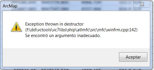
Then I tried to uninstall 10.2.2 and reinstall it again. This time I got the following error. I havent seen this error before.
Any thoughts about this issue?
Thanks!!!
- Mark as New
- Bookmark
- Subscribe
- Mute
- Subscribe to RSS Feed
- Permalink
- Report Inappropriate Content
I'm seeing everyone here seems to get this error when exporting to pdf. I'm getting this error when exporting a point feature class and then attempting to join it to a dbf table. The join doesn't work and the table returns blank. I close arcmap (10.5) to attempt to refresh the system and upon opening it again, I get the destructor error. To get around this error, it appears if I save the dbf and export the point feature class to a shapefile to a folder on my desktop, rather than a (somewhat) buried folder in a network drive, the join works just fine. I'm wondering if others who experience this when exporting to pdf are attempting to save their files in a similarly buried folder? How many levels is too many?
Many thanks on any help.
- Mark as New
- Bookmark
- Subscribe
- Mute
- Subscribe to RSS Feed
- Permalink
- Report Inappropriate Content
Hi, Kelly, in response to your question about working with network data, I generally try to keep network paths as short as possible, or at least make the connection through Windows Explorer as near to the folder containing the data you are working on as possible. It's more efficient, and also less likely that network traffic will interfere with your operation on the data.
Working with shapefiles specifically, I do not know why, but shapefiles are 'discontented' if placed in a folder named "temp", "TEMP" or any variation thereof. They are also 'discontented' if there is a folder with that name ANYWHERE in the path to the shapefile. The data simply does not behave properly for certain operations.
The issue with joining a feature class to a DBF table could be differences in the item definitions - a feature class in a geodatabase can have field names longer than 10 characters, the Short and Long Integer fields are slightly different lengths, etc. Joining a DBF table to a shapefile on the other hand pretty much insures that the field names and field type definitions will match, since the attribute table for the shapefile is another DBF.
I hope this is helpful, that you had a lovely Christmas and that the coming New Year will be the best ever.
- Mark as New
- Bookmark
- Subscribe
- Mute
- Subscribe to RSS Feed
- Permalink
- Report Inappropriate Content
Also having this issue but with a different cpp line#, running Desktop 10.5 on Win7 Enterprise 64-bit.
"ArcMap
Exception thrown in destructor
(f:\dd\vctools\vc7libs\ship\atlmfc\src\mfc\winfrm.cpp:159)
Encountered an improper argument."
- Mark as New
- Bookmark
- Subscribe
- Mute
- Subscribe to RSS Feed
- Permalink
- Report Inappropriate Content
One thing I've seen on the internal Support Page to resolve this particular message is to reset your Esri folder located C:\Users\<user profile>\AppData\Roaming and C:\Users\<user profile>\AppData\Local folders. Rename the ESRI folder to ESRI_Old and attempt the workflow again. Does the error persist?
- Mark as New
- Bookmark
- Subscribe
- Mute
- Subscribe to RSS Feed
- Permalink
- Report Inappropriate Content
This issue is logged as NIM100450 by Esri Support Services. In the migration from our old bug tracking system, NImbus, to the new system, this was marked as a duplicate, but the number of the duplicate bug was unknown. The bug seems to be associated with CAD data, and I have received this error message myself, back at 10.2.x, with the error line cpp:142. Since this is a different software version, and a different operating system, with a slightly different error, I'd log a case with Esri Support Services. We have a lot more tools now than we had several years ago that can be used to actually identify sources of bugs, and find solutions for the errors, so I encourage you to contact us.
- Mark as New
- Bookmark
- Subscribe
- Mute
- Subscribe to RSS Feed
- Permalink
- Report Inappropriate Content
We are suddenly unable to Add data in ArcMap or browse to a directory in ArcCatalog. When we click on Add Data... button in ArcMap there is nothing in the Look in: drop down menu. I tried adding new directory path, but that doesn't do anything. If I keep trying over and over it crashes ArcMap. In ArcCatalog when I try to browse to a directory it crashes ArcCatalog. We are getting the same error message.

We run ArcGIS for Desktop 10.2.1 (version 10.2.1.3497) and ArcFM Desktop 10.2.1c SP1 (build 3445).
The entire organization recently upgraded to MS Office 2016 and since then ArcMap / ArcFM Desktop users have browsing / crashing issues. We also can't add/view .xlsx files to ArcMap / ArcCatalog. It all seems to be related to MS Office 2016 Upgrade.
I currently have an open case with ESRI Canada # 02168552.
Does anyone else have similar issue?
- Mark as New
- Bookmark
- Subscribe
- Mute
- Subscribe to RSS Feed
- Permalink
- Report Inappropriate Content
For the crashing, please try to delete your Normal.mxt, ArcCatalog.gx, and Normal.gxt in your C:\Users\<username>\AppData\Roaming\ESRI\Desktop10.x\ArcCatalog\ and C:\Users\<username>\AppData\Roaming\ESRI\Desktop10.5\ArcMap\Templates\ folders. These are automatically regenerated when you restart ArcMap and ArcCatalog.
For the second issue, Microsoft has released a set of drivers to fix the XLSX support in ArcMap. Search for and install the 2007 Office System Driver: Data Connectivity Components.
- Mark as New
- Bookmark
- Subscribe
- Mute
- Subscribe to RSS Feed
- Permalink
- Report Inappropriate Content
- « Previous
- Next »
- « Previous
- Next »