Turn on suggestions
Auto-suggest helps you quickly narrow down your search results by suggesting possible matches as you type.
Cancel
- Home
- :
- All Communities
- :
- Products
- :
- ArcGIS Explorer Desktop (Retired)
- :
- ArcGIS Explorer Desktop Questions
- :
- ArcGIS Explorer Aerial Photo drawing distance
Options
- Subscribe to RSS Feed
- Mark Topic as New
- Mark Topic as Read
- Float this Topic for Current User
- Bookmark
- Subscribe
- Mute
- Printer Friendly Page
ArcGIS Explorer Aerial Photo drawing distance
Subscribe
2822
0
02-28-2013 05:21 AM
02-28-2013
05:21 AM
- Mark as New
- Bookmark
- Subscribe
- Mute
- Subscribe to RSS Feed
- Permalink
- Report Inappropriate Content
Hi!
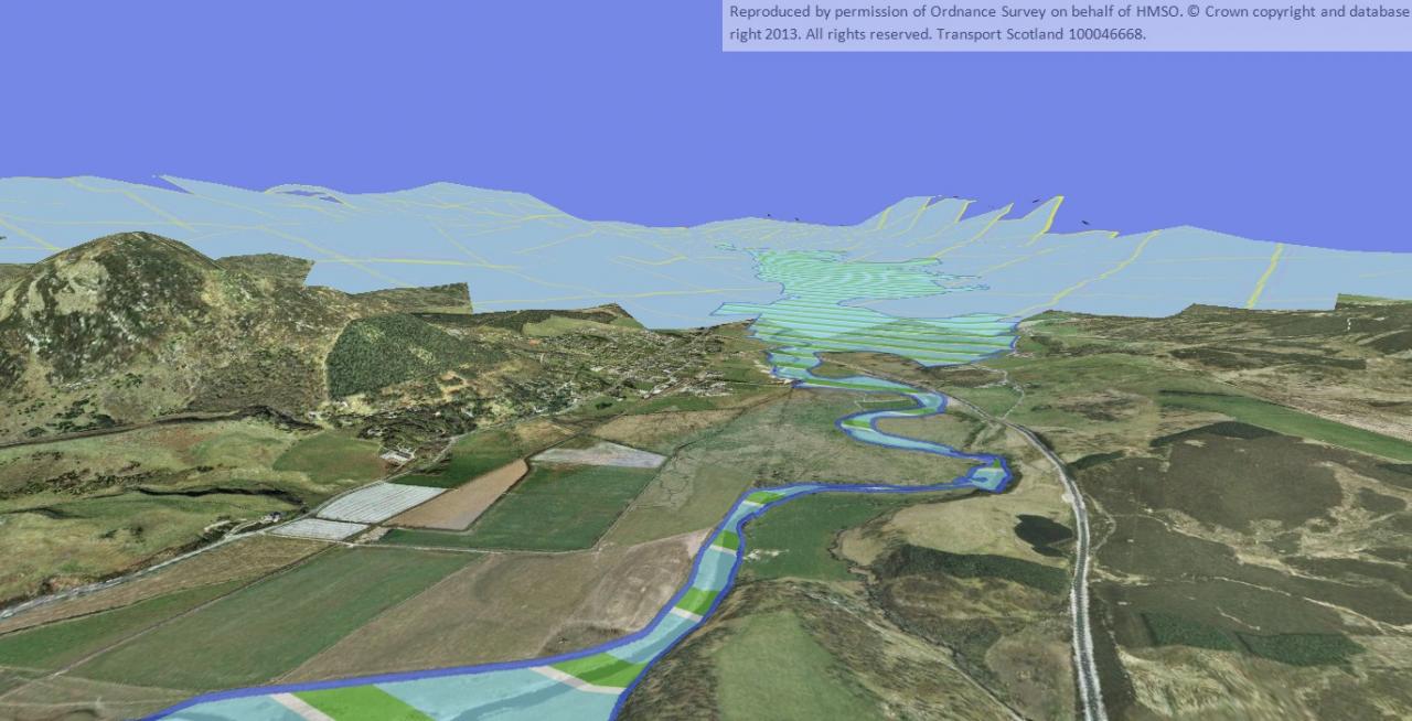
I have developed a cool 3D viewer that uses Aerial Photography draped over a DTM.
It works really well, but unfortunately the aerial photo does not draw over a long distance (see attached). Is there anyway to change this so my client can see more of the landscape drawn in the distance?
Thanks in advance!
Tim :confused:
0 Replies