- Home
- :
- All Communities
- :
- Products
- :
- ArcGIS GeoEvent Server
- :
- ArcGIS GeoEvent Server Blog
- :
- Waze Connector for GeoEvent Extension (10.4.x)
Waze Connector for GeoEvent Extension (10.4.x)
- Subscribe to RSS Feed
- Mark as New
- Mark as Read
- Bookmark
- Subscribe
- Printer Friendly Page
- Report Inappropriate Content
The Real-Time GIS product team is thrilled to announce our newest addition to the ArcGIS GeoEvent Gallery, the Waze Connector for GeoEvent.
The Waze Connector for GeoEvent allows users to receive live data from Waze, the world's largest community-based traffic and navigation app. Through the free Waze Connected Citizens Program (CCP), they support a two-way data exchange between Waze and their municipal partners. This allows for streamlined access to both authoritative information alongside user submitted alerts and hazards.
In order to utilize the Waze data in GeoEvent Extension you must first be a part of their Connected Citizens Program. Information regarding the requirements to participate and apply to join that program can be found at the following link:
Waze Connected Citizens Program
https://www.waze.com/ccp
Once you've received your necessary access credentials you can begin pulling in the live user submitted Alerts and Traffic Jams and consuming that data throughout the ArcGIS platform. The tutorial included with the connector will walk you through the process of polling the feed, filtering by data type, and writing that data out into the spatiotemporal big data store or other data sources. Also included is an optional segment that will allow users to quickly apply the Waze symbology to their newly created web maps.
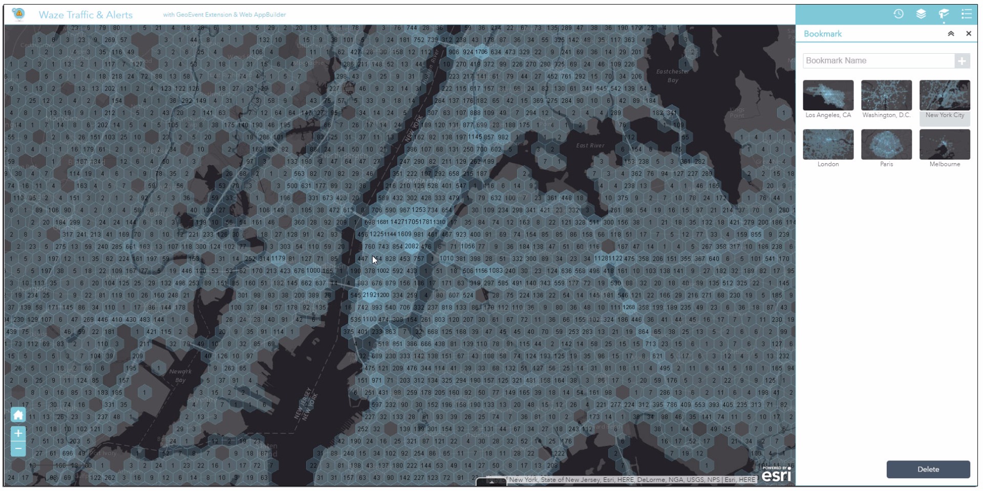
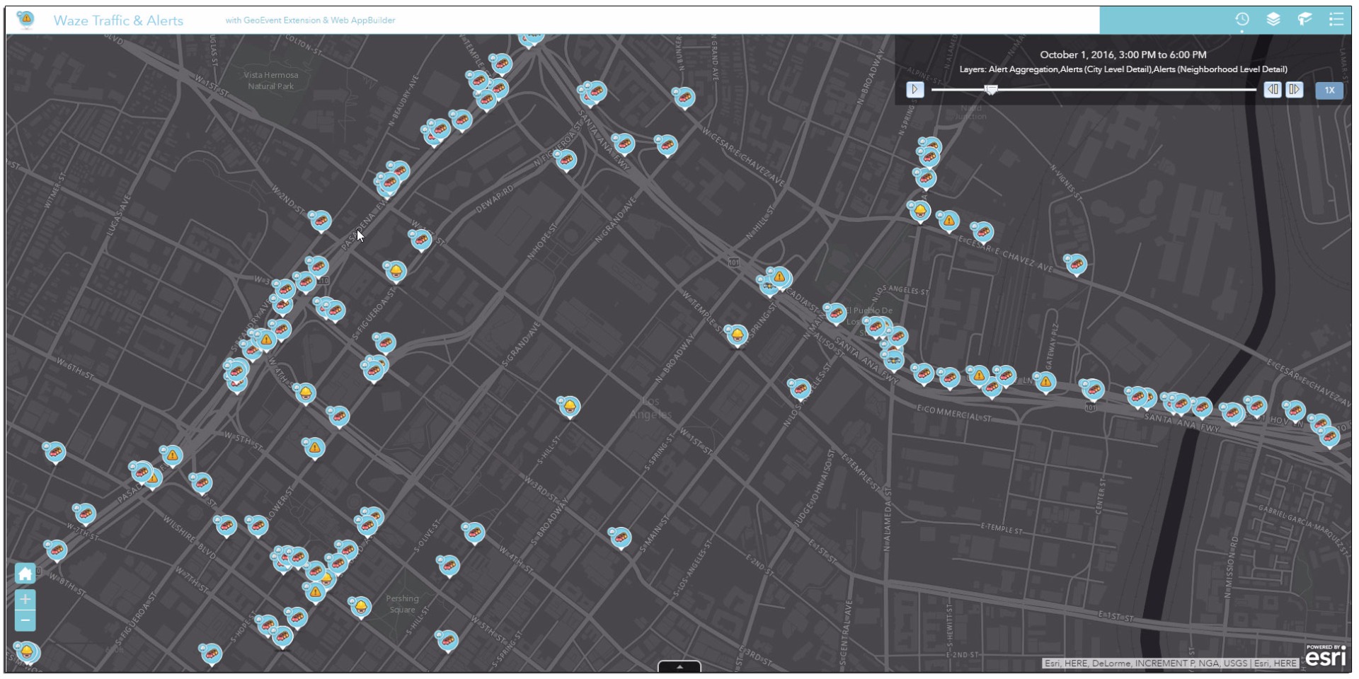
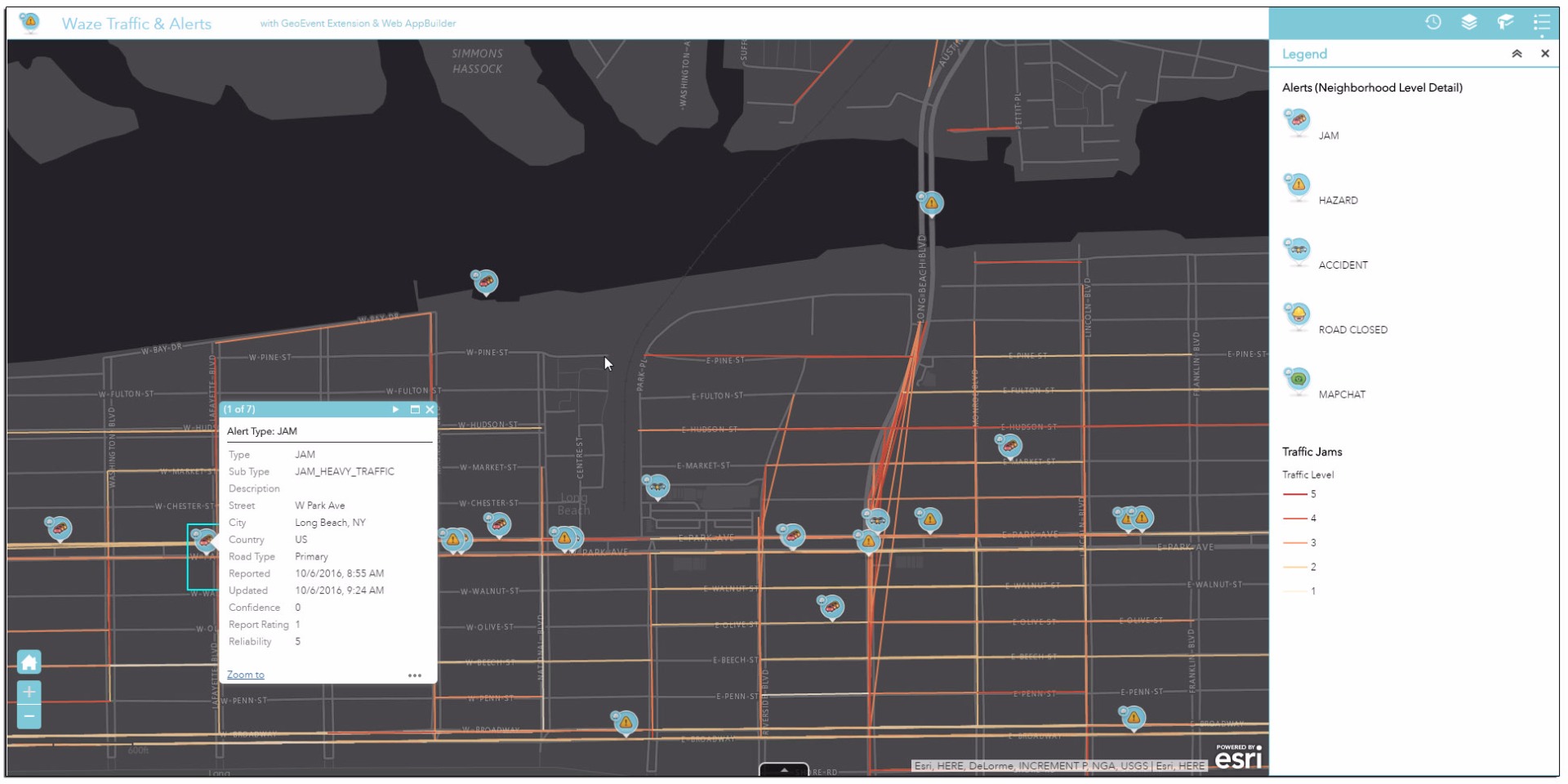
For an example of the types of information being made available to Esri users, and a sneak peak of the new aggregation styles for map services using the spatiotemporal big data store with the 10.5 release, check out the screenshots from our demo application below.

You must be a registered user to add a comment. If you've already registered, sign in. Otherwise, register and sign in.