- Home
- :
- All Communities
- :
- Products
- :
- ArcGIS Hub
- :
- ArcGIS Hub Questions
- :
- How to Organize Content for Open Data?
- Subscribe to RSS Feed
- Mark Topic as New
- Mark Topic as Read
- Float this Topic for Current User
- Bookmark
- Subscribe
- Mute
- Printer Friendly Page
- Mark as New
- Bookmark
- Subscribe
- Mute
- Subscribe to RSS Feed
- Permalink
- Report Inappropriate Content
Greetings,
I have two questions:
1. Is there a way to register an on-premises map service with AGOL in a way that each feature layer is individually added, so that they may be given individual tags?
2. How are organizations controlling which datasets are assigned to thematic categories within their site?
Background:
I've been tasked with setting up my agency's ArcGIS Open Data site. I'd like to know how other organizations organize their Open Data content so that it is "discoverable" and not too time-consuming to manage. I've published an Open Data service on our on-premises ArcGIS Server, registered the service with AGOL and added it as an item to our Open Data group, and in turn added that group to the Open Data site.
1. Now the datasets are showing up on the Open Data site (still Private while in development), but since the AGOL item is a "map image layer," each layer has the same tags - the ones provided for the service:
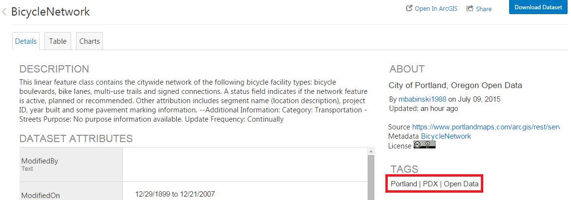
As you can see the feature layer description came through but the tags are service-level tags. I'd like to give each layer tags specific to that layer (we maintain these in a SQL Server database). I've experimented with registering individual feature layers from the open data service in AGOL but I'm worried that if the index of the layer changes when I republish the service that the connection may break, and then with 75+ layers to add this will be very time consuming. So, is there a way to register a service with AGOL in a way that each feature layer is individually added, so that they may be given individual tags?
2. I've created ten text widgets in the Open Data site, each with a link leading to a formatted url that queries the category name:
(Boundary is http://data.pdx.opendata.arcgis.com/datasets?q=boundary&sort_by=relevance)
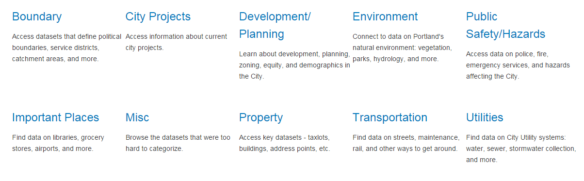
So, how do I structure the tags, metadata, etc for the particular layers so that only the desired layers show up under a search of "boundary?"
Thanks,
Micah
Solved! Go to Solution.
Accepted Solutions
- Mark as New
- Bookmark
- Subscribe
- Mute
- Subscribe to RSS Feed
- Permalink
- Report Inappropriate Content
Hi Micah,
In the URL you have, use keyword instead of q to return datasets based on tags. When the parameter is q it is a query against Title, Description, Tags, but when it's keyword it is only against tags.
If you want to query to individual groups, you can do that too by passing the query to the group ID. If this is what you want to do, we can provide more info.
Also, when all the layers are in 1 service, it can be a bottle neck. If you see any performance issues with Open Data, this would be one thing to check. You could try to add a few more instances to the service or try splitting the data up into different services.
Thank,
Andrew
- Mark as New
- Bookmark
- Subscribe
- Mute
- Subscribe to RSS Feed
- Permalink
- Report Inappropriate Content
Great, thank you Andrew! I imagine the URL parameter info will be particularly useful as we go forward.
My colleague and I took some time to register each individual feature layer in AGOL and added to the Open Data group, so now we have finer control over tags and thumbnails. Would this cause problems down the road if we should decide to add layers to the Open Data service, re-ordering the index numbers of the layers?
I'm still interested in querying by individual group; any additional info on that you could pass along would be fantastic.
Warm Regards,
Micah