- Home
- :
- All Communities
- :
- Developers
- :
- JavaScript Maps SDK
- :
- JavaScript Maps SDK Questions
- :
- Re: Converting coordinates to route params
- Subscribe to RSS Feed
- Mark Topic as New
- Mark Topic as Read
- Float this Topic for Current User
- Bookmark
- Subscribe
- Mute
- Printer Friendly Page
- Mark as New
- Bookmark
- Subscribe
- Mute
- Subscribe to RSS Feed
- Permalink
- Report Inappropriate Content
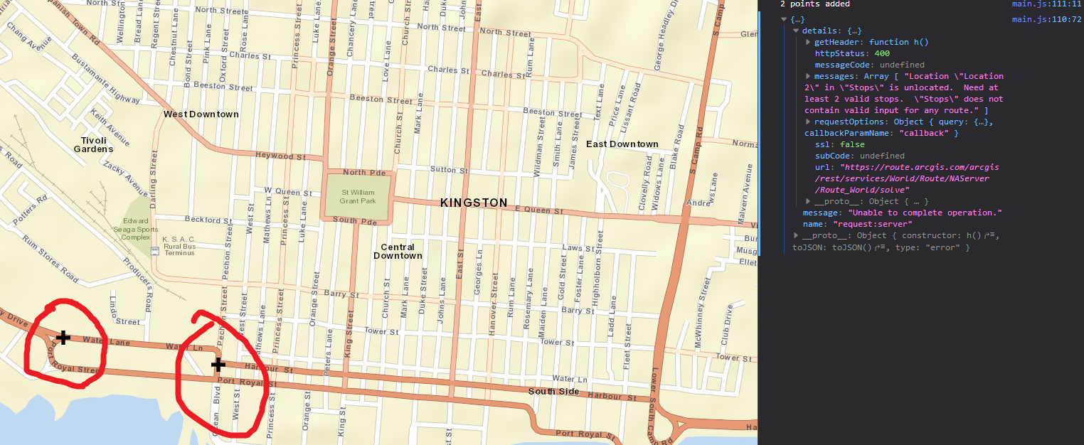
How can i convert coordinates to routeparam compatible stops in order to carry out a RouteTask?
These coordinates are coming from the browser geolocation. Currently when i click on a point and then use the geolocation from the browser I get an error from attempting to solve the route, however when i click on 2 separate points the route solves successfully.
Solved! Go to Solution.
- Mark as New
- Bookmark
- Subscribe
- Mute
- Subscribe to RSS Feed
- Permalink
- Report Inappropriate Content
I am going to try that right now, should I pass in the new geom object to the stops array in the routeparams?
- Mark as New
- Bookmark
- Subscribe
- Mute
- Subscribe to RSS Feed
- Permalink
- Report Inappropriate Content
This indeed works, so in order to use coordinates you have to convert the geometry to webmercator geometry first then push that to the routes params. Esri should make a note of this, or amend it in future releases. thanks for pointing out the suggestions I was stumped.
- Mark as New
- Bookmark
- Subscribe
- Mute
- Subscribe to RSS Feed
- Permalink
- Report Inappropriate Content
Evon,
I don't think they have to be in Web Mercator it is just the fact that all the stops have to be in the same WKID.
- Mark as New
- Bookmark
- Subscribe
- Mute
- Subscribe to RSS Feed
- Permalink
- Report Inappropriate Content
Ok I see, i guess the clicked points were not in the same wkid then.
- Mark as New
- Bookmark
- Subscribe
- Mute
- Subscribe to RSS Feed
- Permalink
- Report Inappropriate Content
Evon,
Correct the clicked points would be created in the WKID of the Map. Which if you are using a standard esri basemap means that it would be WKID 102100 and the browsers geolocation will always be WKID 4326.
- Mark as New
- Bookmark
- Subscribe
- Mute
- Subscribe to RSS Feed
- Permalink
- Report Inappropriate Content
- « Previous
-
- 1
- 2
- Next »
- « Previous
-
- 1
- 2
- Next »