- Home
- :
- All Communities
- :
- Developers
- :
- JavaScript Maps SDK
- :
- JavaScript Maps SDK Questions
- :
- Not Able To Display Query Task Result on Graphic L...
- Subscribe to RSS Feed
- Mark Topic as New
- Mark Topic as Read
- Float this Topic for Current User
- Bookmark
- Subscribe
- Mute
- Printer Friendly Page
Not Able To Display Query Task Result on Graphic Layer
- Mark as New
- Bookmark
- Subscribe
- Mute
- Subscribe to RSS Feed
- Permalink
- Report Inappropriate Content
Using ArcGIS API 3.21 and following code I am trying to populate the result of a Query Task on map by populating the result featureSet on GraphicLayer but I am not getting any thing in result. and No error on Console. Can you please let me know what I am doing wrong?
var map;
require([
"esri/map",
"esri/layers/FeatureLayer",
"esri/layers/GraphicsLayer",
"esri/tasks/query",
'esri/tasks/QueryTask',
'dojo/_base/array',
"esri/graphic",
"esri/symbols/SimpleMarkerSymbol",
"esri/Color",
"dojo/dom",
"dojo/domReady!"
], function(
Map, FeatureLayer, GraphicsLayer, Query, QueryTask, array, Graphic, SimpleMarkerSymbol, Color, dom
) {
map = new Map("mapDiv", {
basemap: "streets",
center: [-88.155000, 41.784042],
zoom: 14,
slider: false
});
var graphicsLayer = new GraphicsLayer();
var markerSymbol = new SimpleMarkerSymbol(
SimpleMarkerSymbol.STYLE_SQUARE, 10, null, new Color([50,50,255])
);
var queryTask = new QueryTask("https://server.domain.com/arcgis/rest/services/ElectricData/FeatureServer/3");
var query = new Query();
query.where = "1=1";
query.returnGeometry = true;
query.outFields = [ "CreationUser"];
queryTask.execute(query).then(onQuerySuccess, onError);
function onQuerySuccess(featureSet) {
array.forEach(featureSet.features, function(feature) {
feature.setSymbol(markerSymbol);
graphicsLayer.add(feature);
});
map.addLayer(graphicsLayer);
}
function onError(error) {
console.error('An error ocurred in the query: ', error);
}
});Solved! Go to Solution.
Accepted Solutions
- Mark as New
- Bookmark
- Subscribe
- Mute
- Subscribe to RSS Feed
- Permalink
- Report Inappropriate Content
Interesting. So you need to manually define the query out spatial reference then
query.outSpatialReference = {wkid:102100};- Mark as New
- Bookmark
- Subscribe
- Mute
- Subscribe to RSS Feed
- Permalink
- Report Inappropriate Content
Bengi,
You need to set the queries outSpatialReference to the maps:
query.outSpatialReference = map.spatialReference;- Mark as New
- Bookmark
- Subscribe
- Mute
- Subscribe to RSS Feed
- Permalink
- Report Inappropriate Content
Thanks for comment Robert I updated the code as:
query.where = "1=1";
query.returnGeometry = true;
query.outSpatialReference = map.spatialReference;
query.outFields = [
"CreationUser"
];but still noting on the map!
- Mark as New
- Bookmark
- Subscribe
- Mute
- Subscribe to RSS Feed
- Permalink
- Report Inappropriate Content
Bengi,
Are getting to the onQuerySuccess function? Can you add a console statement to that function to test?
The way I normally have my querytask execute is this:
queryTask.execute(query, onQuerySuccess, onError);- Mark as New
- Bookmark
- Subscribe
- Mute
- Subscribe to RSS Feed
- Permalink
- Report Inappropriate Content
I also tried to console.log() the results
console.log(featureSet.features[i])which I am getting this points
{type: "point", x: 1034892.977614373, y: 1871653.8816519529, spatialReference{wkid: 102671, latestWkid: 3435}}

- Mark as New
- Bookmark
- Subscribe
- Mute
- Subscribe to RSS Feed
- Permalink
- Report Inappropriate Content
Bengi,
What is returning from the query is still not the correct spatial reference then it is 102671 when it needs to be 102100. Can you show your latest updated code?
- Mark as New
- Bookmark
- Subscribe
- Mute
- Subscribe to RSS Feed
- Permalink
- Report Inappropriate Content
Sure here you are
var map;
require([
"esri/map",
"esri/layers/FeatureLayer",
"esri/layers/GraphicsLayer",
"esri/tasks/query",
'esri/tasks/QueryTask',
'dojo/_base/array',
"esri/graphic",
"esri/symbols/SimpleMarkerSymbol",
"esri/symbols/SimpleLineSymbol",
"esri/symbols/SimpleFillSymbol",
"esri/renderers/SimpleRenderer",
"esri/Color",
"dojo/dom",
"dojo/domReady!"
], function(
Map, FeatureLayer, GraphicsLayer, Query, QueryTask, array, Graphic, SimpleMarkerSymbol, SimpleLineSymbol, SimpleFillSymbol, SimpleRenderer, Color, dom
) {
map = new Map("mapDiv", {
basemap: "streets",
center: [-88.155000, 41.784042],
zoom: 14,
slider: false
});
var graphicsLayer = new GraphicsLayer();
var markerSymbol = new SimpleMarkerSymbol(
SimpleMarkerSymbol.STYLE_SQUARE, 10, null, new Color([50,50,255])
);
var queryTask = new QueryTask("https://server.domain.com/arcgis/rest/services/ElectricData/FeatureServer/3");
var query = new Query();
query.where = "1=1";
query.returnGeometry = true;
query.outSpatialReference = map.spatialReference;
query.outFields = [
"CreationUser"
];
queryTask.execute(query).then(onQuerySuccess, onError);
function onQuerySuccess(featureSet) {
array.forEach(featureSet.features, function(feature) {
feature.setSymbol(markerSymbol);
graphicsLayer.add(feature);
});
console.log(featureSet.features)
map.addLayer(graphicsLayer);
}
function onError(error) {
console.error('An error ocurred in the query: ', error);
}
});- Mark as New
- Bookmark
- Subscribe
- Mute
- Subscribe to RSS Feed
- Permalink
- Report Inappropriate Content
Bengi,
Try changing this line for testing:
query.outFields = ["*"];- Mark as New
- Bookmark
- Subscribe
- Mute
- Subscribe to RSS Feed
- Permalink
- Report Inappropriate Content
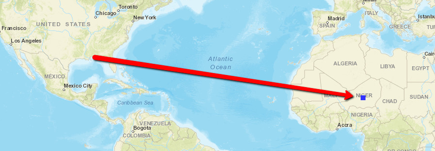
You are right it is actually adding the points to graphiclayer but somewhere in Africa!. Is there any way to update the spatialRefrence?
- Mark as New
- Bookmark
- Subscribe
- Mute
- Subscribe to RSS Feed
- Permalink
- Report Inappropriate Content
and when I try to get map spatial Reference
console.log(map.spatialReference);it outputs undefine