- Home
- :
- All Communities
- :
- Products
- :
- ArcGIS Online
- :
- ArcGIS Online Questions
- :
- Connecting multiple points that are all within the...
- Subscribe to RSS Feed
- Mark Topic as New
- Mark Topic as Read
- Float this Topic for Current User
- Bookmark
- Subscribe
- Mute
- Printer Friendly Page
Connecting multiple points that are all within the same layer
- Mark as New
- Bookmark
- Subscribe
- Mute
- Subscribe to RSS Feed
- Permalink
- Report Inappropriate Content
I am teaching a GIS unit at the American International School Vienna. Students are doing a market analysis.
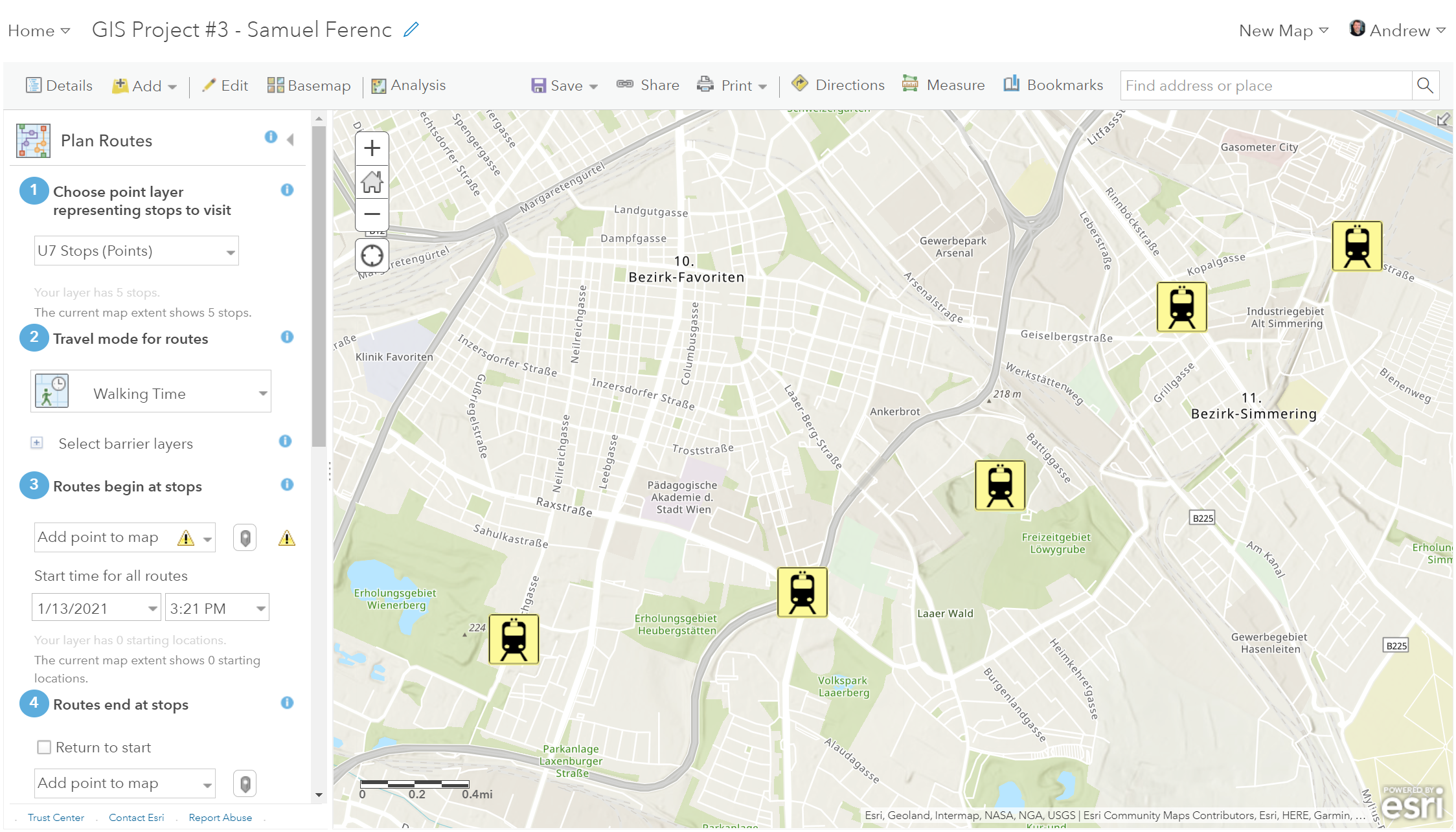
I'm wondering if there is (finally) a way in ArcGIS Online to connect points that are all within the same layer. One of my students chose to do our marketing analysis project on proposing a U7 line in Vienna. He is locating new U-Bahn stops and would like to connect them from end to end. Ultimately there will be around 20 stops. If you look at the attached image, there are a bunch shown.
Even if it's possible to just manually connect points into a sequence, and make a layer for that series of lines between the points, that would be perfect. But I don't see a way to do this; even the connect points feature really is not helping.
The only official way for him to produce this kind of thing, that I know of, is to make each stop its own map note layer, and create lines between each set of subsequent two points - thereby creating several similar analyses. That is ridiculous, though.
We also don't want to make something crazy like a line from each point to every other point.
It's been long enough now that ArcGIS has been around, that what I'm looking for should be possible by now.
Solved! Go to Solution.
Accepted Solutions
- Mark as New
- Bookmark
- Subscribe
- Mute
- Subscribe to RSS Feed
- Permalink
- Report Inappropriate Content
Hi, one of my students figured out a way to do what he wanted to do, and I think for most students who want something like this in their projects, it'll work.
Steps:Add > Add Map Notes
Name the new Map Notes layer "Lines between points" or whatever it's meant to represent
Click "Create"
Instead of using a pushpin, click "Line"
Click the multiple points for start and intermediate points on the map (to make multiple segments)
Double click where the line segments should end
Give a desired title to the line
New lines for the same layer can be created by clicking the "Edit" tool
However, this is not the same as using an analysis tool for driving routes between the points of a layer.
- Mark as New
- Bookmark
- Subscribe
- Mute
- Subscribe to RSS Feed
- Permalink
- Report Inappropriate Content
Doe it have to be done in arcgis online? Creating lines is easy in arcmap or arcgis pro, then you can add it to agol
... sort of retired...
- Mark as New
- Bookmark
- Subscribe
- Mute
- Subscribe to RSS Feed
- Permalink
- Report Inappropriate Content
Yeah, it should be within ArcGIS Online. This is an introductory course, where students are using an education license for our school and authenticating with a Google account (which really simplifies the startup process). If students take a higher level tech class at our school, they can spend a longer period of time on GIS and use the desktop apps, for sure. But at this level, I try to keep it simple and Cloud-based.
Again, the online version of ArcGIS really should allow this (and in an obvious way). I know it's not where Esri's bread is buttered, but this is the kind of thing that students at the high school level will want to do when they are getting introduced to the technology.
- Mark as New
- Bookmark
- Subscribe
- Mute
- Subscribe to RSS Feed
- Permalink
- Report Inappropriate Content
Yes, some would argue for this.
The main help is here
Get started with ArcGIS Online—ArcGIS Online Help | Documentation
And there is lots to create
Create content—ArcGIS Online Help | Documentation
but geometry creation seems limited.
... sort of retired...
- Mark as New
- Bookmark
- Subscribe
- Mute
- Subscribe to RSS Feed
- Permalink
- Report Inappropriate Content
Hi, one of my students figured out a way to do what he wanted to do, and I think for most students who want something like this in their projects, it'll work.
Steps:Add > Add Map Notes
Name the new Map Notes layer "Lines between points" or whatever it's meant to represent
Click "Create"
Instead of using a pushpin, click "Line"
Click the multiple points for start and intermediate points on the map (to make multiple segments)
Double click where the line segments should end
Give a desired title to the line
New lines for the same layer can be created by clicking the "Edit" tool
However, this is not the same as using an analysis tool for driving routes between the points of a layer.