- Home
- :
- All Communities
- :
- Products
- :
- ArcGIS Online
- :
- ArcGIS Online Questions
- :
- Viewshed Analysis
- Subscribe to RSS Feed
- Mark Topic as New
- Mark Topic as Read
- Float this Topic for Current User
- Bookmark
- Subscribe
- Mute
- Printer Friendly Page
- Mark as New
- Bookmark
- Subscribe
- Mute
- Subscribe to RSS Feed
- Permalink
- Report Inappropriate Content
Hi,
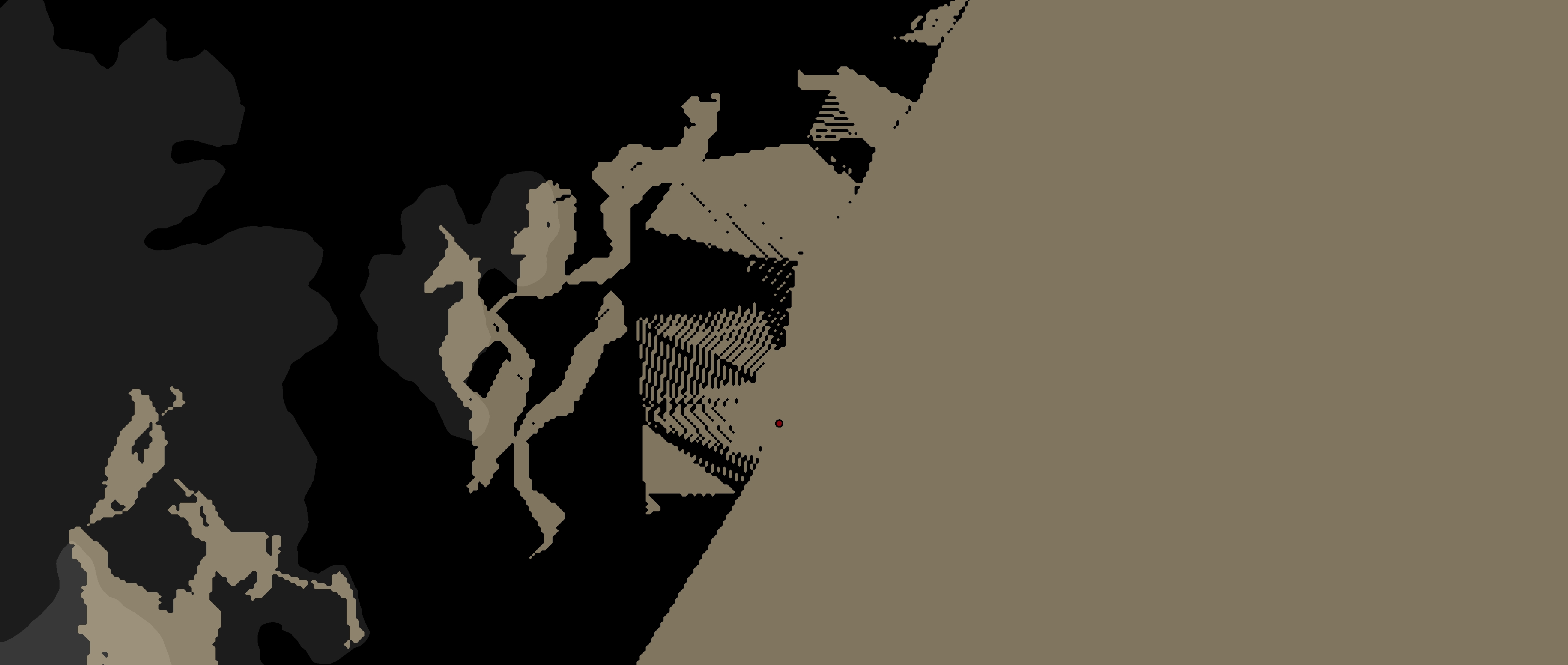
I was hoping that someone might assist me with understanding what the problem is with the viewshed analysis I did. I hope the jpg I attached below worked. In the image, you can see that at this scale the visible areas of the viewshed appear as lines similar to terracing, but the terrain is not actually like that.
Does anyone have any idea why it would appear this way? Is it a problem with the resolution of the dem? (It's a 10 meter dem).
Thanks for your help!
Solved! Go to Solution.
Accepted Solutions
- Mark as New
- Bookmark
- Subscribe
- Mute
- Subscribe to RSS Feed
- Permalink
- Report Inappropriate Content
Lana,
After looking at the raster information and the hillshade output, the Viewshed output is actually consistent with what I would expect given the input elevation model used. The linear visible versus non-visible output that you received is consistent with the values present in the DEM. The triangular output observed is what you might see if the output elevation data was created from either a TIN or contours as Xander mentioned above. You may try to use the 'Focal Statistics' tool on the input raster in an attempt to smooth some of those values if you have access to a Spatial Analyst license which I assume you do given the Hillshade you provided.. The "mean" statistics type would probably generate the best results but keep in mind that there will be some data loss in that process. The output results of the Viewshed tool are closely tied to the quality of input data and some trade-offs have to be made.
Focal Statistics—Help | ArcGIS Desktop
Yuri
- Mark as New
- Bookmark
- Subscribe
- Mute
- Subscribe to RSS Feed
- Permalink
- Report Inappropriate Content
Lana,
In some instances the stair step terracing you observed can be a result of irregular neighboring cell values where resampling has taken place or smoothing of the DEM is needed. This behavior appears west and north-west of the observer point specified. Is there anyway to send along a clipped subset of the elevation model and observer point as a zipped file or a screenshot of the DEM and the raster properties dialogue?
Yuri
- Mark as New
- Bookmark
- Subscribe
- Mute
- Subscribe to RSS Feed
- Permalink
- Report Inappropriate Content
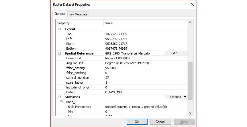
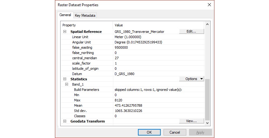
Hi Yuri,
Thanks so much for your response! I've attached 3 screenshots of the raster properties dialogue for you to look at. Is there anything else that I can send you?
Again, thanks for your help!
Lana
- Mark as New
- Bookmark
- Subscribe
- Mute
- Subscribe to RSS Feed
- Permalink
- Report Inappropriate Content
Can you share a screenshot of a hillshade of the DEM? This normally allows for a better interpretation of the quality of the DEM.
- Mark as New
- Bookmark
- Subscribe
- Mute
- Subscribe to RSS Feed
- Permalink
- Report Inappropriate Content
Hi Xander,
Thanks so much for your reply. I've attached a small and large scale image of the hillshade, so that you can see a close-up of the area where the stair step terracing appears in the viewshed.
Thanks,
Lana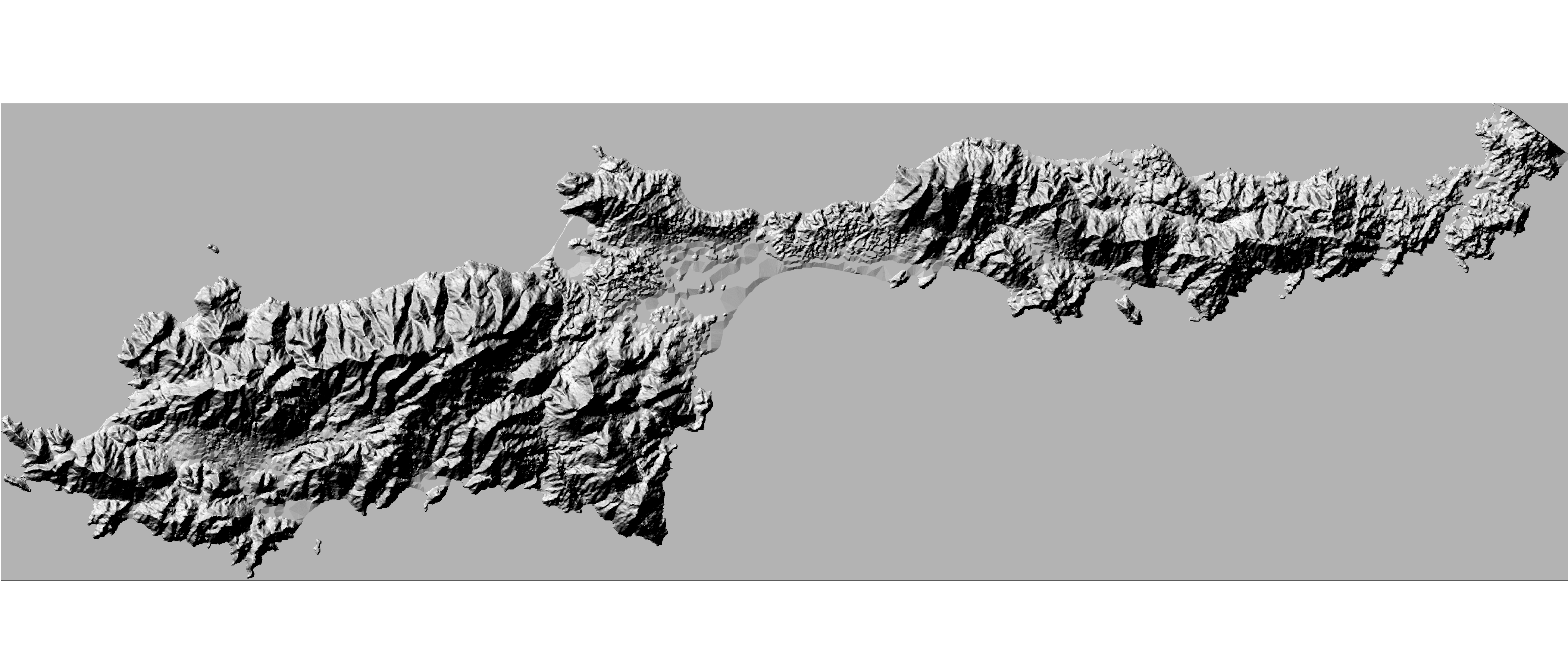
- Mark as New
- Bookmark
- Subscribe
- Mute
- Subscribe to RSS Feed
- Permalink
- Report Inappropriate Content
Hi lanajean , those artifacts are caused by a lack of information and therefore incorrect results when the DEM was created. What source was used (contour lines?). Did the source information cover an area larger than the area of interest? When you interpolate information, you need to have some data outside your area of interest to avoid extrapolation.
- Mark as New
- Bookmark
- Subscribe
- Mute
- Subscribe to RSS Feed
- Permalink
- Report Inappropriate Content
Lana,
After looking at the raster information and the hillshade output, the Viewshed output is actually consistent with what I would expect given the input elevation model used. The linear visible versus non-visible output that you received is consistent with the values present in the DEM. The triangular output observed is what you might see if the output elevation data was created from either a TIN or contours as Xander mentioned above. You may try to use the 'Focal Statistics' tool on the input raster in an attempt to smooth some of those values if you have access to a Spatial Analyst license which I assume you do given the Hillshade you provided.. The "mean" statistics type would probably generate the best results but keep in mind that there will be some data loss in that process. The output results of the Viewshed tool are closely tied to the quality of input data and some trade-offs have to be made.
Focal Statistics—Help | ArcGIS Desktop
Yuri
- Mark as New
- Bookmark
- Subscribe
- Mute
- Subscribe to RSS Feed
- Permalink
- Report Inappropriate Content
Hi Xander and Yuri,
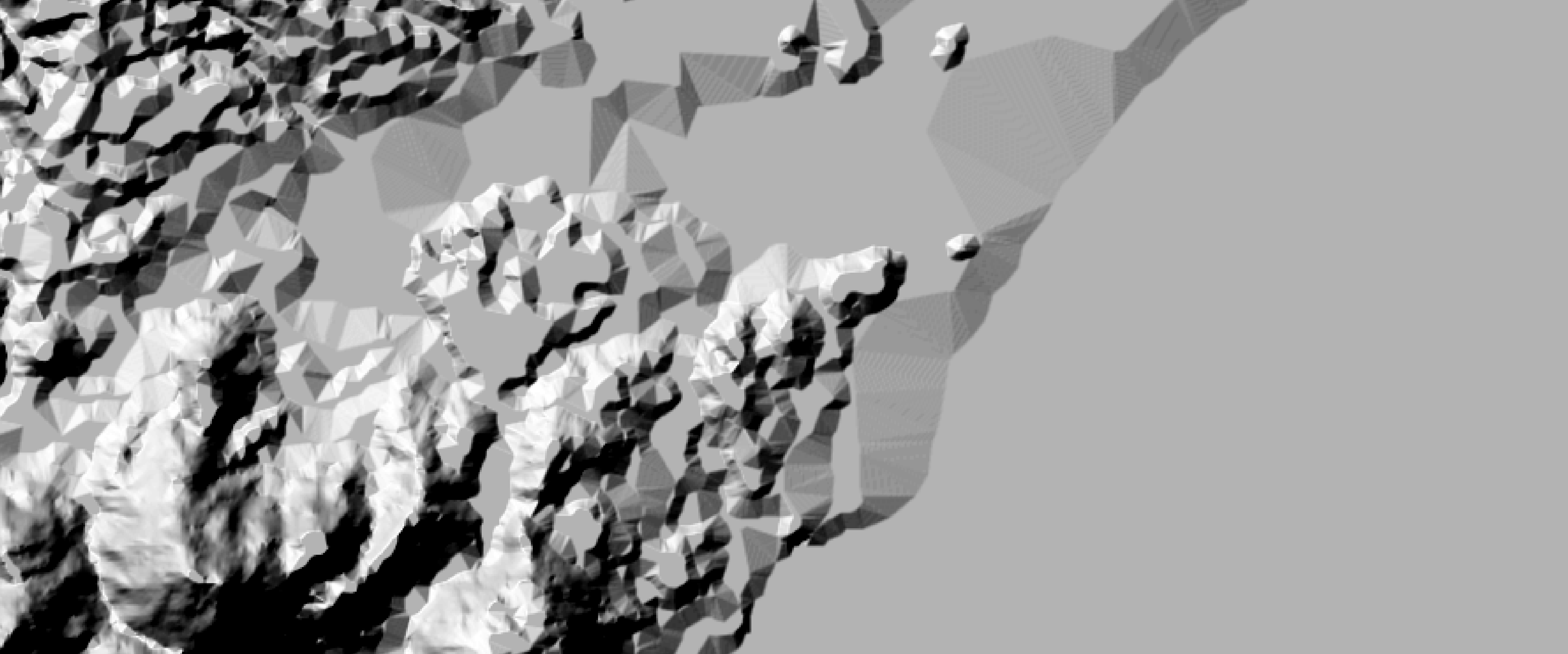
Thanks for the information. Xander, I got this dem from a colleague, so I'm not sure if it was created from contours/TIN, but I will ask. The dem is definitely much larger than my area of interest, which has been a persistent problem for me. I am working on a small archaeological site (c. 45 hectares) in the area of Datca in Turkey, so the scale of data in the dem is much too small for what I need and, as a result, the elevations are not accurate. I've been trying to find a way to get/create a large scale map of the area I need, but I haven't had much luck so far. I have a contour file from a colleague, but sadly it doesn't include any elevations for the contours. I've also tried Google Earth, but can't seem to get any good results from it...
Yuri, I tried the 'Focal Statistics' tool, and it helped quite a bit, as you can see from the image below, but the terracing still appears.
Thanks again for all your help! If you think of any other ideas, please let me know.
Have a great day!
Best,
Lana
- Mark as New
- Bookmark
- Subscribe
- Mute
- Subscribe to RSS Feed
- Permalink
- Report Inappropriate Content
Hi Lana,
Is there anyway you could provide the data so I could take a look? Even a small subset of the data for the area where the observer point resides would be okay.
Yuri