With the release of ArcGIS Pro 2.3 you now have the ability to apply ground to grid corrections. Many of you are familiar with ArcMap's COGO toolbar ground to grid corrections, and will discover a few improvements in this functionality with ArcGIS Pro.
Here are a few examples:
- A heads-up display on the active map to show the correction values currently being applied, without needing to open a properties dialog.
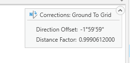
- The Corrections button in the Edit ribbon, gives a quick and easy way to turn ground to grid on and off and, when the Edit ribbon is not active, the corrections are still accessible using the tray button at the bottom of the map.
- Each map in the project stores its own ground to grid corrections, so multiple maps with different corrections can all be stored within a single project.
- A ground to grid icon is displayed next to the values that will have the corrections applied to provide a further visual cue that the corrections are in effect.for the numbers you see.
- Also new with ArcGIS Pro, and something not available in ArcMap, is the ability to leverage Elevation surfaces to compute the combined scale factor from the active map's projection information, the location of the data edited, and the elevation at that location.
For more documentation see Introduction to ground to grid correction.
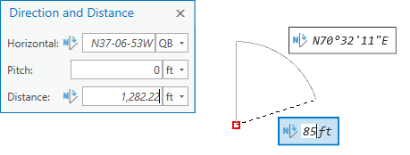
The video attached below demonstrates how to set and use the corrections, and shows how preexisting traverse lines can be scaled and rotated after using an interactive tool to calculate the corrections from given data.
For more information on the shortcuts for the traverse tool, see Data entry shortcuts.
The data for this demonstration is also available for you to download and to try these same steps yourself.
Download the project package from here.