- Home
- :
- All Communities
- :
- Products
- :
- ArcGIS Pro
- :
- ArcGIS Pro Questions
- :
- How to Overlay/add shapefiles that don't have the ...
- Subscribe to RSS Feed
- Mark Topic as New
- Mark Topic as Read
- Float this Topic for Current User
- Bookmark
- Subscribe
- Mute
- Printer Friendly Page
How to Overlay/add shapefiles that don't have the same number of polygons
- Mark as New
- Bookmark
- Subscribe
- Mute
- Subscribe to RSS Feed
- Permalink
- Report Inappropriate Content
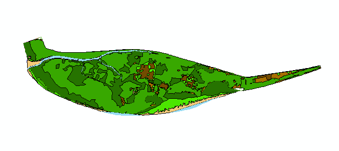
Hello everyone I'm having a hard time trying to overlay my 3 shapefiles. for instand what I'm trying to look at are the LULC changes. For instance I was hoping to be able to do this
Raw data:
Shapefile 1 - Year 2007
| OID | TYPE | ID |
| 1 | Forest | 100 |
| 2 | Shrub | 200 |
| 3 | Grass | 300 |
| 4 | Mudflat | 400 |
Shapefile 2 - Year 2018
| OID | TYPE | ID |
| 1 | Shrub | 020 |
| 2 | Forest | 010 |
| 3 | Mudflat | 040 |
| 4 | Mudflat | 040 |
Shapefile 2 - Year 2021
| OID | TYPE | ID |
| 1 | Forest | 001 |
| 2 | Shrub | 002 |
| 3 | Grass | 003 |
| 4 | Grass | 003 |
What I want my Shapefile to look like:
| OID | TYPE | ID |
| 1 | Forest -Shrub- Forest | 121 |
| 2 | Shrub -Forest-Shrub | 212 |
| 3 | Grass-Mudflat-Grass | 343 |
| 4 | Mudflat-Mudflat-Grass | 443 |
I cannot make this poutcome because the size and and number polygons in each shapefile are different. I want to add the ID number to see th changes. I already did the raster to check the rate of change using this raster equation: ("current raster"-1)*9 + "previous raster" -1 but its hard to put all three togethger to to see which parts changed (in terms of visualization. Thank you in advanced
- Mark as New
- Bookmark
- Subscribe
- Mute
- Subscribe to RSS Feed
- Permalink
- Report Inappropriate Content
In raster world use
Combine (Spatial Analyst)—ArcGIS Pro | Documentation
it produces a unique combination of the classes
... sort of retired...
- Mark as New
- Bookmark
- Subscribe
- Mute
- Subscribe to RSS Feed
- Permalink
- Report Inappropriate Content
If you've got the Image Analyst extension to ArcGIS Pro, then the Change Detection in ArcGIS Pro is your best best.
RE: the field calculation of text to integer based is pretty easy. For example - int(!year2007!) + int(!year2018!) + int(!year2021!) Output is written to a short integer field.