- Home
- :
- All Communities
- :
- Products
- :
- ArcGIS Pro
- :
- ArcGIS Pro Questions
- :
- Re: Labelling woes... (in Pro or in ArcMap)
- Subscribe to RSS Feed
- Mark Topic as New
- Mark Topic as Read
- Float this Topic for Current User
- Bookmark
- Subscribe
- Mute
- Printer Friendly Page
Labelling woes... (in Pro or in ArcMap)
- Mark as New
- Bookmark
- Subscribe
- Mute
- Subscribe to RSS Feed
- Permalink
- Report Inappropriate Content
I am not sure there is an "easy" answer to this but I have given up and am relying on GeoNet to pull me out of a jam.
Is there an "easy button" for labelling just the way I want it? Here are about 66 polygons that need labels visible for each one and need to see the polygon. In Pro, this is how they look without much change in the properties:

I want to see all the labels so I choose Never remove. This is what I get:

Even if I throw in a 50 point offset, 200 point max overrun, 50% buffer, 100 point feature weight to interior and boundary features (and other tweaks), this is my result:
Is there some sort of magic button that will not allow labels to overlap each other? I have attempted to mess around with all of the settings in the label properties and have not come up with a good solution (I do have Maplex Label Engine turned on). My best bet is to convert to annotations and move them that way, manually, by hand, one at a time. (small snippet:  )
)
I keep thinking I'm missing something super obvious. Tell me where I can find the easy button (in ArcGIS Pro preferably or ArcMap - it doesn't matter). Thanks!
- Mark as New
- Bookmark
- Subscribe
- Mute
- Subscribe to RSS Feed
- Permalink
- Report Inappropriate Content
To follow up on Chris's and Darren's comments, I do both...
This seems to only work in ArcMap, not Pro.
But, in layout view, if you double click on the data frame (I don't remember what this is called), it will be special highlighted with a dashed outline. Then, I insert and manipulate the labels. What this does is that it treats the labels different as just adding normal labels in layout view.
Example, if I add labels in layout view, their fixed without the layout view. If I geographically move the map, the labels stay fixed where I put them. When I double click on the data frame and then add the labels, their fixed geographically, and sort-of-fixed in layout. Meaning that when I geographically move the map, the labels move to and kind of act scale-dependently too.
I haven't done this in awhile since I primarily use Pro, but I do remember this working better than using Data view and using layout view standardly, if that makes sense.
- Mark as New
- Bookmark
- Subscribe
- Mute
- Subscribe to RSS Feed
- Permalink
- Report Inappropriate Content
Hi Adrian,
You've got two different things going on here. And you are correct that one of them is only possible in Arcmap.
When I double click on the data frame and then add the labels, they're fixed geographically
This is map annotation and it is not available in Pro. You are placing the text in a map annotation layer.
About adding new text to a map—Help | ArcGIS Desktop
if I add labels in layout view, they're fixed without the layout view. If I geographically move the map, the labels stay fixed where I put them
This is graphic text on a layout. it is available in both ArcMap and Pro. it is placed on the layout and not tied to the data on the map.
https://pro.arcgis.com/en/pro-app/help/layouts/add-and-modify-graphics-and-text.htm
The equivalent to map annotation in Pro is geodatabase annotation. It is annotation just the same but is stored in a geodatabase instead of the map. This makes it reusable for other projects.
Annotation—ArcGIS Pro | ArcGIS Desktop
Adding labels/text in layout view as graphic text is not recommended. Any change to the scale or extent of your map will render the text useless as it's just on the "glass" over the map not actually "in" the map as part of it.
thanks
Wendy
- Mark as New
- Bookmark
- Subscribe
- Mute
- Subscribe to RSS Feed
- Permalink
- Report Inappropriate Content
Wendy,
Thanks for the clarification and definitions. It's good to know what they're officially called. I agree that it's better to have geographically fixed labels versus loose graphic text. I guess I'm "old school" but I like how ArcMap stores it as map annotation directly into the map. Having to make a separate geodatabase annotation file is a little too much work for me. But, if I were to want to repeat those same labels on a different map, then I would definitely do that. However, I have found that labels are so custom (in my world) that repeatability does not occur much.
- Mark as New
- Bookmark
- Subscribe
- Mute
- Subscribe to RSS Feed
- Permalink
- Report Inappropriate Content
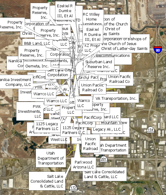
Can you suggest me to fix some of the labels.. Most of them look good and have several that showed in red labels meaning it is overlapped..

I went through 8 of the Ranger Districts on my Forests and found some of them do have Labels that are overlaps.
Let me know if you have any questions then will do reply. They are due by next Month .
Much Christmas appreciated !
I am using ArcGIS 10.5.1
Adrian WelshDarren WiensJayanta PoddarTed KowalDana NolanSamuel TrothChris Donohue, GISP
- Mark as New
- Bookmark
- Subscribe
- Mute
- Subscribe to RSS Feed
- Permalink
- Report Inappropriate Content
Since most of the labels look good... A lot of excellent techniques - most all will work for you have already been discussed throughout this thread.
Since there are not many my initial suggestion is to convert labels to annotation and hand place and size them.... or use Key number since it appears that you have plenty of space around the periphery.
- Mark as New
- Bookmark
- Subscribe
- Mute
- Subscribe to RSS Feed
- Permalink
- Report Inappropriate Content
Thank you. This one is not bad but I have others that are very difficult to deal with. I will post it tomorrow (Wednesday 19 Dec 2018 ) as I have been working on various things to deal with...( my head sweating ha ha )
- Mark as New
- Bookmark
- Subscribe
- Mute
- Subscribe to RSS Feed
- Permalink
- Report Inappropriate Content
If it were me, I might try creating a new field in the attribute table called "label_number", assign each feature a unique ID number, then label using the label number, not the label text. You might still need to convert to annotation but most likely there will be fewer unplaced annotation labels. Then create a legend for just that feature class, sorted by unique values, many fields (label_number and your text label), convert to graphics, ungroup, delete symbol patches, format how you wish and place somewhere in your data frame. It's basically a hack for key numbering, but of course the dynamic nature of labeling is lost. Good luck.
- Mark as New
- Bookmark
- Subscribe
- Mute
- Subscribe to RSS Feed
- Permalink
- Report Inappropriate Content
Agree with the approach that Anna has, create a new field with an unique Id. Then label unique number. The only thing I would change from the above would be to insert the table with the labels tied to the unique number. I have done this with Desktop many times. I am sure you could do this in pro.
- Mark as New
- Bookmark
- Subscribe
- Mute
- Subscribe to RSS Feed
- Permalink
- Report Inappropriate Content
Good to know. Thank you
- Mark as New
- Bookmark
- Subscribe
- Mute
- Subscribe to RSS Feed
- Permalink
- Report Inappropriate Content
In case this helps, I'll throw out a pragmatic approach I sometimes use for problematic maps:
1. Convert the feature class you want to label off of to a feature class in a File Geodatabase.
2. Add a field with text (string) type to this feature class called "LabelProcess" or similar.
3. Set the map to Layoutview, with the desired scale and all the layers on that need to be displayed.
4. Make sure Maplex is active.
5. Start labelling. Play with the settings in Maplex until you get the most possible labels looking good.
6. Select all features with labels that worked. Using Field Calculator, calculate the "LabelProcess" field to now include the attribute "Maplex Only" or similar.
7. Copy the feature class you are labeling off of in the Table of Contents so you now have 2 listed.
8. For one of them, set a Definition Query so that it just displays the ones that are "LabelProcess" field = "Maplex Only".
9. For the other one, set a Definition Query so that it just displays the ones that are "LabelProcess" field <> "Maplex Only".
10. Turn off the feature class with that is based on "Maplex Only".
11. On the one that is <> "Maplex Only", try a different combination of settings. For example, consider allowing the label to be rotated, using a leader line, reducing font size, splitting the label into more than one line, etc". Turn on the other layer to make sure there will be no overlap or other visual conflicts.
12. Once a batch of these work, select the features and then using Field Calculator populate the "Label Process" field with a good descriptive name.
13. Copy the feature class being labeled, set a Definition query to be equal to the latest description.
14. Update the Definition Query of the labels that still don't have a good solution to cull out the ones that worked in the last step.
15. Continue the above steps until you get to a point where Maplex will no longer effectively label features. At this point, one will have to switch gears and manually label these.
16. Convert this last batch to annotation, making sure you only are exporting the ones that have do not have a sucessful label from an above process. Then manually align, rotate, add leader lines, etc.
17. As a final step, turn on all the copies of the feature class in the Table of Contents, along with the Annotation created in the last step. Ensure that it all fits well together. There may may another cleanup step here if some things work well individually but not together. Example: A leader line generated in one step overlaps a label for another step.
18. Note - if it is possible the map will be shifted in extent after doing all this, it may be worth it to do an additional step and blow out all the labels to annotation layers. This will "fix" them to one spot, whereas labels tend to "float around" somewhat due to Maplex if the map is shifted, which can cause visual conflicts.
I use this approach on large complex maps with many labels and challenges like a variety of polygons sizes that need to be labeled. For example, we have a poster-sized citywide Zoning map where every polygon needs to be labeled clearly with the zoning designation, and the polygons vary in size from a 70 square feet to several thousand square feet. There are areas with many "small" polygons with different zoning designations all closely lumped together besides areas of large polygons, so pure Maplex or Standard labeling is ineffective. Manually labeling all 1,400 polygons is a bit tedious, so this process helps use the power of Maplex to do the bulk of the labeling and then saves just the "troublesome" labels for the more time-consuming manual processing.
Chris Donohue, GISP