- Home
- :
- All Communities
- :
- Products
- :
- ArcGIS Spatial Analyst
- :
- ArcGIS Spatial Analyst Questions
- :
- Create Heatmap
- Subscribe to RSS Feed
- Mark Topic as New
- Mark Topic as Read
- Float this Topic for Current User
- Bookmark
- Subscribe
- Mute
- Printer Friendly Page
- Mark as New
- Bookmark
- Subscribe
- Mute
- Subscribe to RSS Feed
- Permalink
- Report Inappropriate Content
Hi there,
i think i'm having a simple questions for you experts.
what do i want? a simple heatmap based on points. Maybe some interpolation (IDW) will work but i couldn't handle it out of the box. So if someone could help me with some parameters i would appreciate that. Maybe i can reach my goal by doing it just with some symbolization. This is what i've done so far, but i think this will not be working.
What do i have: thousand of points (no Z-Value->So i thought IDW which is based only on the distance would be a good solution.)
As mentioned before i've made buffers of my points (buffer1 ->gradient fill, buffer2) in two ways (1xwith dissolve, 1xwithout dissolve) in order to see what i can do based on symbolization to get a visualization like the heat-map below.
Buffer1

Buffer2

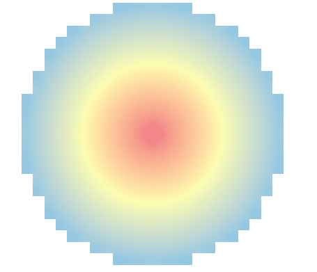
Heat:

Thanks!
Chris
Solved! Go to Solution.
Accepted Solutions
- Mark as New
- Bookmark
- Subscribe
- Mute
- Subscribe to RSS Feed
- Permalink
- Report Inappropriate Content
The inverted Euclidean Distance with a maximum distance defined will do exactly that...
- Mark as New
- Bookmark
- Subscribe
- Mute
- Subscribe to RSS Feed
- Permalink
- Report Inappropriate Content
Hi Chris,
Try Kernel Density (Spatial Analyst). Keep the population field as "None". All the points would be calculated once.
ArcGIS Help (10.2, 10.2.1, and 10.2.2)
Thanks,
Jay
Think Location
- Mark as New
- Bookmark
- Subscribe
- Mute
- Subscribe to RSS Feed
- Permalink
- Report Inappropriate Content
Thanks Jay,
very nice, but not exactly what i need. Maybe changing some parameters would help?
Each point has the same "weight". The two points i marked look like they have a "lower" priority.
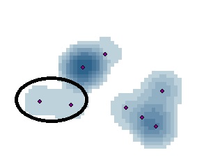
Remember my picture of the buffers above: Hundreds of Buffers with a gradient fill - > i want to combine them.
One point should look like this:
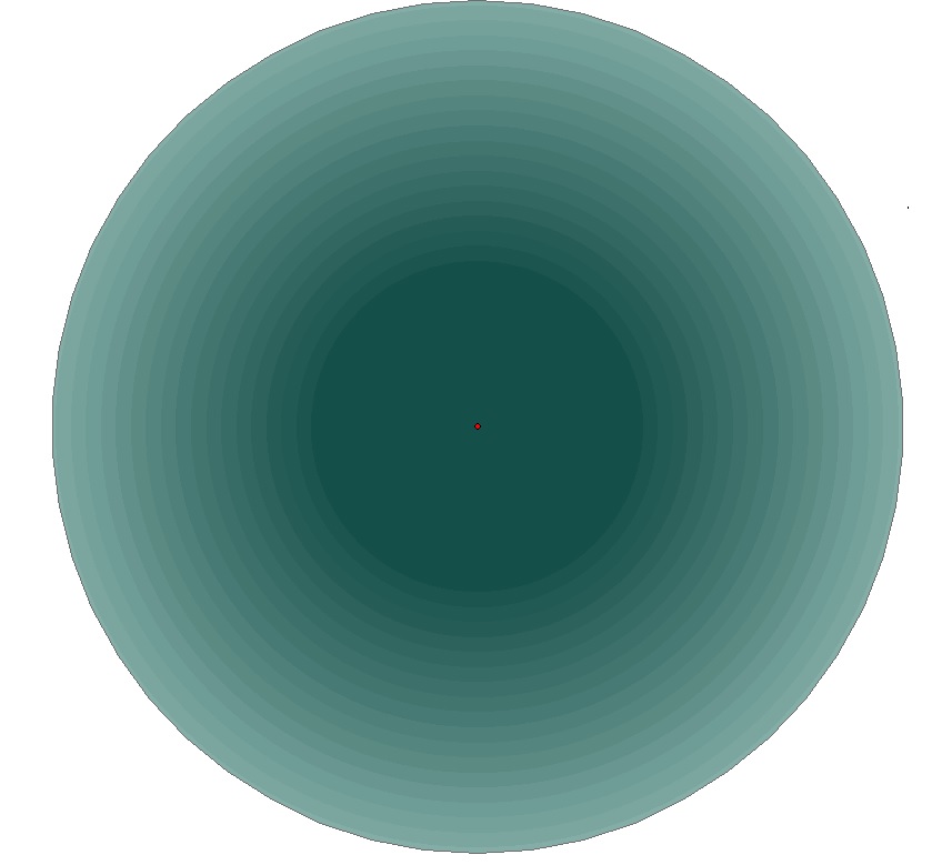
I don't know if i'm on the right way. The concentration of points doesn't matter so much, because each point souhld have fixe
spread. Just the space where no points are, should have a "lower" priority.
- Mark as New
- Bookmark
- Subscribe
- Mute
- Subscribe to RSS Feed
- Permalink
- Report Inappropriate Content
In this case, use the Euclidean Distance (Spatial Analyst) with a maximum distance set to the size of the circles and then invert the distances (maxsize - distance).
But you shouldn't call it a heatmap...
- Mark as New
- Bookmark
- Subscribe
- Mute
- Subscribe to RSS Feed
- Permalink
- Report Inappropriate Content
Yes, the Euclidean Distance is a way for one circle. but is there a possibility to combine the polygons/circles? I don't think so, because they are overlapping as well. Euclidean Distance with dissolved buffers logically isn't any option.
So i think, an interpolation or a heat-map is the only way.
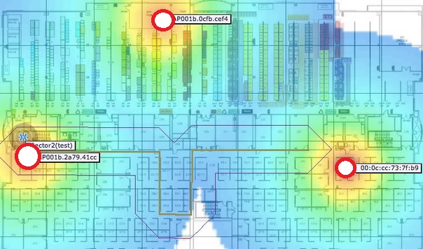
So just lets get back to the start with a simple question. How to create a map like below with three points (marked as red circles). This is exactly what i want. Which option would you choose?:
- Mark as New
- Bookmark
- Subscribe
- Mute
- Subscribe to RSS Feed
- Permalink
- Report Inappropriate Content
The inverted Euclidean Distance with a maximum distance defined will do exactly that...
- Mark as New
- Bookmark
- Subscribe
- Mute
- Subscribe to RSS Feed
- Permalink
- Report Inappropriate Content
Great. Thanks.
Last question: Any idea how to get the borders(Raster) smoother/rounder?
The cellSize is nice, but maybe threre are better options..
- Mark as New
- Bookmark
- Subscribe
- Mute
- Subscribe to RSS Feed
- Permalink
- Report Inappropriate Content
Increasing the resolution (decrease the CellSize) is the only option in case raster is your output.
Visually you could create buffers around each point using the same maximum distance (or perhaps a litlle larger) and put the buffer polygons beneath the raster layer using the same color of the outer ring in the raster layer. This might work...
- Mark as New
- Bookmark
- Subscribe
- Mute
- Subscribe to RSS Feed
- Permalink
- Report Inappropriate Content
OK, thanks.
The Euclidean Distance works very well with my sample points (50 points).
When i do it with my whole dataset (larger extend (1000 points)) an error appears:
010067:Error in executing grid expression.
Tried different things in the environments, but didn't work.
- Mark as New
- Bookmark
- Subscribe
- Mute
- Subscribe to RSS Feed
- Permalink
- Report Inappropriate Content
Can you post the expression too? This error refers to:
Description
There was a problem executing the map algebra expression.
Solution
Check the syntax of the function and ensure that you are correctly specifying all the required and any optional parameters. Be sure to check that the data type is correct. For example, specifying a character string in the command when a numerical value is expected may cause this error.