- Home
- :
- All Communities
- :
- Products
- :
- ArcGIS Spatial Analyst
- :
- ArcGIS Spatial Analyst Questions
- :
- Density of Geocoded Addresses
- Subscribe to RSS Feed
- Mark Topic as New
- Mark Topic as Read
- Float this Topic for Current User
- Bookmark
- Subscribe
- Mute
- Printer Friendly Page
Density of Geocoded Addresses
- Mark as New
- Bookmark
- Subscribe
- Mute
- Subscribe to RSS Feed
- Permalink
- Report Inappropriate Content
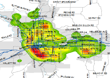
I'm attempting to show the density of addresses in a service area. The addresses have been projected and the function is one that we have done before for an annual report. Attached is a snip of previous years results compared to this years. You can see the difference between the two and I can't figure out why the results are so different when the address list is pretty similar year to year.

The only thing that stands out to me is in the Kernel Density settings there is no data listed under "Search radius (optional) as there has been previously.
- Mark as New
- Bookmark
- Subscribe
- Mute
- Subscribe to RSS Feed
- Permalink
- Report Inappropriate Content
Hi Mike,
Could you use Point Density—Help | ArcGIS for Desktop instead of the Kernel Density tool?
- Mark as New
- Bookmark
- Subscribe
- Mute
- Subscribe to RSS Feed
- Permalink
- Report Inappropriate Content
Kernel Density—Help | ArcGIS for Desktop search radius is in my copy???/ what arcmap and spatial analyst are you using and
KernelDensity (in_features, population_field, {cell_size}, {search_radius}, {area_unit_scale_factor}, {out_cell_values}, {method})
- Mark as New
- Bookmark
- Subscribe
- Mute
- Subscribe to RSS Feed
- Permalink
- Report Inappropriate Content
Dan,
We use ArcGIS 10.4 for desktop
Mike
- Mark as New
- Bookmark
- Subscribe
- Mute
- Subscribe to RSS Feed
- Permalink
- Report Inappropriate Content
so am I and that is the help for 10.4 and I assume you are using arctoolbox spatial analyst toolset. I am not on arc* now, but when you launch the tool itt doesn't show
Make sure you are using projected data in order for it to make sense and see the help topics
and if that doesn't work, whip off a code snippet to see if that works
(Optional) | The search radius within which to calculate density. Units are based on the linear unit of the projection of the output spatial reference. For example, if the units are in meters—to include all features within a one-mile neighborhood—set the search radius equal to 1609.344 (1 mile = 1609.344 meters). The default search radius (bandwidth) is computed specifically to the input dataset using a spatial variant of Silverman's Rule of Thumb that is robust to spatial outliers (that is, points that are far away from the rest of the points). See the usage tips above for a description of the algorithm. |
- Mark as New
- Bookmark
- Subscribe
- Mute
- Subscribe to RSS Feed
- Permalink
- Report Inappropriate Content
I do have the data projected (NAD_1983 and the appropriate state plane for my geographic location). I've tried some other projections as well but to no avail.
I'm not following when you say code snippet. Sorry, I have no formal training in ArcMap and my understanding of it is pretty limited unfortunately.
- Mark as New
- Bookmark
- Subscribe
- Mute
- Subscribe to RSS Feed
- Permalink
- Report Inappropriate Content
Ok.... have you opened arctoolbox, spatial analyst toolset, kernel density tool (which is the link I sent). Is there not an option on the dialog for what you want? The help indicates some changes in pre 10.2.1 and post in how the calculations are performed... like search radius... This is obviously what is causing the difference and if you want to replicate what you previously saw, then you will have to do so. Did something appear as a default before usisng the similar dataset you had? Then you will have to emulate the default or provide an alternative. In short, there is nothing wrong with the tool, but more onus is being placed on the user to provide inputs to control outputs that meet their needs.
My reference to the code snippet was in reference to the assumption that there was no optional search radius being provided, as in the line was missing. skip this if you don't understand. But use the dialog and provide the inputs that you provided in previous years in order for comparison to be made.