- Home
- :
- All Communities
- :
- Products
- :
- ArcGIS Spatial Analyst
- :
- ArcGIS Spatial Analyst Questions
- :
- Least cost path help needed (unwanted straight lin...
- Subscribe to RSS Feed
- Mark Topic as New
- Mark Topic as Read
- Float this Topic for Current User
- Bookmark
- Subscribe
- Mute
- Printer Friendly Page
Least cost path help needed (unwanted straight lines!)
- Mark as New
- Bookmark
- Subscribe
- Mute
- Subscribe to RSS Feed
- Permalink
- Report Inappropriate Content
Hello!
So, I’m very much a beginner with GIS and I’m stuck creating a least cost path, so I was wondering if someone could help me, please!
Basically, I’m trying to highlight which river valleys would most likely be flooded in the event of a volcanic eruption producing a mudflow, which would usually follow the steepest path available. I’m using a DEM as my cost surface raster.
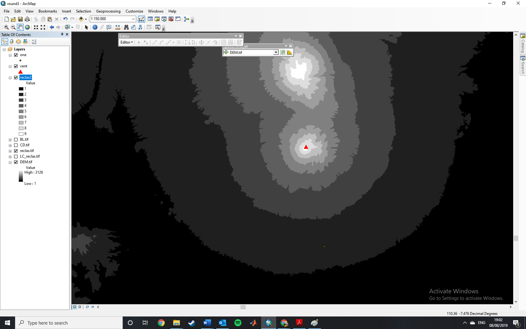
As I understand it, I would have to reclassify the DEM before I use the cost distance tool and then the least cost path tool. However, as I want the LCP to follow the river valley, I would need to reclassify the DEM to have many breaks (or even use the unique values button) so that the river valley is still visible and not all merged into one. Right? Or does the DEM have to be reclassified into 9 subgroups? If so, I then lose the river valley outline and I’m not sure what to do from then on. (I’ve attached some screen shots to hopefully show this).
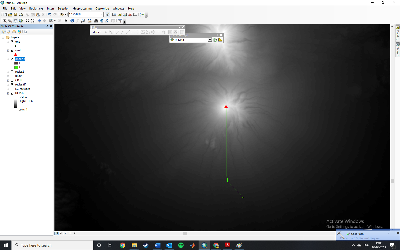
Then I come to my next problem… If I try reclassifying the DEM so that it has 100 equal breaks and then using the cost distance tool, (with a point feature at the volcano’s vent as the source data and the reclassified DEM as the cost raster) I then get the expected cost distance raster and back link raster. I then input these into the LCP tool along with another point feature that I’ve randomly placed somewhere downslope of the volcano for the destination data, I get a path output, but it’s basically a straight line and doesn’t really follow any of the river valleys like you would expect? (Please see picture attached)
So, I’m not sure how to get past this… Please can you help me! 😛
- Mark as New
- Bookmark
- Subscribe
- Mute
- Subscribe to RSS Feed
- Permalink
- Report Inappropriate Content
I believe you might want to use the Hydrology Toolset. Here is a good link describing the process to accomplish what I believe you are trying to do.
- Mark as New
- Bookmark
- Subscribe
- Mute
- Subscribe to RSS Feed
- Permalink
- Report Inappropriate Content
If you take a DEM and run Fill followed by the Flow Direction tool, you can use the flow direction raster with the Cost Path to trace downstream. From the Cost Path help:
Cost Path can be used to determine the flow path based on D8 flow direction. To use Cost Path in this way, use a D8 flow direction raster as input for the Input cost backlink raster. You also need to supply an Input cost distance raster; the Input cost distance raster is not used to determine the path. Whether you use a constant raster or a digital elevation model (DEM), your path will be the same; only an attribute value on your path will vary. See the Flow Direction tool for more information on D8 flow direction rasters.
That said, you may want to look into a model the USGS has had going for years called LAHARZ. (Originally developed with ArcInfo Workstation back in the late 90s!)