- Home
- :
- All Communities
- :
- Products
- :
- ArcGIS Spatial Analyst
- :
- ArcGIS Spatial Analyst Questions
- :
- Re: Slope from DEM (ETRS UTM ZONE 30)
- Subscribe to RSS Feed
- Mark Topic as New
- Mark Topic as Read
- Float this Topic for Current User
- Bookmark
- Subscribe
- Mute
- Printer Friendly Page
Slope from DEM (ETRS UTM ZONE 30)
- Mark as New
- Bookmark
- Subscribe
- Mute
- Subscribe to RSS Feed
- Permalink
- Report Inappropriate Content
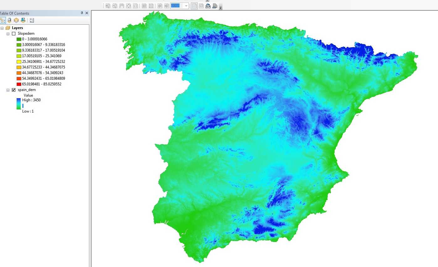
Hi,
I am trying to create a slope from a DEM which in theory is pretty straight forwards but as you can see the result is a bit obscure. The cells were re-sampled from 30m to 50m resolution but I dont see why the DEM should result in this...
I would greatly appreciate the help!
John
- Mark as New
- Bookmark
- Subscribe
- Mute
- Subscribe to RSS Feed
- Permalink
- Report Inappropriate Content
The DEM was originally in the projected coordinate system? and X, Y and Z units are all in meters?
Did you calculate slope in the in-resampled DEM for comparison?
- Mark as New
- Bookmark
- Subscribe
- Mute
- Subscribe to RSS Feed
- Permalink
- Report Inappropriate Content
The original was in WGS84 so it was projected to ETRS UTM 30N, the units are in meters, although thats X and Y, not sure about Z though I am assuming so... The DEM was re sampled when it was projected. It is also the product of a mosaic. I am trying to backtrack a bit to when it was projected but I am not sure why its produced that
- Mark as New
- Bookmark
- Subscribe
- Mute
- Subscribe to RSS Feed
- Permalink
- Report Inappropriate Content
To clarify... WGS84 is a datum and not a coordinate system. Was the file in WGS84 UTM blah blah... or was it a Geographic coordinate system with a WGS84 datum?
Projection is one step
Resampling is another
When you projected to UTM what cell size did you explicitly set in the Environments tab of the project tool? There is no resampling during this process. Resampling occurs when you already have a projected raster with a cell size of X and you want to have one in Y. X and Y (ie 50, 30 m) need to be in the same units to begin with, not degrees (as WGS84 geographic coordinate system)
- Mark as New
- Bookmark
- Subscribe
- Mute
- Subscribe to RSS Feed
- Permalink
- Report Inappropriate Content
Thanks for the quick answers, sorry, the original DEM was in GCS_WGS_1984 and the Datum was D_WGS_1984 as well. When I originally used project raster, I set the cell size to 50.
The original cell size was in degrees which was 0.00833... in degrees and i specified it to 50m when i projected it
- Mark as New
- Bookmark
- Subscribe
- Mute
- Subscribe to RSS Feed
- Permalink
- Report Inappropriate Content
Then I would just reproject the GCS version of the DEM to the cell size you want and skip the resampling step altogether. Do this in the Environments tab for the Project tool in Arctoolbox, there are a whole load of raster settings that can be made there. In fact they are the only environment settings that I rely on. I presume that if you aren't in the U.S your X, Y coordinates will be in metres, but I would also confirm the Z values from source as well. When projected, proceed with Slope, again setting the cell size, snap raster etc in the Environments tab of the Slope tool
- Mark as New
- Bookmark
- Subscribe
- Mute
- Subscribe to RSS Feed
- Permalink
- Report Inappropriate Content
Oh sorry, to clarify, that's what I did, i didn't re-sample, I just used the project tool and specified the output cells to be 50. I got the DEM from Ita.cr.usgs.gov/gtop030 which gave me two DEMs with a 30m resolution in WGS_1984 which I then mosaic'd together and projected them to UTM 30N using the raster project with a specified cell size of 50m. The originals seem to be fine that's why I am baffled by the output
- Mark as New
- Bookmark
- Subscribe
- Mute
- Subscribe to RSS Feed
- Permalink
- Report Inappropriate Content
the link doesn't work and the site appears to be a usgs data source. I would check there for a full descriptions, I am sure it is something in the procedure but at this stage I have no clue if you are setting proper settings in the Environments tab of both the Project and Slope tool. Maybe someone who has used these data would kindly chime in.
- Mark as New
- Bookmark
- Subscribe
- Mute
- Subscribe to RSS Feed
- Permalink
- Report Inappropriate Content
So the data im using is the GOTOP30 from EarthExplorer using Get Data | The Long Term Archive .
I am sure it is somewhere during the projection from WGS to ETRS UTM 30N. I reworked the process from the original DEMS and got the same result.
I dont really understand whats causing this but perhaps there is another source of data that can provide me a reliable 50m DEM of spain...
- Mark as New
- Bookmark
- Subscribe
- Mute
- Subscribe to RSS Feed
- Permalink
- Report Inappropriate Content
unless it is the Z factor in the slope table that is causing the issue but I am not so sure where to find out what the Z units are