- Home
- :
- All Communities
- :
- Products
- :
- ArcPad
- :
- ArcPad Questions
- :
- Shape file with Z and M,
- Subscribe to RSS Feed
- Mark Topic as New
- Mark Topic as Read
- Float this Topic for Current User
- Bookmark
- Subscribe
- Mute
- Printer Friendly Page
Shape file with Z and M,
- Mark as New
- Bookmark
- Subscribe
- Mute
- Subscribe to RSS Feed
- Permalink
- Report Inappropriate Content
I couldn???t figure out the distinction between having point shape file, pointZ and PointM.
[ATTACH=CONFIG]30395[/ATTACH]
What is the impact of these shape files as points are captured from the field?
Thank you
Best
Jamal
Jamal Numan
Geomolg Geoportal for Spatial Information
Ramallah, West Bank, Palestine
- Mark as New
- Bookmark
- Subscribe
- Mute
- Subscribe to RSS Feed
- Permalink
- Report Inappropriate Content
A quick answer to your question is that Z-Values (PointZ) have the ability to store elevation (such as GPS height) along with the default X,Y coordinates whereas M-Values allow the ability to store linear measurements (such as offsets within ArcPad). A few links below discuss these options a bit more in depth.
Working with offsets
GPS Height
Feature class basics (under the 'Vertical measurements using z-values' and 'Linear measurements using m-values' sections)
Hope this helps.
- Mark as New
- Bookmark
- Subscribe
- Mute
- Subscribe to RSS Feed
- Permalink
- Report Inappropriate Content
Hi Jamal,
A quick answer to your question is that Z-Values (PointZ) have the ability to store elevation (such as GPS height) along with the default X,Y coordinates whereas M-Values allow the ability to store linear measurements (such as offsets within ArcPad). A few links below discuss these options a bit more in depth.
Working with offsets
GPS Height
Feature class basics (under the 'Vertical measurements using z-values' and 'Linear measurements using m-values' sections)
Hope this helps.
Many thanks Luke for the help.
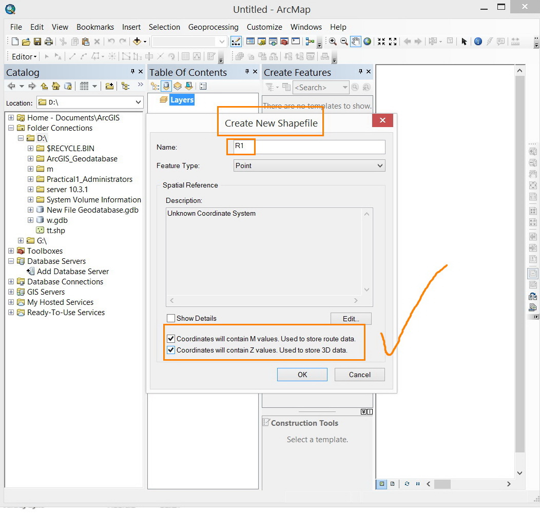
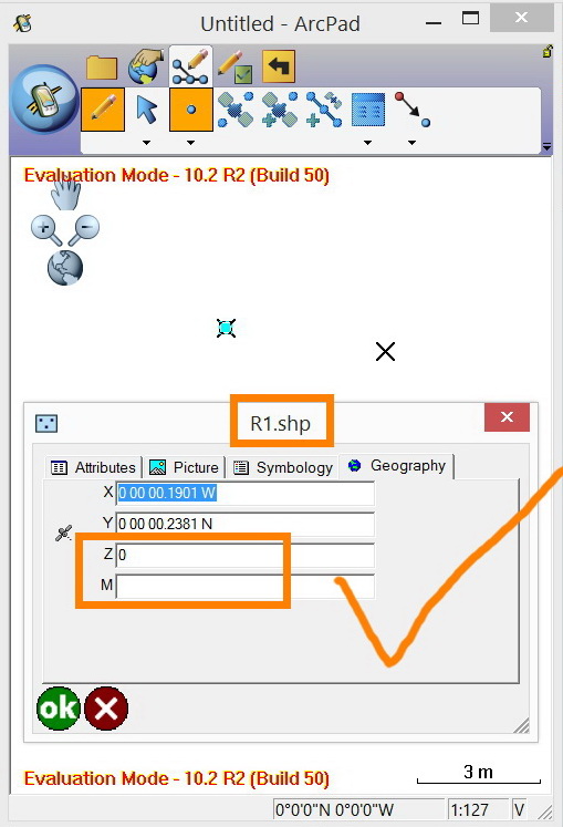
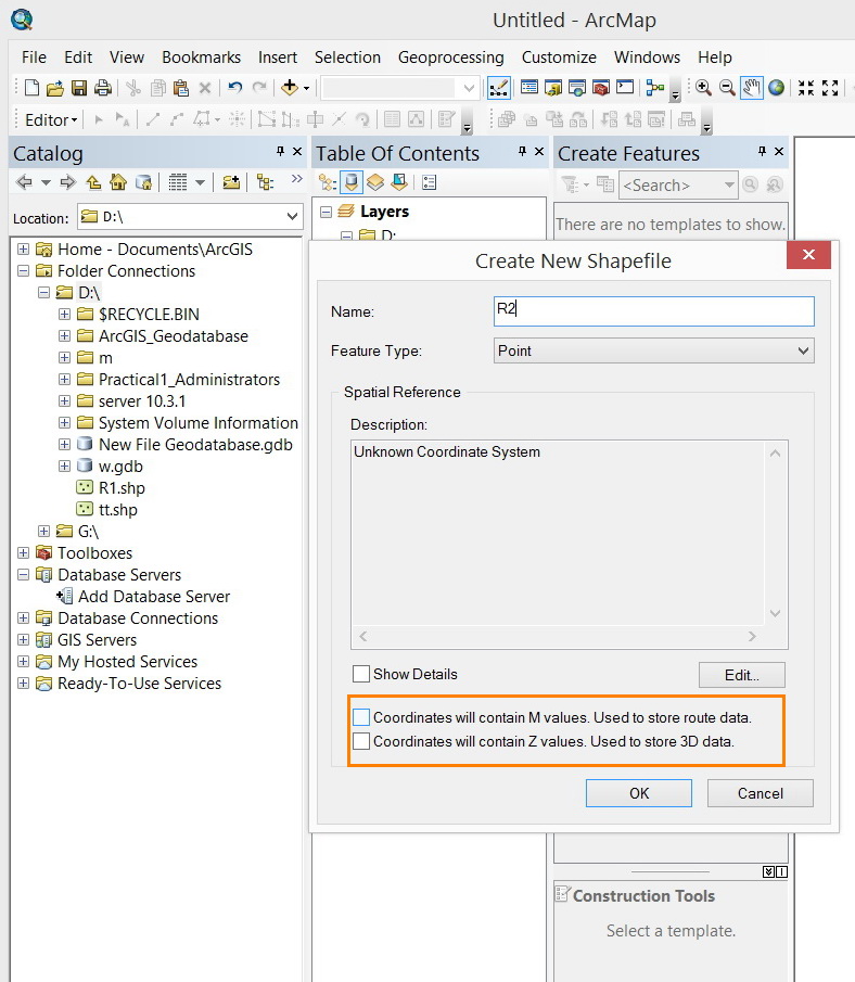
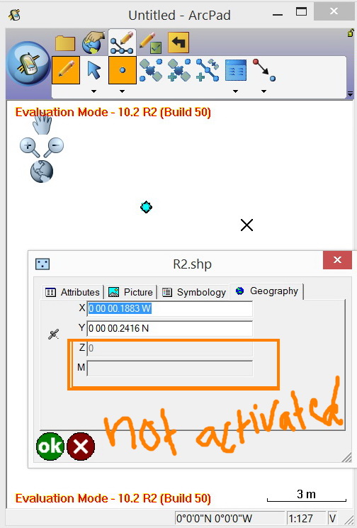
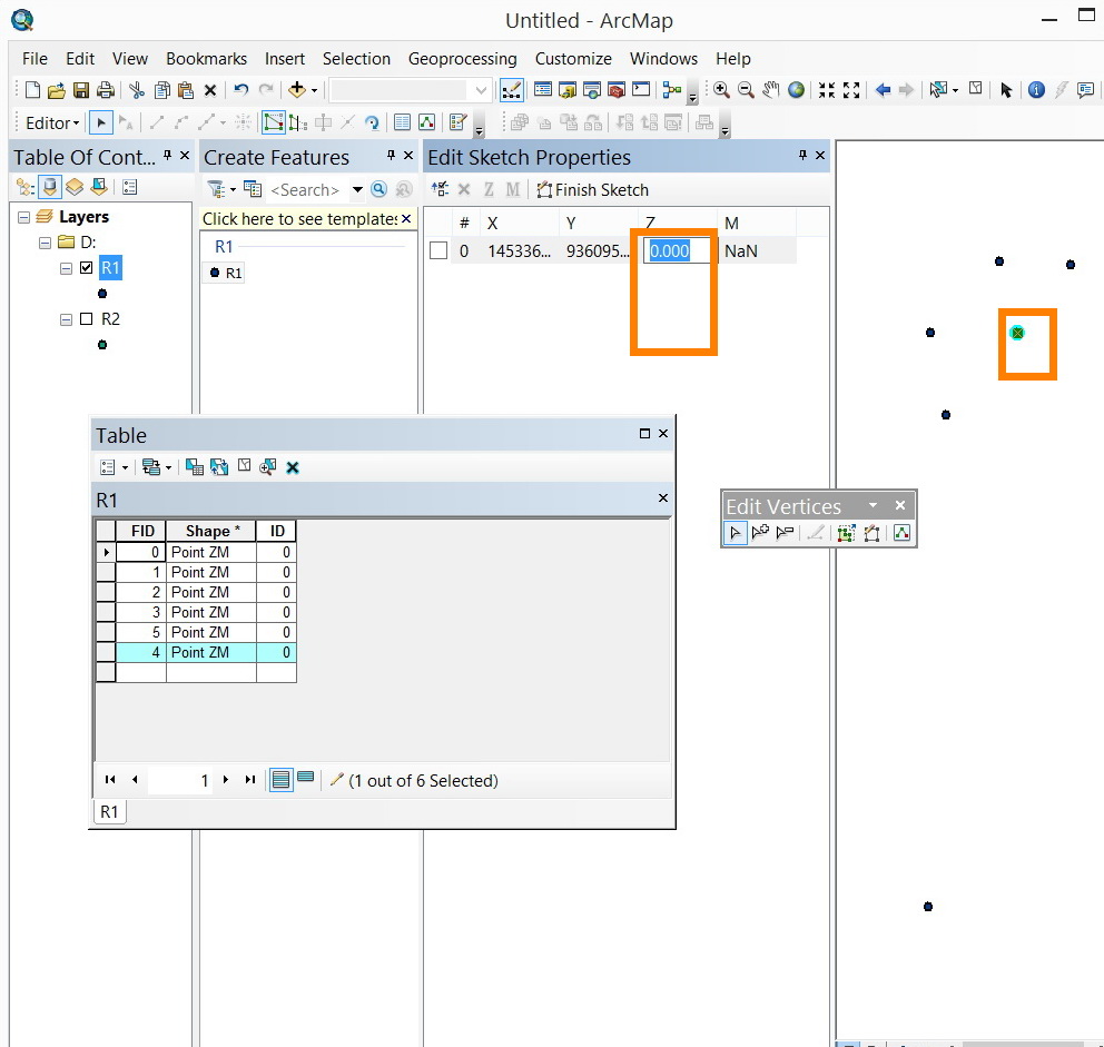
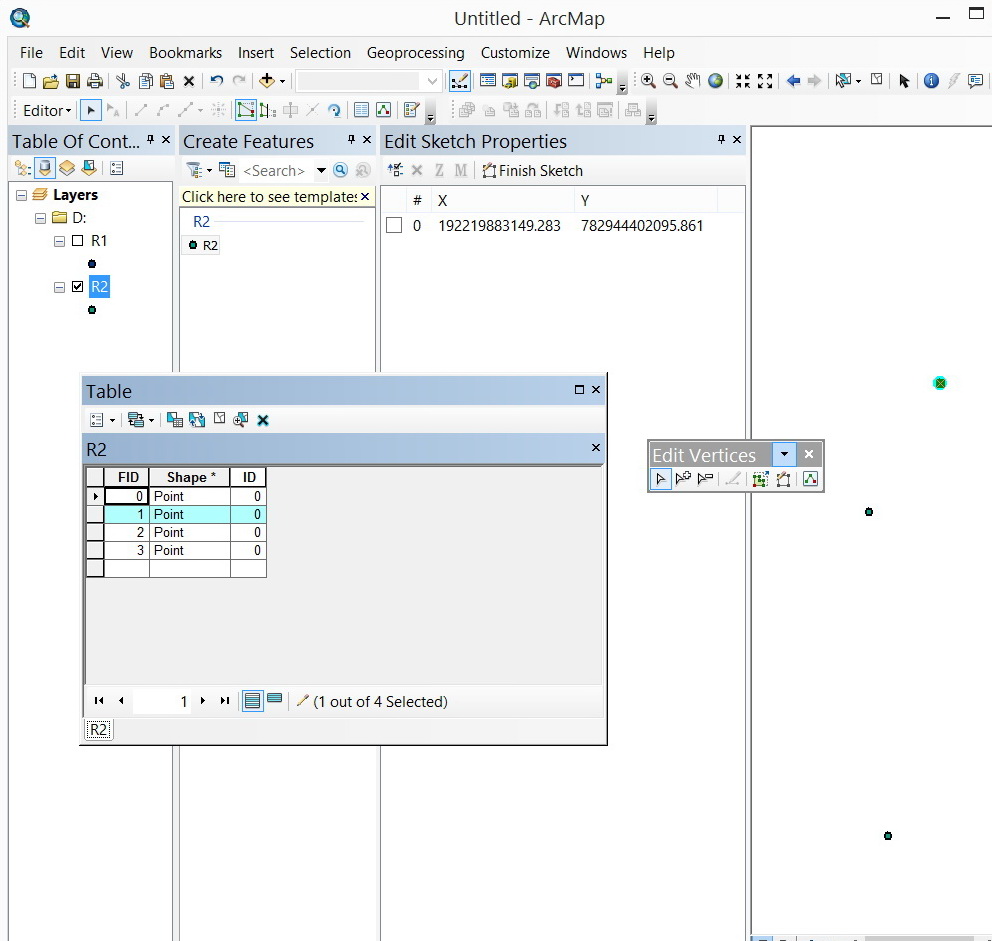
I aimed at creating a shape file that stores XY and Z as points are captured from the ground. This is why I selected the pointZ.
[ATTACH=CONFIG]30399[/ATTACH], [ATTACH=CONFIG]30400[/ATTACH], [ATTACH=CONFIG]30401[/ATTACH]
At the end, I tried to open the pointz shape file from the ArcMap but it appears no field that stores the elevation values.
[ATTACH=CONFIG]30402[/ATTACH]
What might be the issue here?
Jamal Numan
Geomolg Geoportal for Spatial Information
Ramallah, West Bank, Palestine
- Mark as New
- Bookmark
- Subscribe
- Mute
- Subscribe to RSS Feed
- Permalink
- Report Inappropriate Content
Enabling the z-value as a shape file is created
- allows collecting the Z (elevation) when adding a shape file in an application (like ArcPad) installed in GPS device,
- allows adding the Z value through the “edit sketch properties” in the ArcMap
Jamal Numan
Geomolg Geoportal for Spatial Information
Ramallah, West Bank, Palestine
- Mark as New
- Bookmark
- Subscribe
- Mute
- Subscribe to RSS Feed
- Permalink
- Report Inappropriate Content
Hola Jamal,
I wanted to add my two cents to your post, and hopefully this applet will assist you and make things easier for you. Since I see you are looking to capture Z & M values for your data, here is a ArcScript that may make things easier for you in your workflow. This is not written by Esri or supported by us (Support Services/Esri) but we do post items that may assist our customers.
Good Luck!
Gracias, Jamal!
Add XYZ to Table
http://arcscripts.esri.com/details.asp?dbid=16785
Juan
- Mark as New
- Bookmark
- Subscribe
- Mute
- Subscribe to RSS Feed
- Permalink
- Report Inappropriate Content
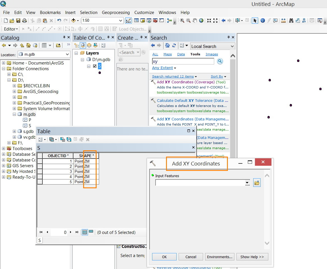
Thanks Juan,
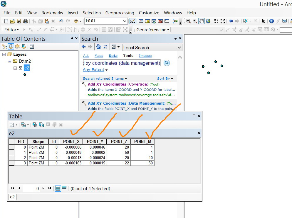
My issue here is how to stick the Z-value in the attribute table in case the Z-value is set to be enabled. The XY coordinates can be calculated using the “add xy coordinates” tool but how about the z value? How it can be incorporated in the attribute table as a field?
Jamal Numan
Geomolg Geoportal for Spatial Information
Ramallah, West Bank, Palestine
- Mark as New
- Bookmark
- Subscribe
- Mute
- Subscribe to RSS Feed
- Permalink
- Report Inappropriate Content
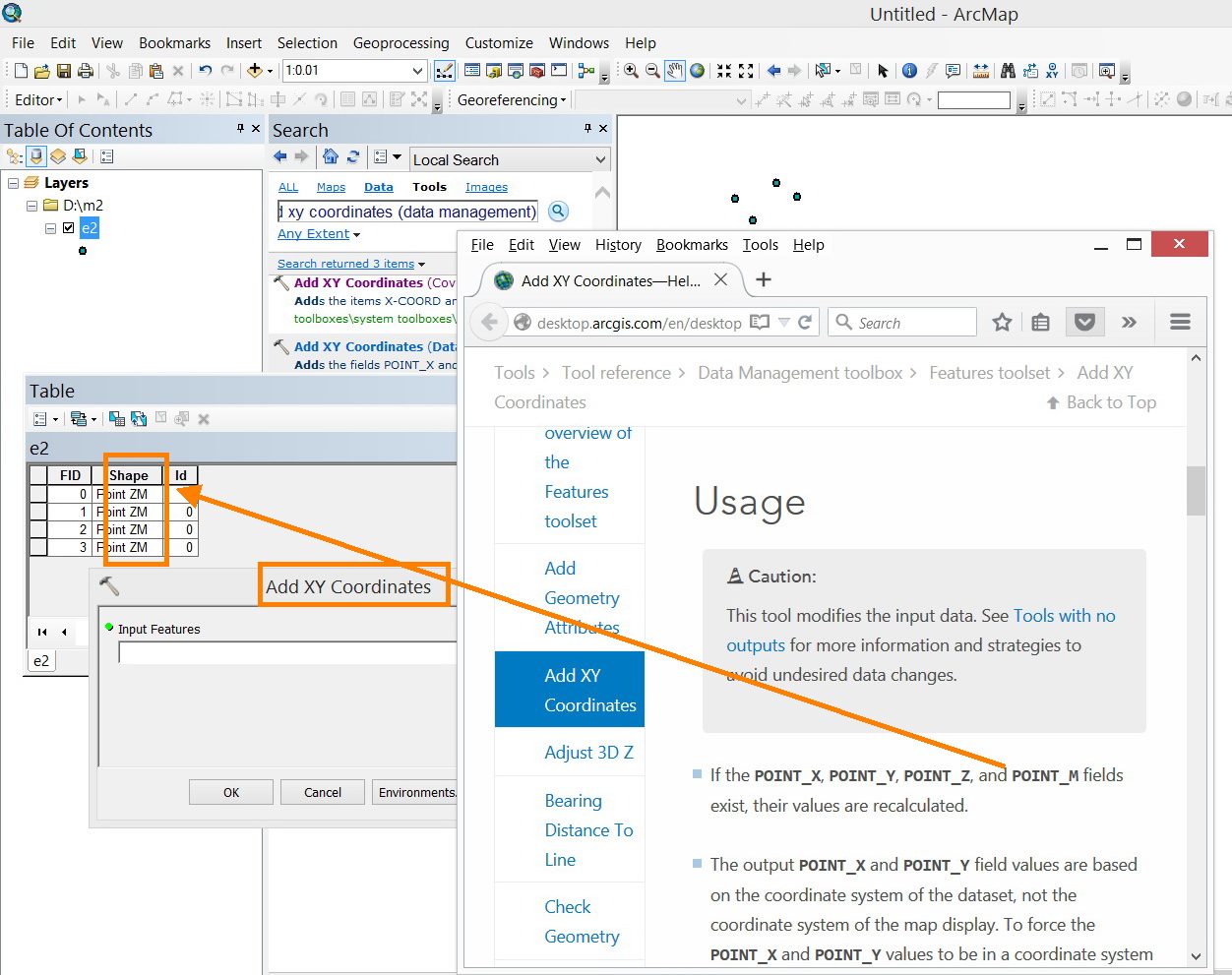
the help topic is useful
http://desktop.arcgis.com/en/desktop/latest/tools/data-management-toolbox/add-xy-coordinates.htm
- Mark as New
- Bookmark
- Subscribe
- Mute
- Subscribe to RSS Feed
- Permalink
- Report Inappropriate Content
It works fine
Jamal Numan
Geomolg Geoportal for Spatial Information
Ramallah, West Bank, Palestine
- Mark as New
- Bookmark
- Subscribe
- Mute
- Subscribe to RSS Feed
- Permalink
- Report Inappropriate Content
Yes, that is what it said...but only for ZM enabled files
- Mark as New
- Bookmark
- Subscribe
- Mute
- Subscribe to RSS Feed
- Permalink
- Report Inappropriate Content
Thanks Dan.
Jamal Numan
Geomolg Geoportal for Spatial Information
Ramallah, West Bank, Palestine