Turn on suggestions
Auto-suggest helps you quickly narrow down your search results by suggesting possible matches as you type.
Cancel
- Home
- :
- All Communities
- :
- Products
- :
- Data Management
- :
- Data Management Questions
- :
- ASCII to RASTER conversion problems
Options
- Subscribe to RSS Feed
- Mark Topic as New
- Mark Topic as Read
- Float this Topic for Current User
- Bookmark
- Subscribe
- Mute
- Printer Friendly Page
05-13-2013
07:32 AM
- Mark as New
- Bookmark
- Subscribe
- Mute
- Subscribe to RSS Feed
- Permalink
- Report Inappropriate Content
Hi, New to this so bear with me!
I have recently downloaded some .asc elevation data from Digimap and am trying to convert this to rasters, however everytime I use the ASC to Rater tool I encounter the same error messages:
ERROR 010328: Syntax error at or near symbol,.
ERROR 010267: Syntax error in parsing grid expression
I have tried saving the raster to different locations, I have also checked the data to make sure its in the correct format and contains no ',' instead of '.'.
Can anyone help?
Solved! Go to Solution.
1 Solution
Accepted Solutions
05-14-2013
12:57 AM
- Mark as New
- Bookmark
- Subscribe
- Mute
- Subscribe to RSS Feed
- Permalink
- Report Inappropriate Content
When you set the raster output name you should always use 8 characters or less, does not start with a number, uses a..z and 0..9 are characters only and don't place your grid in a folder with spaces or other weird characters. So avoid "documents & settings" as this has spaces and an & symbol.
Keep your folder structure and naming convention simple. This does mean the naming convention can become quite cryptic but then thats what metadata is for...
File geodatabases can support rasters with longer names.
Duncan
Keep your folder structure and naming convention simple. This does mean the naming convention can become quite cryptic but then thats what metadata is for...
File geodatabases can support rasters with longer names.
Duncan
8 Replies
05-13-2013
05:21 PM
- Mark as New
- Bookmark
- Subscribe
- Mute
- Subscribe to RSS Feed
- Permalink
- Report Inappropriate Content
Post a sample of the asc file.
05-13-2013
11:56 PM
- Mark as New
- Bookmark
- Subscribe
- Mute
- Subscribe to RSS Feed
- Permalink
- Report Inappropriate Content
Hi
Thanks for replying...Im sure the problem is something simple and obvious!
File attached (opened in WordPad).
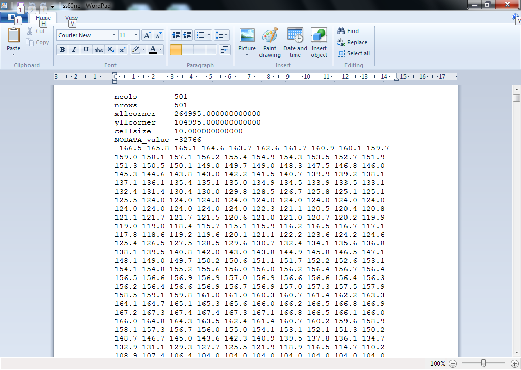
Screen shot 1 contains the header info for one of the files, While screen shot 2 contains some of the main body of the data further down the file.
Does this help?
Steve
Thanks for replying...Im sure the problem is something simple and obvious!
File attached (opened in WordPad).
Screen shot 1 contains the header info for one of the files, While screen shot 2 contains some of the main body of the data further down the file.
Does this help?
Steve
05-14-2013
12:57 AM
- Mark as New
- Bookmark
- Subscribe
- Mute
- Subscribe to RSS Feed
- Permalink
- Report Inappropriate Content
When you set the raster output name you should always use 8 characters or less, does not start with a number, uses a..z and 0..9 are characters only and don't place your grid in a folder with spaces or other weird characters. So avoid "documents & settings" as this has spaces and an & symbol.
Keep your folder structure and naming convention simple. This does mean the naming convention can become quite cryptic but then thats what metadata is for...
File geodatabases can support rasters with longer names.
Duncan
Keep your folder structure and naming convention simple. This does mean the naming convention can become quite cryptic but then thats what metadata is for...
File geodatabases can support rasters with longer names.
Duncan
05-14-2013
01:49 AM
- Mark as New
- Bookmark
- Subscribe
- Mute
- Subscribe to RSS Feed
- Permalink
- Report Inappropriate Content
Hi
Thanks for this. I'll give it a try in a min. Is this just generic advice for most ARCGIS functions, or specifically for the problem I'm having?
Steve
Thanks for this. I'll give it a try in a min. Is this just generic advice for most ARCGIS functions, or specifically for the problem I'm having?
Steve
05-14-2013
02:35 AM
- Mark as New
- Bookmark
- Subscribe
- Mute
- Subscribe to RSS Feed
- Permalink
- Report Inappropriate Content
Definitely for ESRI grids but also good practise for other datasets. For example if you create a bunch of shapefiles starting with numbers then decide to import them into a geodatabase, you cannot, as geodatabases do not support tables beginning with numbers or contain spaces\weird characters.
So avoid shooting yourself in the foot all the time and employ a strict, simple, naming convention backed up with simple metadata to explain the name if it gets a bit cryptic (which it can if you start generating hundreds of datasets).
If you start geo-processing with crazy names then python/model builder will blow up and cause you a head ache. And they do get crazy, some "expert" consultant was sending me data with commas and superscript 2's in the dataset name...
05-14-2013
03:27 AM
- Mark as New
- Bookmark
- Subscribe
- Mute
- Subscribe to RSS Feed
- Permalink
- Report Inappropriate Content
Yes, thanks for this advice. It certainly seemed to be the problem. I have a space in the file name. Once I removed it then the rasters were created no problem! Simples.
Now to work out out to merge all the rasters into one complete dataset! I like working with this sort of data, but the software would appear to require that I be working with it all the time...so as to be completly at one with it...borg like. Still, it does look good when its done, and I get some interesting data.
Cheers
Steve
(will probably post again soon! :p)
05-14-2013
05:31 AM
- Mark as New
- Bookmark
- Subscribe
- Mute
- Subscribe to RSS Feed
- Permalink
- Report Inappropriate Content
Steve,
For the benefit of others you should mark you post as answered and are encouraged to vote up or down answers/questions.
Duncan
For the benefit of others you should mark you post as answered and are encouraged to vote up or down answers/questions.
Duncan
07-22-2017
06:01 AM
- Mark as New
- Bookmark
- Subscribe
- Mute
- Subscribe to RSS Feed
- Permalink
- Report Inappropriate Content
hi I Still have this problem I am not saving any output name with space or any character but still it is giving me this syntax error. I make interpolation map than save it to as vector than use it it as my input and it gives me same error
Kindly help me to solve this error.