- Home
- :
- All Communities
- :
- Products
- :
- Data Management
- :
- Data Management Questions
- :
- Generate Contour from DEM
- Subscribe to RSS Feed
- Mark Topic as New
- Mark Topic as Read
- Float this Topic for Current User
- Bookmark
- Subscribe
- Mute
- Printer Friendly Page
Generate Contour from DEM
- Mark as New
- Bookmark
- Subscribe
- Mute
- Subscribe to RSS Feed
- Permalink
- Report Inappropriate Content
Hi guys,
How can I generate nicer contour map from SRTM DEM data downloaded from the internet.
I already did the process using 3d Analyst and here's my output.

I made used of these data attached.
Please advise if there's any other way to generate contour. This is 5 meter contour interval.
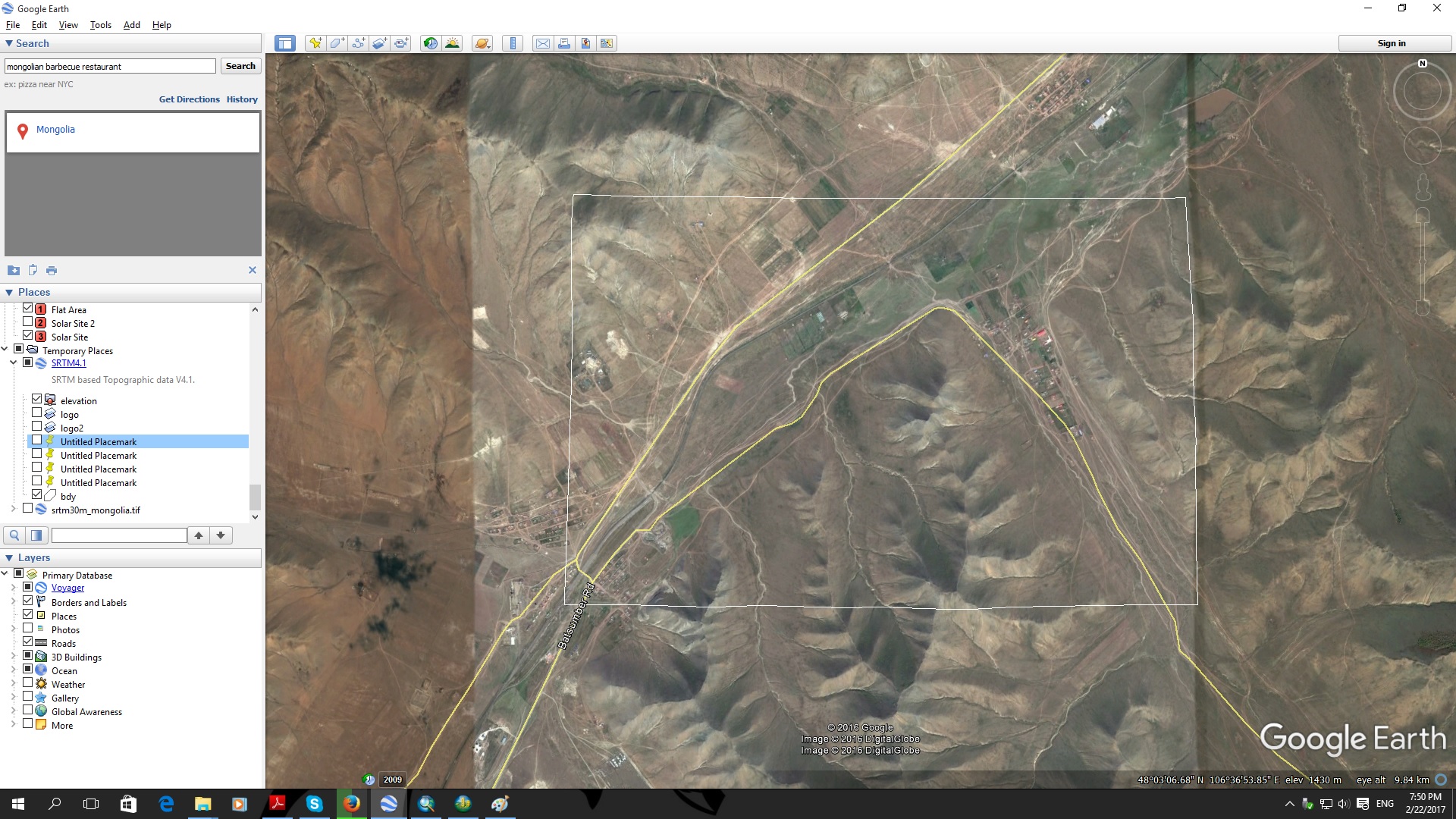
This is the Sat Image from Google Earth.
Thank you guys
- Mark as New
- Bookmark
- Subscribe
- Mute
- Subscribe to RSS Feed
- Permalink
- Report Inappropriate Content
Hi Leslie,
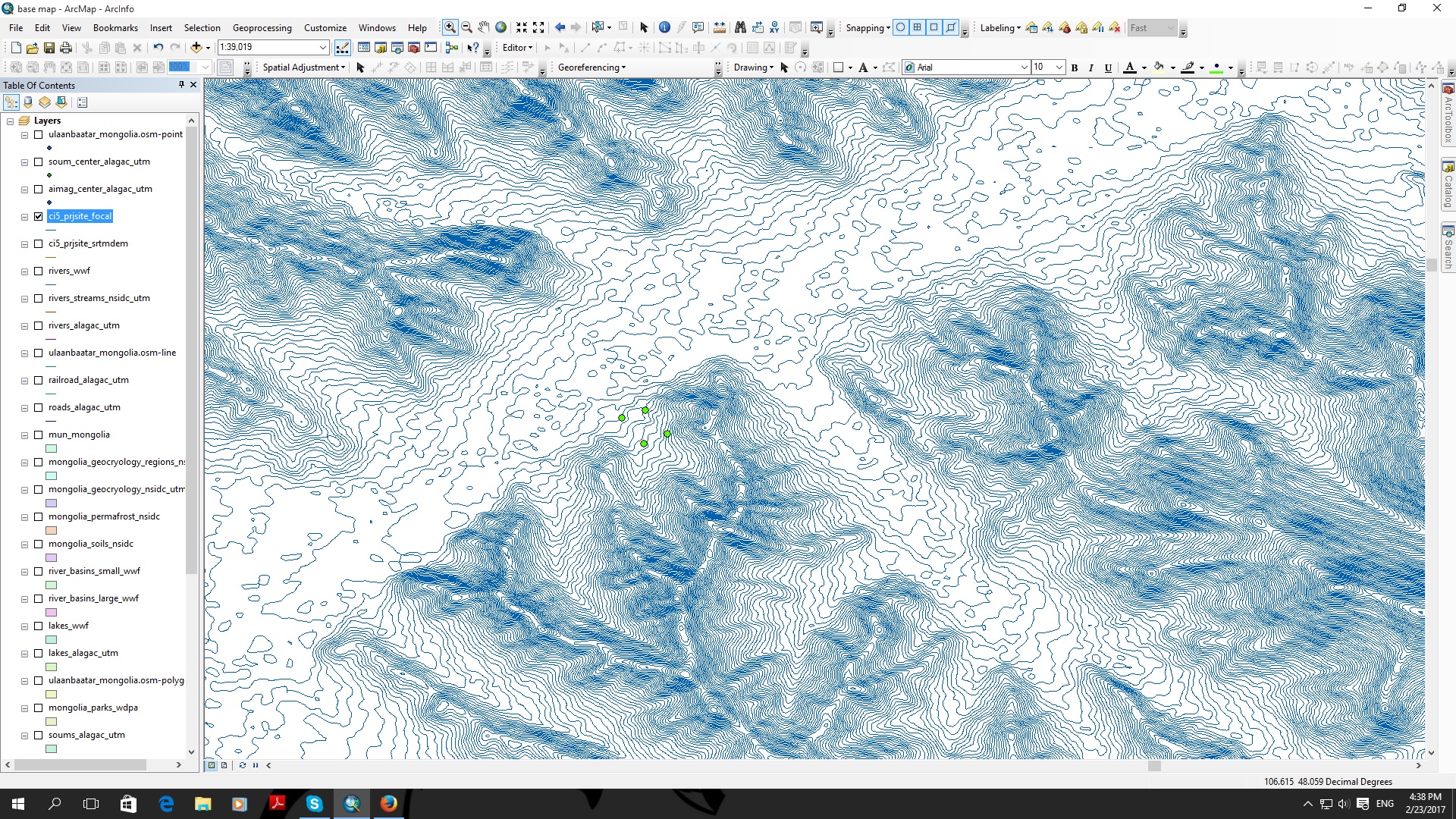
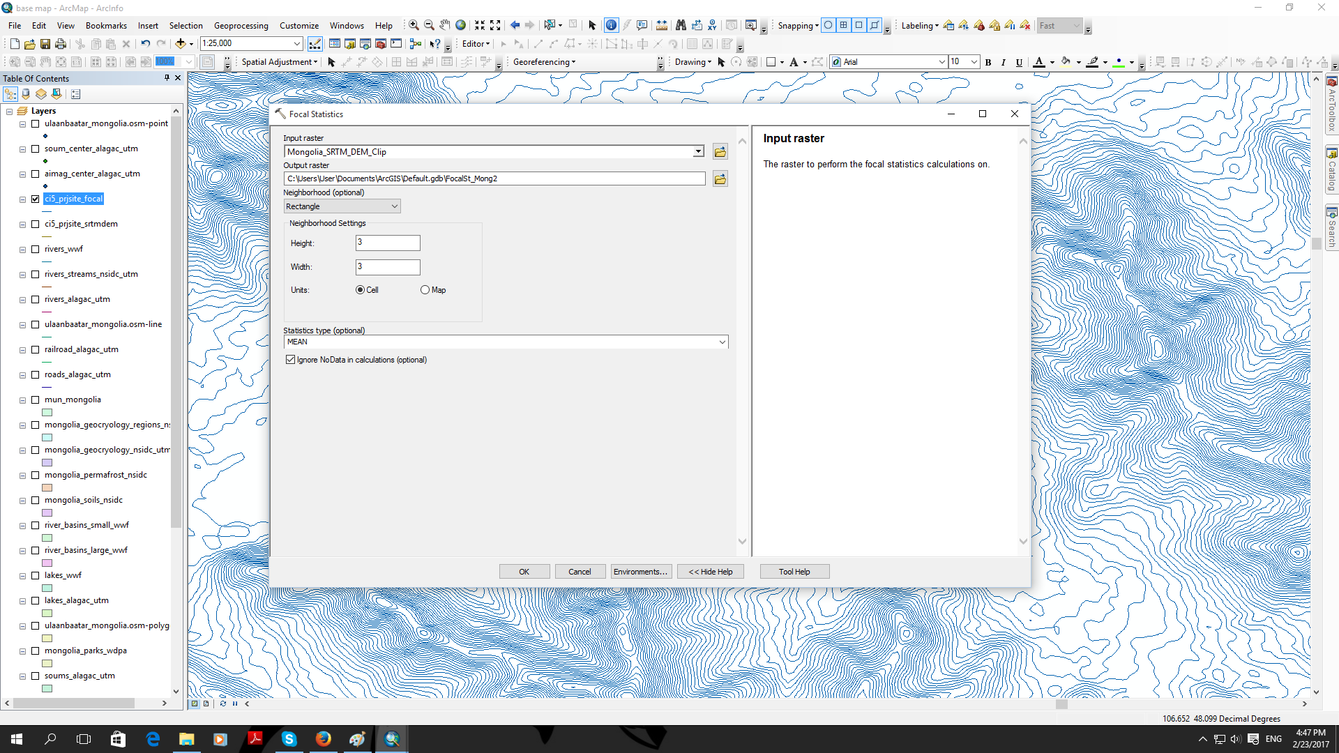
I tried using your data and creating contours directly from the SRTM DEM did generate alot of erroneous looking contours. I believe this can be attributed to mainly the fact that your elevation values are all integers, with no floating point. Therefore, it can create contours around the edge of several cells since they can easily have the same elevation. In order to make more cartographically pleasing contours, I ran the Focal Statistics Tool using a 3x3 window calculating a mean value for each cell. This obviously degrades the data from the original slightly, but does also create contours that are mcuh closer to the type of contours you are expecting. It also has the benefit of generating floating point elevation values(since we are averaging many integers), instead of the integer values that caused alot of our artifacts.
In the below screenshot, the purple lines are the contours generated by the unsmoothed DEM, the light blue are the contours from the smoothed DEM.

I hope this is what you were looking for, let me know if you have any further questions.
Ian
- Mark as New
- Bookmark
- Subscribe
- Mute
- Subscribe to RSS Feed
- Permalink
- Report Inappropriate Content
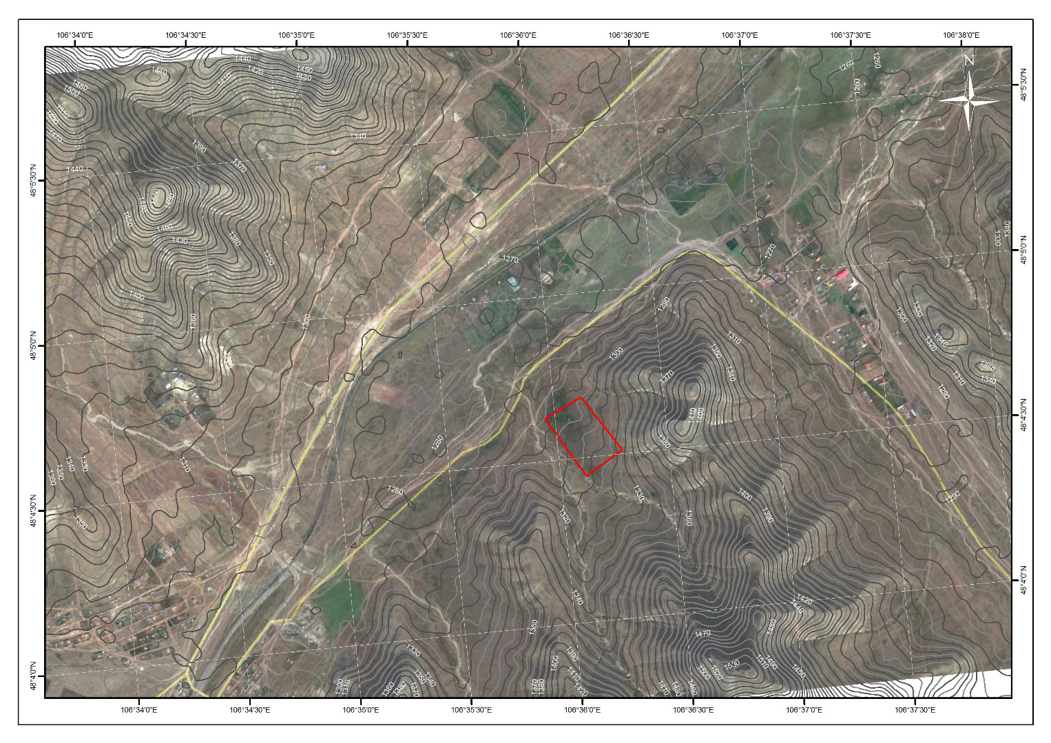
i just followed your suggestion by using the focal stat tool and here's my output.
Way much better than my previous output.
I didn't change the default figures for processing the raster and after that i just click the contour under 3d analyst.
If i make the lines smooth, do the accuracy of contour would change? i mean is it necessary to smooth the line if the objective of this contour data will be for construction purposes.
- Mark as New
- Bookmark
- Subscribe
- Mute
- Subscribe to RSS Feed
- Permalink
- Report Inappropriate Content
They are planning to use SRTM data as the basis for construction purposes? That data is really coarse(1 value for a 25m x 25m area) and since all the elevation is integer instead of float you already have a fairly significant margin of error in the data(the actual value for a cell could have been 1249.49, but the sensor rounded to nearest integer), just based on how it was collected and stored(not to mention the SRTM in Eurasia has a mean height error of +/- .7m).
I don't think the focal statistics would effect the data to such a degree that it would cause significant changes in whatever planning they are doing. I'm guessing they are needed the contours for some kind of cut/fill analysis, what program are they planning to do the planning in? Many CAD-type programs can handle DEMs and generate surface contours from them all on their own. Actually usually if I'm making contours from a DEM I prefer to created them in AutoCAD/Civil3D as opposed to ArcGIS(for small scale areas/coarser data, if I'm working over a large scale or very fine data I use Arc, since CAD doesn't handle large surfaces as well as ArcGIS).
Dan_Patterson, curtvprice, got any additional comments? I was also thinking based on how coarse the original data is, would 5m contours even be "accurate" based on the large cell size?
- Mark as New
- Bookmark
- Subscribe
- Mute
- Subscribe to RSS Feed
- Permalink
- Report Inappropriate Content
depends on ultimate use and budget... drone las data is pretty cheap around here and extremely good
- Mark as New
- Bookmark
- Subscribe
- Mute
- Subscribe to RSS Feed
- Permalink
- Report Inappropriate Content
This will actually be used for the proposal only. Detailed surveying will come after further studies of the area.
- Mark as New
- Bookmark
- Subscribe
- Mute
- Subscribe to RSS Feed
- Permalink
- Report Inappropriate Content
Why is it that my map is tilted? is it normal? or is it because my georeferencing is wrong since the image tilted when i did the process.
- Mark as New
- Bookmark
- Subscribe
- Mute
- Subscribe to RSS Feed
- Permalink
- Report Inappropriate Content
These contours look fine to me. You could select fewer of them and do smoothing using tools in the Edit toolbox if they are too jaggy for you.
As for the tilted image, since all your layers seem to be overlaying nicely, there is no error -- ArcMap is doing what is supposed to do - projecting data layers on the fly to match your data frame projection.
- Mark as New
- Bookmark
- Subscribe
- Mute
- Subscribe to RSS Feed
- Permalink
- Report Inappropriate Content
Thank you for your help.