- Home
- :
- All Communities
- :
- Products
- :
- Data Management
- :
- Data Management Questions
- :
- Re: What projection should I use to measure in met...
- Subscribe to RSS Feed
- Mark Topic as New
- Mark Topic as Read
- Float this Topic for Current User
- Bookmark
- Subscribe
- Mute
- Printer Friendly Page
What projection should I use to measure in meters?
- Mark as New
- Bookmark
- Subscribe
- Mute
- Subscribe to RSS Feed
- Permalink
- Report Inappropriate Content
Dear all,
I want to do some distance calculations in ArcGIS, but it is always calculating in degrees. I think the only way to make it measure my distances in meters is to change the data and the data frame to an appropriate projection? (I have set the map properties to meters already.) However, I do not know which projection to choose. I am looking at an area that is roughly at 31.0309° N, 103.1831° E. I have read somewhere else that UTM is good, but Arc offers so many different UTM projections that I was lost again. I think the UTM grid should be 48.
Is anybody able to suggest a specific coordinate reference system that I can try? Thanks ever so much in advance.
Carina
Solved! Go to Solution.
- Mark as New
- Bookmark
- Subscribe
- Mute
- Subscribe to RSS Feed
- Permalink
- Report Inappropriate Content
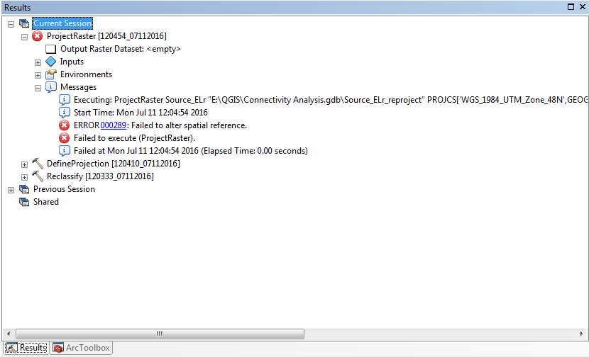
Anyone any ideas why the Project Raster tool should stop working? It worked all right for the rest I did, but I have to reproject a few layers now. And it won't do it anymore. Instead I get this error:

- Mark as New
- Bookmark
- Subscribe
- Mute
- Subscribe to RSS Feed
- Permalink
- Report Inappropriate Content
linked to new question Project Raster: Error 000289 Failed to alter spatial reference
- « Previous
- Next »
- « Previous
- Next »