- Home
- :
- All Communities
- :
- Products
- :
- Geoprocessing
- :
- Geoprocessing Questions
- :
- Re: Extend polygon to line in batch?
- Subscribe to RSS Feed
- Mark Topic as New
- Mark Topic as Read
- Float this Topic for Current User
- Bookmark
- Subscribe
- Mute
- Printer Friendly Page
Extend polygon to line in batch?
- Mark as New
- Bookmark
- Subscribe
- Mute
- Subscribe to RSS Feed
- Permalink
- Report Inappropriate Content
I am looking for a good way to 'fill the gaps' between my county's polygon layer and a land use layer I inherited.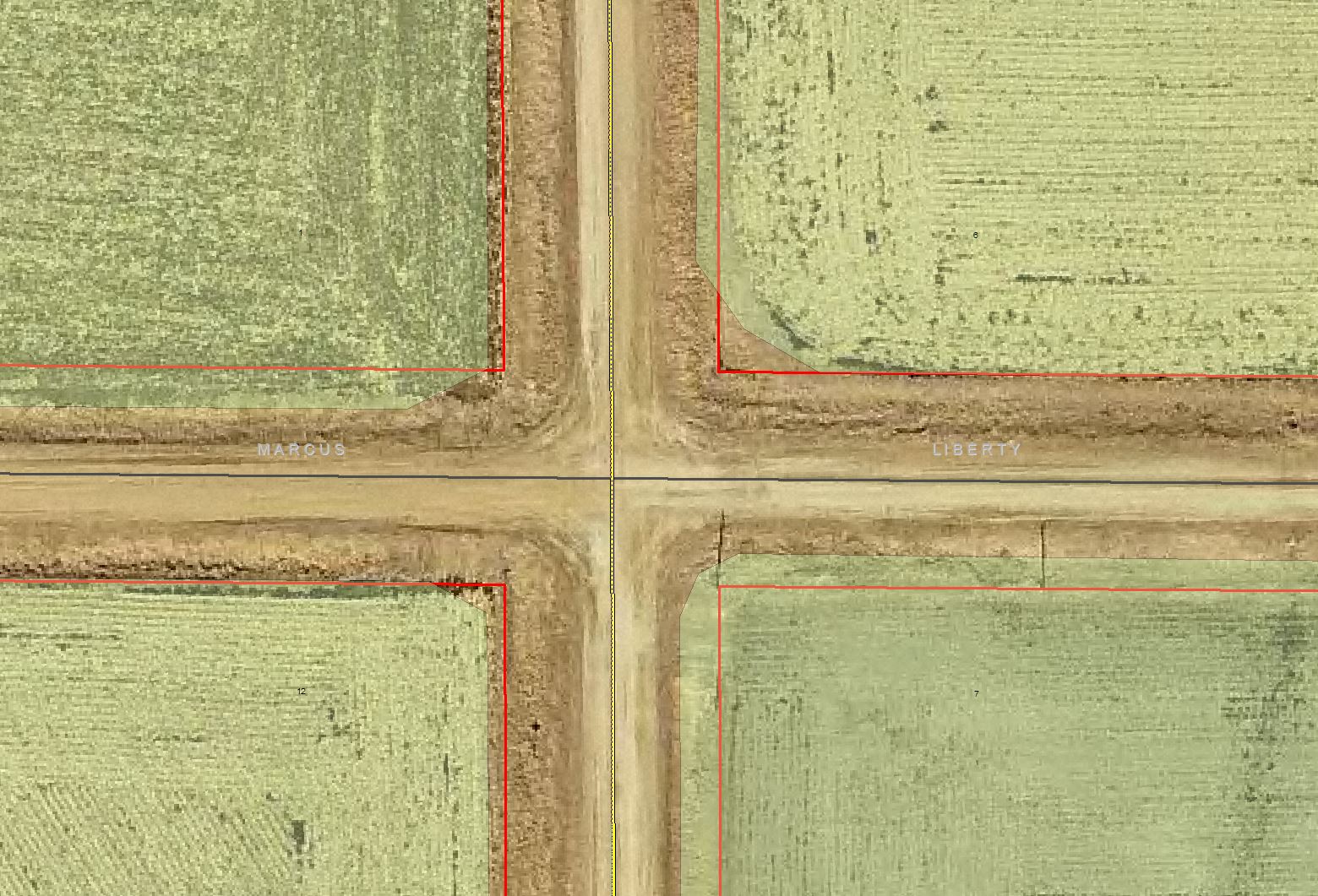
I need the green symbolized land use polygons to, at the very least, overlap the red lined parcel polygons. There are several thousands of this example throughout my county and I would like to avoid correcting them by hand if I can. Does anyone have a solution or tool for my situation? Thank you!
- Mark as New
- Bookmark
- Subscribe
- Mute
- Subscribe to RSS Feed
- Permalink
- Report Inappropriate Content
That sounds like an interesting possibility. Could work.
Chris Donohue, GISP
- Mark as New
- Bookmark
- Subscribe
- Mute
- Subscribe to RSS Feed
- Permalink
- Report Inappropriate Content
Micah,
After running the loop over 6 parcel shapefiles I couldn't tell any difference in the movement of the lines (I left the cluster tolerance at the default value) Perhaps with many more iterations and a bit of wizardry with the cluster tolerance it might have worked. I ended up doing it the old fashioned way.
Thanks again for all your help!
- « Previous
-
- 1
- 2
- Next »
- « Previous
-
- 1
- 2
- Next »