- Home
- :
- All Communities
- :
- Products
- :
- Geoprocessing
- :
- Geoprocessing Questions
- :
- how to use create space time cube tool
- Subscribe to RSS Feed
- Mark Topic as New
- Mark Topic as Read
- Float this Topic for Current User
- Bookmark
- Subscribe
- Mute
- Printer Friendly Page
how to use create space time cube tool
- Mark as New
- Bookmark
- Subscribe
- Mute
- Subscribe to RSS Feed
- Permalink
- Report Inappropriate Content
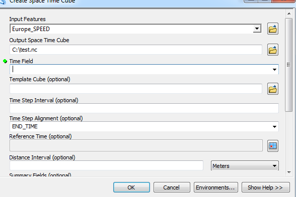
Hi, I am using the "Space Time Cube" tool, and get the below error message. I wonder would anyone know and place help with this problem.
Thanks!

- Mark as New
- Bookmark
- Subscribe
- Mute
- Subscribe to RSS Feed
- Permalink
- Report Inappropriate Content
that output location is really 'difficult'... why don't you try a simpler, like in c:\test Try to avoid the Users... folder, folders with spaces and certainly the desktop. Also if this is the second time that you tried it,the error may indicate that the file already exists and clicking on the X will reveal more details.
- Mark as New
- Bookmark
- Subscribe
- Mute
- Subscribe to RSS Feed
- Permalink
- Report Inappropriate Content
Thanks, Dan. That works. But now the problem becomes that when I tried to select a time field, it does not show any option for me to click.
- Mark as New
- Bookmark
- Subscribe
- Mute
- Subscribe to RSS Feed
- Permalink
- Report Inappropriate Content
well that probably means that you don't have a field with a 'Date' type.Perhaps you need to go through the production procedure to ensure that you have the data structured properly. The format is quite specific and sometimes people assume that the STC will apply to their data when in fact, it doesn't.
Create Space Time Cube—Help | ArcGIS for Desktop
Good luck
- Mark as New
- Bookmark
- Subscribe
- Mute
- Subscribe to RSS Feed
- Permalink
- Report Inappropriate Content
I have year, month, and date information coded in separate column...I checked the required time field info, but not clear whether or not I need to have year/month/date in the same column?
- Mark as New
- Bookmark
- Subscribe
- Mute
- Subscribe to RSS Feed
- Permalink
- Report Inappropriate Content
I suspect they are string/text fields and not a proper Date field... chec the column properties
- Mark as New
- Bookmark
- Subscribe
- Mute
- Subscribe to RSS Feed
- Permalink
- Report Inappropriate Content
Thanks, Dan. I just checked: it is a double.
- Mark as New
- Bookmark
- Subscribe
- Mute
- Subscribe to RSS Feed
- Permalink
- Report Inappropriate Content
The field containing the date and time (timestamp) for each point. This field must be of type Date.
from the link I sent... so you now have to create a proper Date from what you have...
- Mark as New
- Bookmark
- Subscribe
- Mute
- Subscribe to RSS Feed
- Permalink
- Report Inappropriate Content
what is it you are trying to do by the way? If you want to work with n-dimensional data, then this isn't the only option, I work with it all the time, using NumPy, SciPy and their brethren. May not have the cool graphics, but you can emulate just about anything you want with those and matplotlib or other graphics interfaces. This can all be accomplished and accompanied with ArcMap and/or Pro. I have blogged about NumPy and array data in general extensively.
- Mark as New
- Bookmark
- Subscribe
- Mute
- Subscribe to RSS Feed
- Permalink
- Report Inappropriate Content
Hi Dan, thank you. Yes, I am working on a n-dimensional data, including country and location (i.e., latitude/longitude) where each conflict event occurred as well as time (year, month, and date) each event happened. What I would like to do is to run the emerging hot spot tool for my conflict data. To do that, I have to implement the "create space time cube" tool.
So, in my case, would you suggest me to try other options (you mentioned above) or stick with the ArcGIS?
Again, thank you.