Airbus Defense & Space Satellite Tasking at the Esri User Conference
- Subscribe to RSS Feed
- Mark as New
- Mark as Read
- Bookmark
- Subscribe
- Printer Friendly Page
- Report Inappropriate Content
At the recent 2014 Esri User Conference I showed on-demand satellite tasking from Airbus Defense & Space using a couple of examples with imagery obtained on-demand the week before the conference. Since then I've gotten several questions about the tasking, and the applications that were shown. Here's an outline of the presentation.
The demonstration began by showing the Airbus Defense and Space - Satellite Tasking & Archive application. I had used a beta version of the application to obtain the imagery shown, and the application was released just prior to the User Conference and is now available via the ArcGIS Marketplace.
The application enables you to search for a location (I used San Diego), then click to locate a 10 km x 10 km area of interest. Click Search to find imagery.
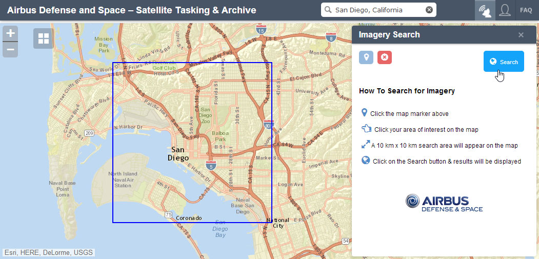
The app returns a list of options to choose from, which include the following:
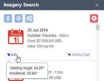
Instant Tasking
You can task to capture an image from the next available satellite pass of either Pleiades (50cm resolution) or SPOT (1.5m resolution) satellites, guaranteeing image capture on an exact date. This is best for when you absolutely must have the imagery as soon as possible. The image will be "as captured," so there are no guarantees to cloud cover percentage, so consider the weather and atmospheric conditions before using this option. These options are indicated by the red 1 Shot Tasking symbol. Click Info to get more details.
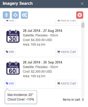
Automatic Tasking
Request imagery within the next 30 or 60 days. If you don't need the imagery as soon as possible, you benefit from getting a guarantee of the cloud cover.
Search the archive
Browse the archive of imagery that overlaps your area of interest. Hover over the selection to display the yellow shaded coverage of the image against your area of interest, or click Preview to see more details.
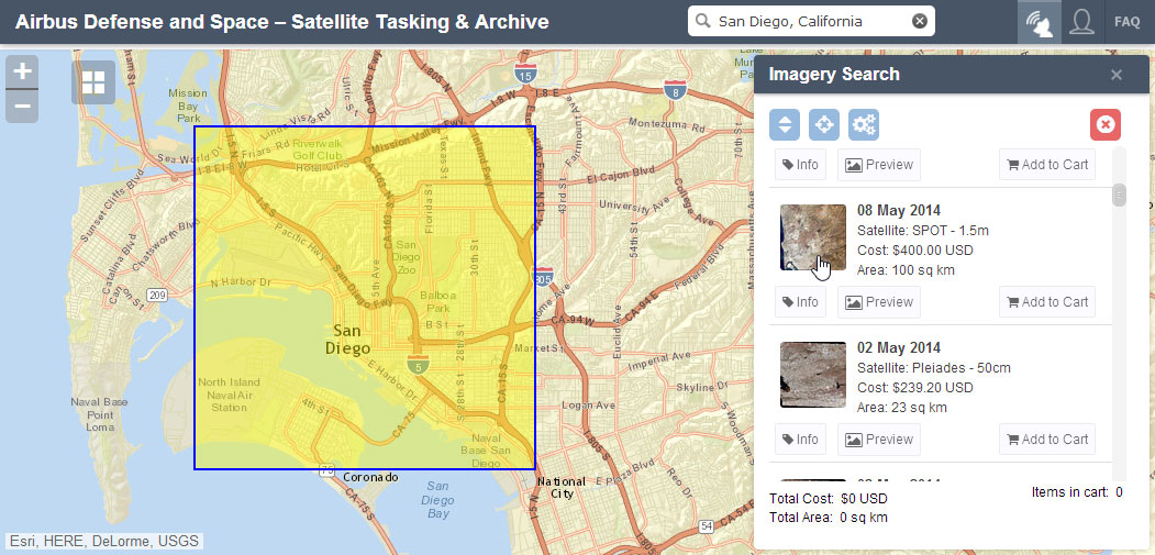
Not shown or mentioned during the User Conference demonstration, the application also offers sorting and custom date range and percent cloud cover filters.
Examples:
A Partnership in Preservation: Coogan Farm in Connecticut, a project of The Trust for Public Land (TPL) is an example where the imagery could potentially be used for monitoring and stewardship.
Internally Displaced Persons in Iraq: Imagery that shows camps that have sprung up as Iraqis have fled their homes for safer areas during recent turmoil.
A Tornado's Swath of Destruction in Pilger, Nebraska: This third example was not shown during the Plenary, but is added here. It shows the devastating impact of an EF4 tornado on the town of Pilger, Nebraska.
All of these examples were authored using the Story Map Swipe template.
Note: The above is just a recap of what was demonstrated at the Esri UC. For more on this application, and other services offered by Airbus Defense & Space, search the ArcGIS Marketplace using the keyword Airbus. Note that this is a new Marketplace offering, and pricing and licensing is subject to change.
You must be a registered user to add a comment. If you've already registered, sign in. Otherwise, register and sign in.