Mostly Mapping Map of the Day - September 18, 2014
- Subscribe to RSS Feed
- Mark as New
- Mark as Read
- Bookmark
- Subscribe
- Printer Friendly Page
- Report Inappropriate Content
September has been an especially tough month in California. Already impacted by severe drought, vast portions of the state neared or broke record temperatures as a heat wave spread across Southern California. Fueled by hot and dry conditions, just a day ago there were a dozen fires, adding to the total of more than 4,000 wildfires that California has endured so far this year.
The King Fire, centered 60 miles east of Sacramento and visible over a hundred miles away, tripled in size in roughly 24 hours, yesterday threatening more than 12,000 homes. Near Yosemite National Park another fire has damaged or destroyed over 70 structures, including 37 homes. Just north of the popular resort destination of Mammoth Lakes, along California's Eastern Sierra, a fire threatened the town of June Lake, driving evacuations and highway closures. And the list goes on...
At the state's northern edge, a fire destroyed 150 structures in the town of Weed, including two churches, a community center, and the town library. The Boles Fire, as it is known, has also damaged a mill, one of the cornerstones of the town's economy. At its peak, nearly the entire town of 3,000 was evacuated.
I walked into the office of Paul Doherty, Esri's Disaster Response Program technical lead, yesterday. He toured me through what is today's map of the day. It's a map compiled and used by CalFire, the California Governor's Office of Emergency Services (Cal OES), and the Siskiyou County Office of Emergency Services to collect and display information used in damage assessment and briefings concerning the Boles Fire.
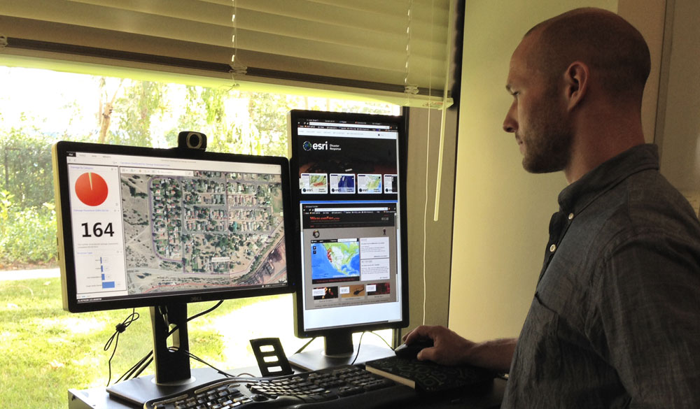
The continually updating map uses Dashboard for ArcGIS, and the data behind it is collected using Collector for ArcGIS and the new ArcGIS Online GeoForm app template. The big picture can be seen using the US Wildfire Activity Public Information Map, found on the Esri Disaster Response Program mapping and GIS portal.
You must be a registered user to add a comment. If you've already registered, sign in. Otherwise, register and sign in.