Turn on suggestions
Auto-suggest helps you quickly narrow down your search results by suggesting possible matches as you type.
Cancel
- Home
- :
- All Communities
- :
- Products
- :
- Imagery and Remote Sensing
- :
- Imagery Ideas
- :
- Expose Export Raster Renderer Settings to Python/A...
Options
- Subscribe to RSS Feed
- Mark as New
- Mark as Read
- Bookmark
- Follow this Idea
- Printer Friendly Page
- Report Inappropriate Content
Expose Export Raster Renderer Settings to Python/Arcpy
Follow this Idea
645
0
03-24-2015 03:28 PM
Status:
Open
- Mark as New
- Bookmark
- Subscribe
- Mute
- Subscribe to RSS Feed
- Permalink
- Report Inappropriate Content
It is possible to export rasters in ArcMap by right clicking the layer-> Data-> Export:
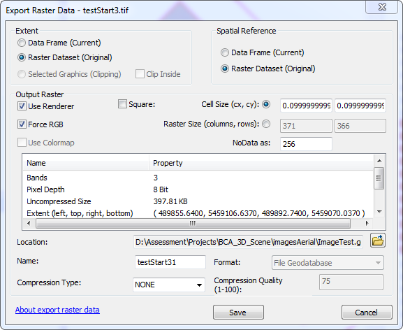
You can then click 'Use Renderer' check box to ensure the image you export uses the current symbology/rendering settings for that raster layer.
There does not appear to be any geoprocessing tools that match this 'Use Renderer' functionality.
Exposing these settings in python/arcpy will help in automating the process of exporting raster layers with current symbology settings.
You must be a registered user to add a comment. If you've already registered, sign in. Otherwise, register and sign in.