- Home
- :
- All Communities
- :
- Products
- :
- Imagery and Remote Sensing
- :
- Imagery Questions
- :
- Poor image quality in generated map server cache t...
- Subscribe to RSS Feed
- Mark Topic as New
- Mark Topic as Read
- Float this Topic for Current User
- Bookmark
- Subscribe
- Mute
- Printer Friendly Page
Poor image quality in generated map server cache tiles
- Mark as New
- Bookmark
- Subscribe
- Mute
- Subscribe to RSS Feed
- Permalink
- Report Inappropriate Content
Hi all,
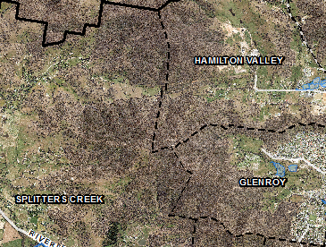
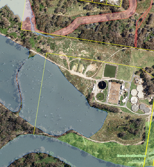
We've received some new aerial imagery so I'm in the process of generating a new cached tiled map service. What I'm finding is that the aerial imagery in the generated tiles is of a poorer quality than how it looks in ArcMap. We've built pyramids on the imagery and at most scales the quality is as expected. See images below for comparison between expected (screenshot from ArcMap) and generated (screenshot from generated tiles). The only thing that comes to mind is a mismatch between pyramid scales and tile cache scales, but I would have thought the image in ArcMap would look the same as the generated image. Is this behavior normal? Any ideas on how to 'fix' it?


FYI ben_vk
Solved! Go to Solution.
Accepted Solutions
- Mark as New
- Bookmark
- Subscribe
- Mute
- Subscribe to RSS Feed
- Permalink
- Report Inappropriate Content
Possible issue may be that the pyramids from the original data were created using Nearest sampling. Suggest you re-create the pyramids using Bilinear/Average as sampling method. Do this from the "Build Pyramids and Statistics tool" (but turn off stats generation).
- Mark as New
- Bookmark
- Subscribe
- Mute
- Subscribe to RSS Feed
- Permalink
- Report Inappropriate Content
Thanks very much for the quick reply, Peter. That makes sense, I'll give it a go and report back.