Turn on suggestions
Auto-suggest helps you quickly narrow down your search results by suggesting possible matches as you type.
Cancel
- Home
- :
- All Communities
- :
- Products
- :
- Mapping
- :
- Mapping Questions
- :
- Geo - Partial Overlapping Links limitations?
Options
- Subscribe to RSS Feed
- Mark Topic as New
- Mark Topic as Read
- Float this Topic for Current User
- Bookmark
- Subscribe
- Mute
- Printer Friendly Page
Geo - Partial Overlapping Links limitations?
Subscribe
835
3
08-24-2012 05:08 AM
08-24-2012
05:08 AM
- Mark as New
- Bookmark
- Subscribe
- Mute
- Subscribe to RSS Feed
- Permalink
- Report Inappropriate Content
I'm attempting to create a realistic map of a fiber network by utilizing the 'initialize link vertices' From the Schematic Builder Properties. Our fiber cables are derived from our communication maps that include highly detailed paths (I.e. lots of vertices and arcs in short lengths). Many of our links, from manhole to manhole, are less than 200' and are not straight paths. In some locations of our network there are several cables that share partially identical geometries and I want to separate these so I can visualize all of the cables in our network where overlap exists. When I attempt to use the Geo - Partial Overlapping Links tools, no geometries are changed in the schematic and all cables stay overlapped. I've attempted to change the parameters and cannot get any results by making the buffer/offset both larger and smaller.
I'm starting to wonder if our network is too detailed for the tool. Is anyone aware of limitations to network complexity? Any other ways I might be able to achieve the desired results?
Thank You!
I'm starting to wonder if our network is too detailed for the tool. Is anyone aware of limitations to network complexity? Any other ways I might be able to achieve the desired results?
Thank You!
3 Replies
08-24-2012
06:49 AM
- Mark as New
- Bookmark
- Subscribe
- Mute
- Subscribe to RSS Feed
- Permalink
- Report Inappropriate Content
No limitation that I can think of. Usually if it doesn't separate anything, means it didn't find a conflict. So that first property setting 'BufferWidth' is very important. That is what it uses to find a conflict and then it uses the next value 'offset' for the new spacing. ***Remember that these settings are interpreted in map units. So if your map units are decimal degrees and your conflict setting is 1...well, it will be a bit strange. So make sure to either have more realistic map units, or to set the property value to something that makes sense based on those units '.00005' for example.
If you still can't get it to work, if possible, export your diagram as XML, clean up any critical information as needed, and get it to me so we can take a look.
If you still can't get it to work, if possible, export your diagram as XML, clean up any critical information as needed, and get it to me so we can take a look.
08-24-2012
07:50 AM
- Mark as New
- Bookmark
- Subscribe
- Mute
- Subscribe to RSS Feed
- Permalink
- Report Inappropriate Content
I just wanted to follow up with some screenshots and my workflow because your comments helped out and I have it working.
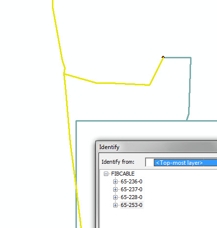
In attachment "4_Cables" I'm highlighting 4 partially overlapping cables. At this point they overlap, but start/end in different locations. They are spatially coincident in this locations because they exist in the same ductbank and the routes are built from the ductbank geometry.
The map units are in feet, and I had to use an incredibly small buffer width and offset. See "overlap settings".
The last image, "After_Running_Pola", shows the same cables with the offset applied.
However, it crashes if I run against the entire schematic, but if I select a few features it works perfectly. I wonder about the crash issue now...
08-28-2012
02:33 PM
- Mark as New
- Bookmark
- Subscribe
- Mute
- Subscribe to RSS Feed
- Permalink
- Report Inappropriate Content
You must be doing it wrong, our software never crashes 😄
What version of ArcGIS are you on and what does the 'entire schematic' really mean? How many nodes, links etc...? If the crash is reproducible, can you watch the memory on your machine and see what happens when you run this to see if it is a memory limitation? This algorithm is pretty memory intensive as it has a lot of calculations to figure out especially if you are doing this on a large diagram. How much RAM is on this machine?
What version of ArcGIS are you on and what does the 'entire schematic' really mean? How many nodes, links etc...? If the crash is reproducible, can you watch the memory on your machine and see what happens when you run this to see if it is a memory limitation? This algorithm is pretty memory intensive as it has a lot of calculations to figure out especially if you are doing this on a large diagram. How much RAM is on this machine?