- Home
- :
- All Communities
- :
- Products
- :
- Mapping
- :
- Mapping Questions
- :
- Georeferencing problem
- Subscribe to RSS Feed
- Mark Topic as New
- Mark Topic as Read
- Float this Topic for Current User
- Bookmark
- Subscribe
- Mute
- Printer Friendly Page
Georeferencing problem
- Mark as New
- Bookmark
- Subscribe
- Mute
- Subscribe to RSS Feed
- Permalink
- Report Inappropriate Content
Hello,
I have a map of all South Africa and a little bit more. I am trying to georeference this map for some time, but I get big errors. I believe that the small scale is the problem (around 1:8 000 000). I tried to cut the map in 4, but still nothing... I never georeference maps with this scale. The maps doesn't have a grid, it has some coordinates on the sides, but I am not sure they are correct.
Do you have any suggestions?
Thank you,
Alex
- Mark as New
- Bookmark
- Subscribe
- Mute
- Subscribe to RSS Feed
- Permalink
- Report Inappropriate Content
Which map of SA is it?
If you havn't got a graticule to use and you don't know what coordinate system the map has been published in, this will be quite difficult.
- Mark as New
- Bookmark
- Subscribe
- Mute
- Subscribe to RSS Feed
- Permalink
- Report Inappropriate Content
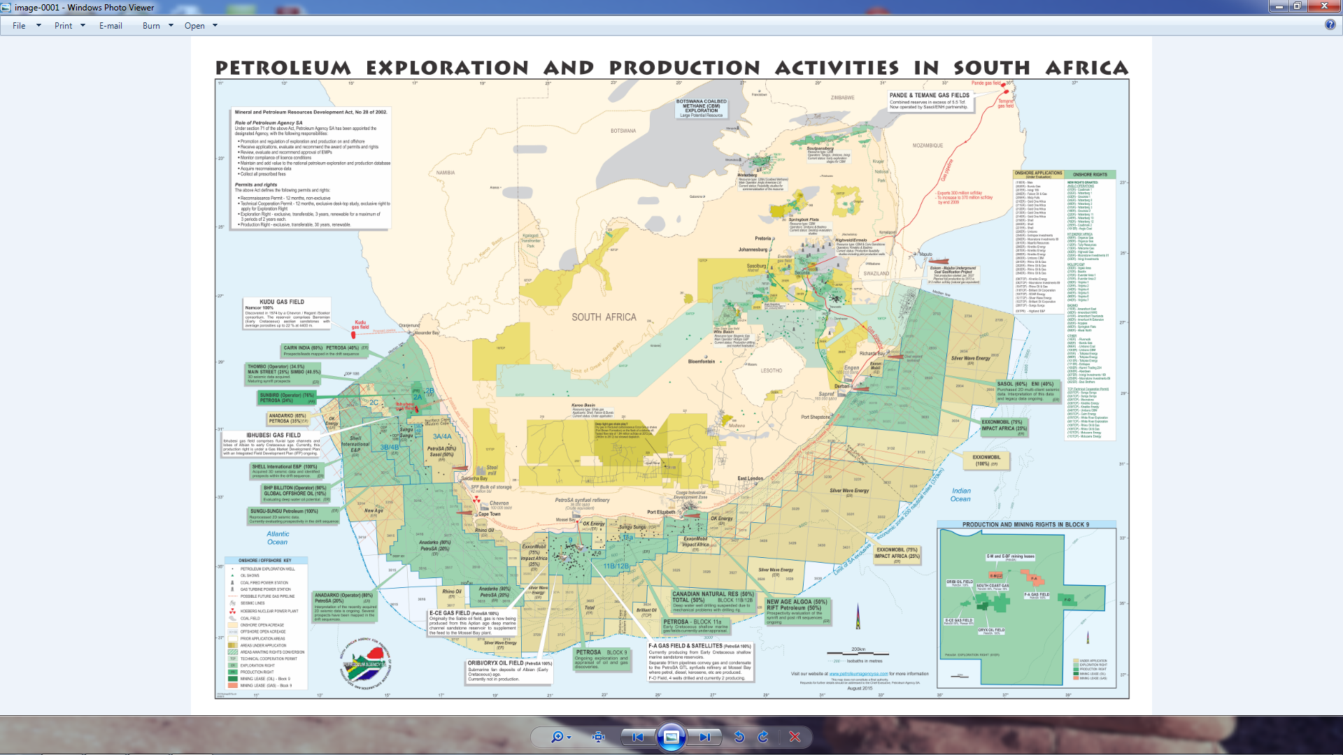
It's the map of petroleum exploration and production actvities in SA.
- Mark as New
- Bookmark
- Subscribe
- Mute
- Subscribe to RSS Feed
- Permalink
- Report Inappropriate Content
Is this data or a piece of paper?
And the source? DMR?..
If its national extent it may be a SAf Albers equal area projection.
Can you post a snapshot here?
- Mark as New
- Bookmark
- Subscribe
- Mute
- Subscribe to RSS Feed
- Permalink
- Report Inappropriate Content
Thank you for your time!
- Mark as New
- Bookmark
- Subscribe
- Mute
- Subscribe to RSS Feed
- Permalink
- Report Inappropriate Content
Ok, went to their web site and got the original pdf. Then printed it to a jpeg to have a play with the georeferencing.
Tried a standard SAf albers, but the map is centred on ~21degE (instead of 24 or 25E).
Georeffed it using points along the coast / border, but it also looks pretty horrible.
The map has been put together in Coral Draw. So its very difficult to get this correct without knowing what the original is in.
Could try contacting the author - Shaheed Russon (from the properties of the pdf).