- Home
- :
- All Communities
- :
- User Groups
- :
- PLSS Editing
- :
- Questions
- :
- Which is best when adding a Control Point when the...
- Subscribe to RSS Feed
- Mark Topic as New
- Mark Topic as Read
- Float this Topic for Current User
- Bookmark
- Subscribe
- Mute
- Printer Friendly Page
Which is best when adding a Control Point when there is no line point in a fabric
- Mark as New
- Bookmark
- Subscribe
- Mute
- Subscribe to RSS Feed
- Permalink
- Report Inappropriate Content
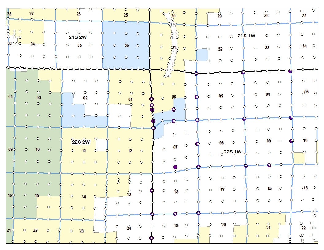
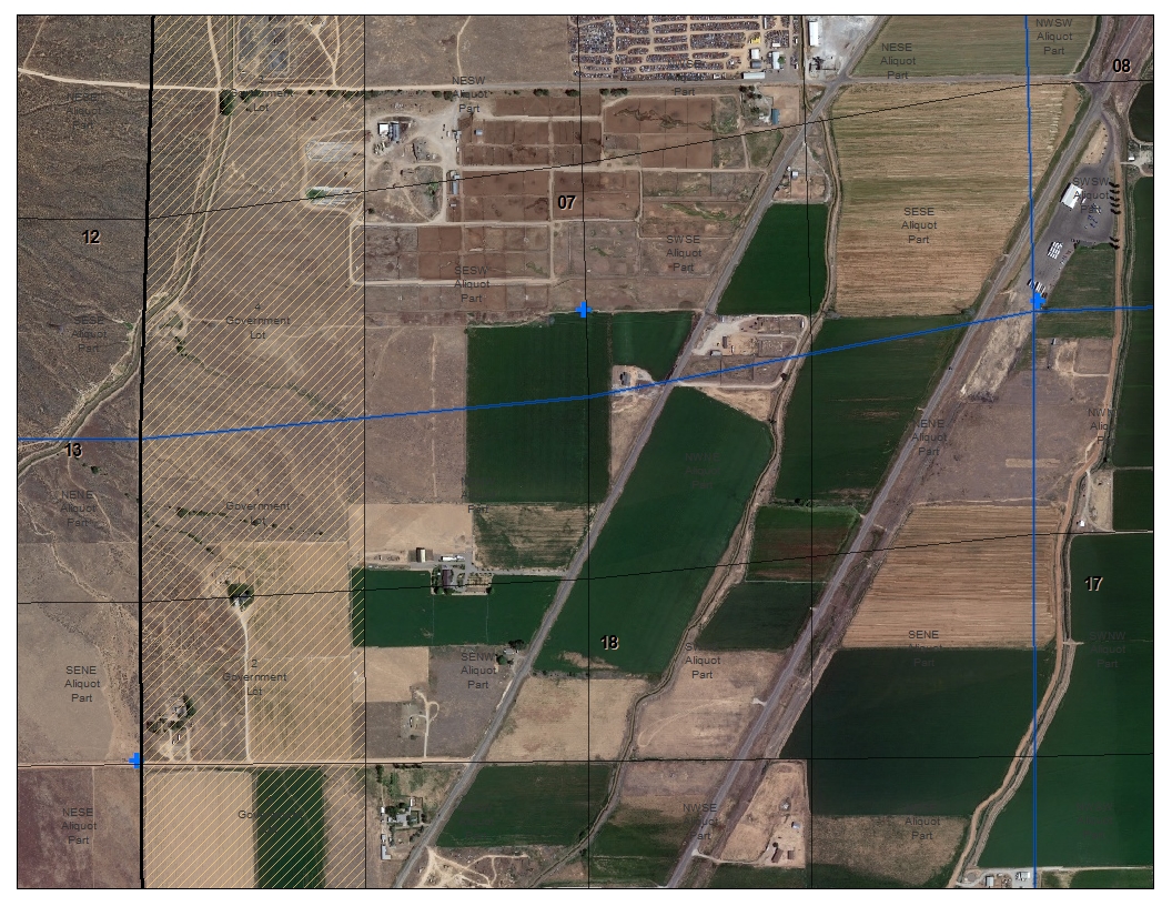
Afternoon We have been looking over the Project areas T22S R1W and found a couple of interesting things we will be dealing with. I have hopefully added a couple of jpg's to view.
In Section 7 (Three...jpg) we will have a big shift northward of the bottom line in the section, easy to associate it with the lower point. But no control along the west Township/Section line.
In the above Section 6 (Two..jpg) we have points from BLM one of those is the corner point for Sec. 6 100600. This when added as control will not have a point to associate it with.
The section line now is following the Gov Lot lines, are those incorrect?
In general I would go in and edit the polygons, which would create the needed fabric point, or add the control point and then edit the polygon snapping to the control.
Anybody have thought on this?
- Mark as New
- Bookmark
- Subscribe
- Mute
- Subscribe to RSS Feed
- Permalink
- Report Inappropriate Content
Is there any imagery in this area we could use to supplement the control, although I know that is risky. I think you are right to be leary without some control on the west boundary
- Mark as New
- Bookmark
- Subscribe
- Mute
- Subscribe to RSS Feed
- Permalink
- Report Inappropriate Content
Nancy
Yes imagery shows field line and fence line following along there. And I do have tie sheets for reference monuments on the Township line to the west I am going look at.
- Mark as New
- Bookmark
- Subscribe
- Mute
- Subscribe to RSS Feed
- Permalink
- Report Inappropriate Content
Great info Mike - nice detective work. I think you can add some control type 8 - image control - along that side of the townships to get things adjusted. watch for any imp[act to your adjusted lines that might be unexpected on the west side of the township line.
- Mark as New
- Bookmark
- Subscribe
- Mute
- Subscribe to RSS Feed
- Permalink
- Report Inappropriate Content
Is there any documentation on what control type 8 - image control means and how it is used?
- Mark as New
- Bookmark
- Subscribe
- Mute
- Subscribe to RSS Feed
- Permalink
- Report Inappropriate Content
Hi Mike
not really we have not developed a "best practice" or work flow for the control types, but since control is control the type is mostly to see at a glance some high level source info. there is digitized which i presume would come from a map like a 1:24,000 and then the image control type 8 and the other types seem to imply a level of agency. Perhaps when to go to imagery for control would be up to each data steward, but certainly if you have the tie sheets and some good imagery and need some control to balance the adjustment then it would be warranted. that's my 2 cents anyway
- Mark as New
- Bookmark
- Subscribe
- Mute
- Subscribe to RSS Feed
- Permalink
- Report Inappropriate Content
Hey Mike,
It appears that the BLM control came from a 2014 corrective resurvey. The plat can be found on the BLM GLO land records page.
Search Results - BLM GLO Records
You may want to look at integrating the survey to your fabric along with the control. The new survey appears to mitigate some of the issues in the data that you are experiencing.
Briefly, this is the order of operations that we came up with:
- Load new control
- Create from Parent (second division)
- Abstract bearings and distances from 2014 plat.
- Send old data to historic layer
- Attribute Lots 16 & 15 according to the plat
- Perform a regional adjustment on the affected area.