- Home
- :
- All Communities
- :
- Developers
- :
- Python
- :
- Python Questions
- :
- Calculate Dice Similarity Coefficient - Python
- Subscribe to RSS Feed
- Mark Topic as New
- Mark Topic as Read
- Float this Topic for Current User
- Bookmark
- Subscribe
- Mute
- Printer Friendly Page
Calculate Dice Similarity Coefficient - Python
- Mark as New
- Bookmark
- Subscribe
- Mute
- Subscribe to RSS Feed
- Permalink
- Report Inappropriate Content
I'm trying to determine how to calculate the Dice Similarity Coefficient between two rasters. The one raster is the ground truth result of a road surface area, the second raster is the result from a Computer Vision and Machine Learning (Convolutional Neural Network). I'm trying to understand how the Dice Similarity Coefficient works so that I can replicate it as a Python\NumPy function to run against all the sample results and ground truth results that were manually determined.
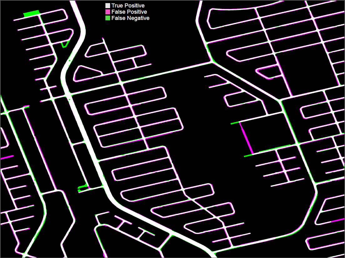
NB: Id also like determine the following raster below which depicts True Positive; False Positive and False Negative
Wikipedia: Sorensen-Dice Cofficient
Formula:

Raster Result:
- Mark as New
- Bookmark
- Subscribe
- Mute
- Subscribe to RSS Feed
- Permalink
- Report Inappropriate Content
functionally equivalent I think... you will have SciPy installed if you are using recent versions of ArcMap or ArcGIS Pro. So if memory serves, check to see if this is the same.
from scipy.spatial.distance import dice
- Mark as New
- Bookmark
- Subscribe
- Mute
- Subscribe to RSS Feed
- Permalink
- Report Inappropriate Content
Thanks Dan  , will check it out and get back to you.