- Home
- :
- All Communities
- :
- Developers
- :
- Python
- :
- Python Questions
- :
- Detect Feature Changes
- Subscribe to RSS Feed
- Mark Topic as New
- Mark Topic as Read
- Float this Topic for Current User
- Bookmark
- Subscribe
- Mute
- Printer Friendly Page
Detect Feature Changes
- Mark as New
- Bookmark
- Subscribe
- Mute
- Subscribe to RSS Feed
- Permalink
- Report Inappropriate Content
Hi!
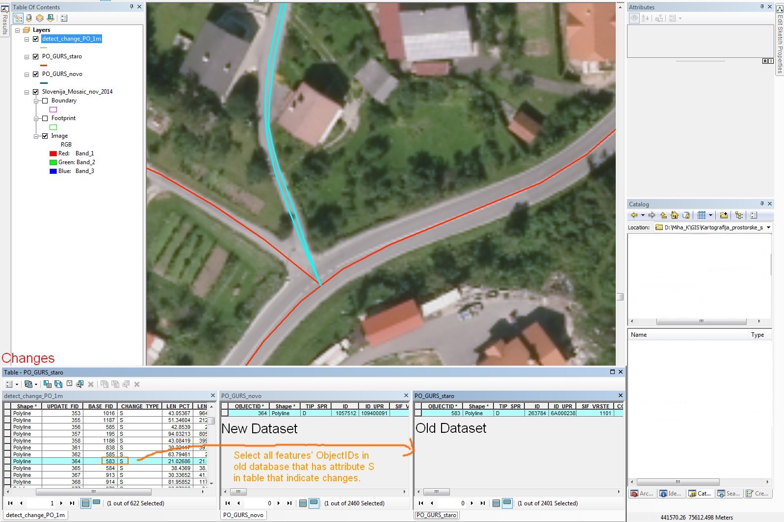
After searching for tool to detect changes in road network I came across with this tool. I ran it on two time-different road databases. The results are graphic display and attribute table. In attribute table you get information for instances if there is attribute or spatial change. More about this tool you can read in ArcGIS Help.
For example: in attribute table that indicate changes are 622 features with attribute S which indicates spatial changes between old and new dataset. It can mean that new part of road was additionally build (road was upgraded) or destroyed for example.
What I would like to do is to select all ObjectIDs in old dataset that has attribute S in the table that indicate spatial changes and delete them also in old dataset.
I assume this can be done quickly with python. But I do not know much about python so I would appreciate your help!
- Mark as New
- Bookmark
- Subscribe
- Mute
- Subscribe to RSS Feed
- Permalink
- Report Inappropriate Content
Is there any reason you need to do this in python?
In an ArcMap edit session, just select the features (select by attribute) then delete.
If you want to use a tool, in ArcMap, use a definition query on the layer and save that to a lyr file.
Then use the lyr file as input to the Delete features tool.
- Mark as New
- Bookmark
- Subscribe
- Mute
- Subscribe to RSS Feed
- Permalink
- Report Inappropriate Content
I tried this but it does not delete features in old dataset.
Solution I found could be to join tables of old dataset with table of detect changes, then use select by attributes and delete selected features (which have attributes S (spatial), SA (Spatial and attribute) and D (Delete). After that I selected new and spatially changed features from table of changes, export them load them in old database and got pretty good results.
- Mark as New
- Bookmark
- Subscribe
- Mute
- Subscribe to RSS Feed
- Permalink
- Report Inappropriate Content
What happens if you define a relate (rather than creating a join)? See: Essentials of relating tables—Help | ArcGIS for Desktop . It allows you to push a selection from one table to a related table.
- Mark as New
- Bookmark
- Subscribe
- Mute
- Subscribe to RSS Feed
- Permalink
- Report Inappropriate Content
Hi,
the arcpy tool mentioned before (Detect Feature Changes—Help | ArcGIS for Desktop) can compare two feature classes for changes. But is it somehow possible to detect from the 'begin' to the 'end' of a session of the edit mode, which features have changed and pass that list on to arcpy?